Support WBUR
Forecast: Warm air moves through Friday, with a dose of powerful wind and rain
It's been the coldest start to December we've had in 18 years. But a warm wind will drive unseasonably mild air into the region briefly later this week.
The surge in temperatures comes with a trade-off: Rain and damaging wind gusts will blow through, creating the most impactful part of this dynamic storm system.
Overnight warm up
Thursday temperatures will slowly climb through the 40s, with the high temperature for the day actually after dark. In fact, the warmest part of this system arrives while most people are sleeping, with temperatures pushing into the low 50s by Friday morning.
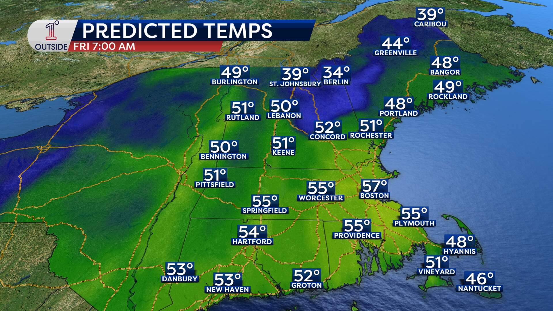
The heat moves in because Boston be firmly planted in the "warm sector" of this storm — a slice of real estate between two frontal boundaries that floods the area with milder, moisture-rich air. The result? A shockingly warm weather Friday morning.
Rain and isolated thunder
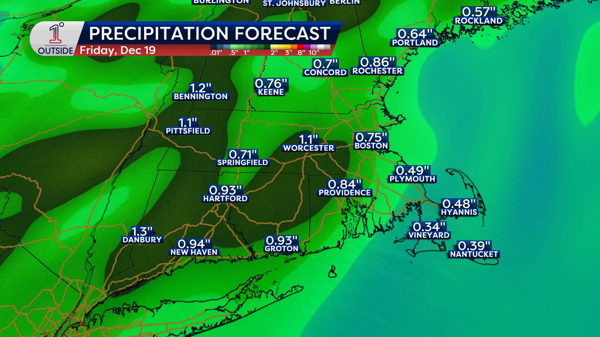
As the warm air arrives Thursday night, so does the rain. Expect scattered showers after midnight, then a solid swath of steady rainfall, filling in Friday morning. The heaviest precipitation will fall from late morning through mid afternoon, with most locations picking up half-an-inch to 1 inch of rain. There’s even a small chance for embedded thunder, so don't be surprised by some rumbles.
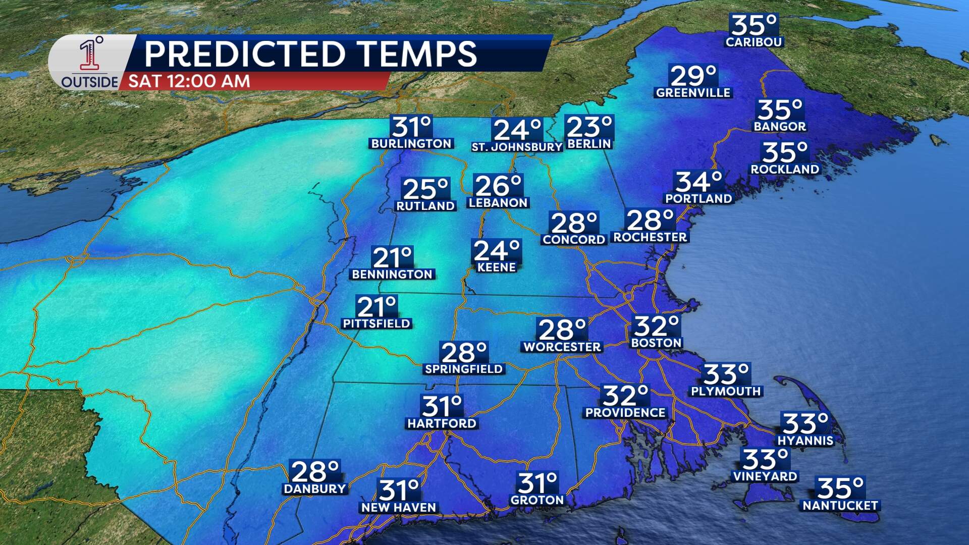
But this isn’t just a soggy system. It’s also dynamic. A powerful cold front slices through Friday afternoon, flipping winds and yanking temperatures sharply downward. Expect steadily falling temperatures from the 40s Friday evening to the upper 30s by 9 p.m. It will dip to freezing in Boston around midnight.
With that sharp temperature drop, any leftover moisture on roads, sidewalks and driveways will have a chance to freeze Friday night into Saturday morning. Look out for black ice.
Winds whip up
Winds just a few thousand feet above the ground will be screaming — reaching 100 mph in some spots — thanks to a roaring low-level jet of air overhead. The big question is how much of that wind will push down to the surface.
Expect widespread gusts of 40 to 50 mph across much of the Bay State on Friday, including Boston. Along the immediate coast of the South Shore, Cape Cod and south coast, there are signs that gusts will top out at 50 to 60 mph. It's not out of the question that Cape Cod sees isolated higher gusts up to 70 mph.
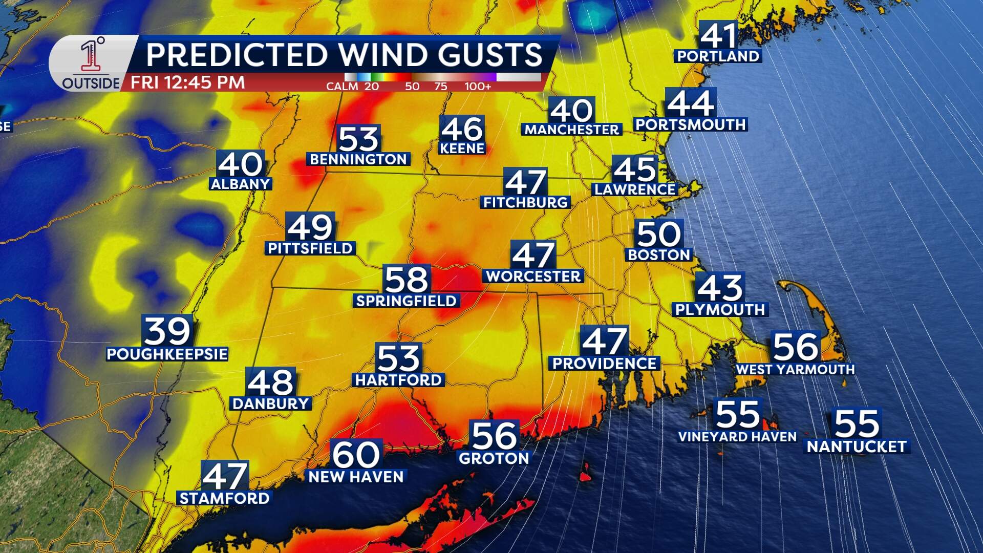
As a result, pockets of tree damage and power outages are likely, especially when the "core" of wind comes through between 9 a.m. and 1 p.m. Friday.
Rough seas
If you're part of the marine community or planning a ferry ride, keep a close eye out. Seas offshore will churn up 15–to-20-foot swells Friday into Saturday. Nearshore wave heights of 5 to 8 feet are plausible. There's also the potential for a bit of minor splashover will during the Friday morning high tide cycle along the south coast.
Chill returns this weekend
After the wild ride on Friday, the weekend is all about settling back into December. Saturday brings highs only in the mid 30s, with wind chill in the 20s. Sunday will be near seasonable, with highs inching into the 40s.
There’s also a clipper system that will slide through — but these systems often lack moisture and are very fast moving. Aside from perhaps a stray shower or flurry, there will be little to no impact.
