Support WBUR
Brace yourselves: Cold air returns to New England, with weekend snow possible
As Boston settles into mid-January, another pattern change is underway. While we've seen milder-than-normal conditions at times recently, that's about to shift. A sweeping Arctic front will drive down temperatures Thursday afternoon, ushering in a biting wind chill and raising the potential for slick roads and spotty snow squalls.
Thursday: Weather whiplash
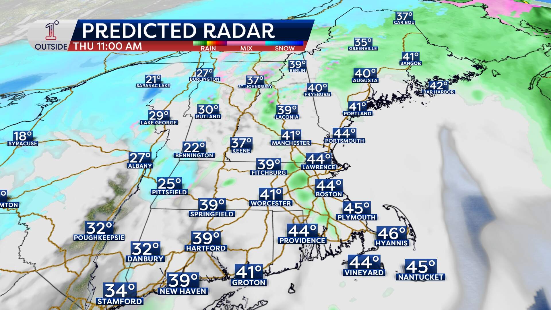
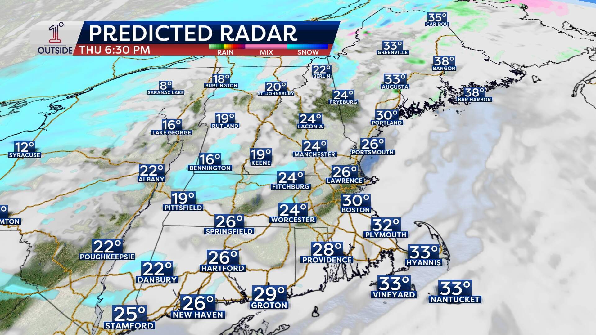
Thursday starts mild, with temperatures in the 40s across Eastern Massachusetts and scattered rain showers possible in the morning. But a sharp cold front slices across the region from west to east in the afternoon. Behind it comes falling temperatures, a gusty wind, and the potential for isolated snow showers or even quick-hitting snow squalls.
Squalls can be highly localized and fast-moving, like summer thunderstorms. For example, a town like Brookline could see a brief burst of snow, while Cambridge gets nothing. But don’t let the brevity fool you: a squall could drop a quick coating on untreated surfaces and send pavement temps below freezing by late afternoon, leading to localized slick spots.
Expect temperatures to fall rapidly through the 30s during the late afternoon and evening, then continue dropping after that.
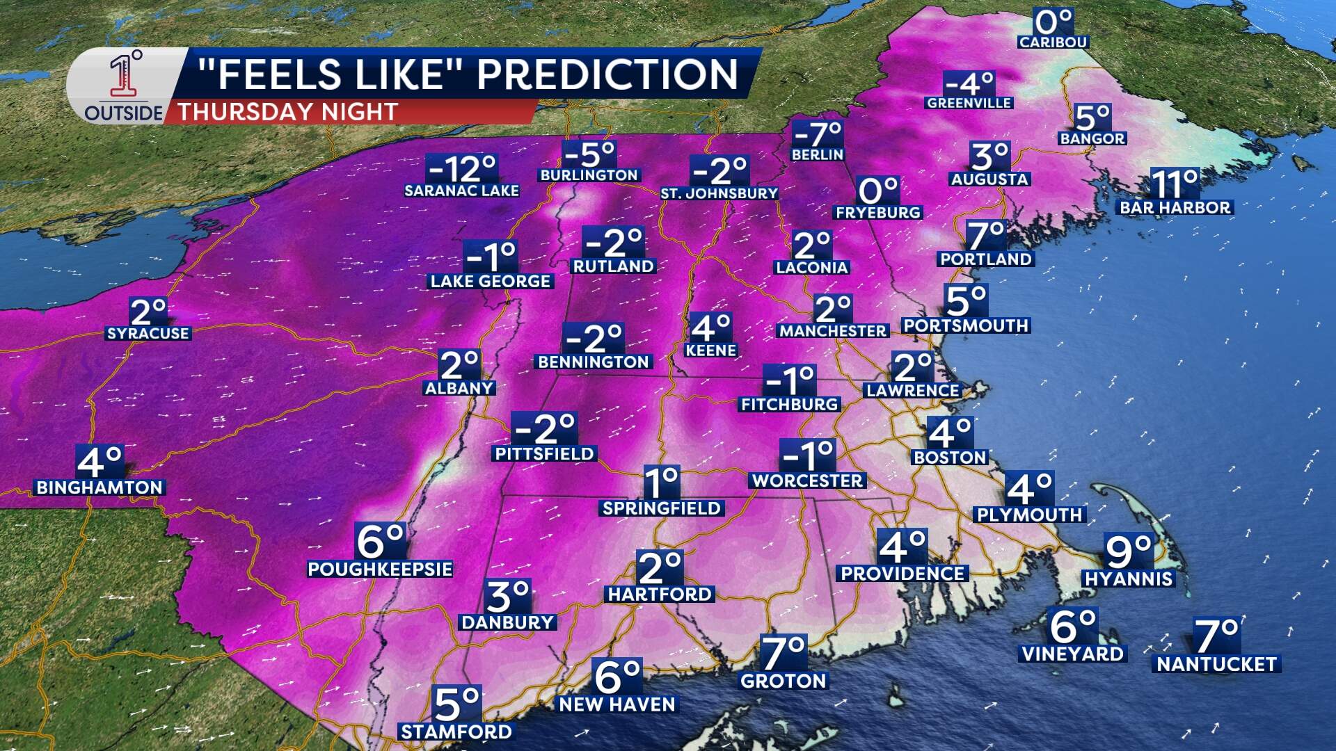
Thursday night into Friday: Wind chill takes over
As the Arctic air deepens, winds will ramp up. Many of us will see gusts in the 30-40 mph range. By Friday morning, the wind chill across Eastern Massachusetts will hover near zero degrees, with actual air temps in the teens.
For Boston, Friday will feature bright skies with brisk winds and a below-average high around 30.
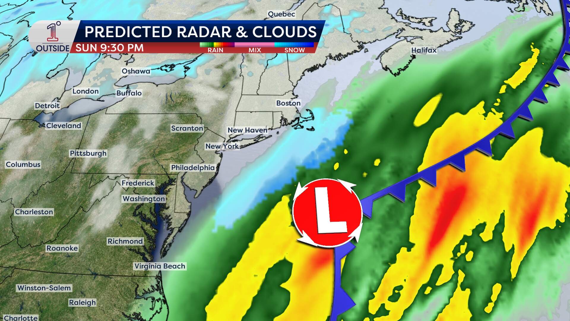
Weekend storm potential: Still watching the details
We're also monitoring the weekend for possible snow, and the exact impact for Boston remains uncertain.
Multiple fast-moving upper-level disturbances — what meteorologists call "shortwaves" — will rotate through the jet stream and introduce energy into the atmosphere at different times. If these pieces align just right, we could see a storm track that taps moisture from both the Gulf of Mexico and Atlantic.
At the moment, light snow or a wintry mix appears possible Friday night into Saturday, particularly north and west of the city. For Boston, this could bring anything from wet flakes to rain showers. The impact looks minimal, and any accumulation would likely be on the order of a coating to perhaps an inch. Another system may develop Sunday night into Monday, but it’s too soon to say whether that one targets us more directly or passes offshore.
Looking ahead: Colder next week
Temperatures should rebound some on Saturday, but another cold blast follows Sunday into early next week. Highs in Boston may struggle to get out of the 20s by Tuesday and Wednesday.
This is all part of a broader pattern flip across North America, with cold air from the Northern Plains expanding eastward. Even our warmest states won't be spared from the coming cold: For Florida residents, highs won't get out of the 50s for the start of next week with morning lows in the 30s.
If you're a snow lover, this pattern shift brings more opportunity for accumulation again, but also more uncertainty as we watch how the upper-level energy arranges itself over the Northeast.
