Support WBUR
Potential monster weekend storm could dump snow on Boston as polar vortex pushes arctic air into the U.S.
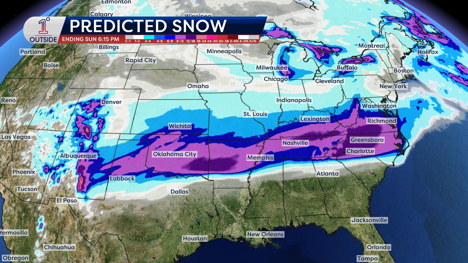
Update — If you’ve been waiting for a "classic" winter wallop, this weekend looks like it will finally deliver. A winter storm is going to develop on Friday in the southern Plains and track east, with historic snowfall, crippling ice and major travel disruptions for millions of Americans.
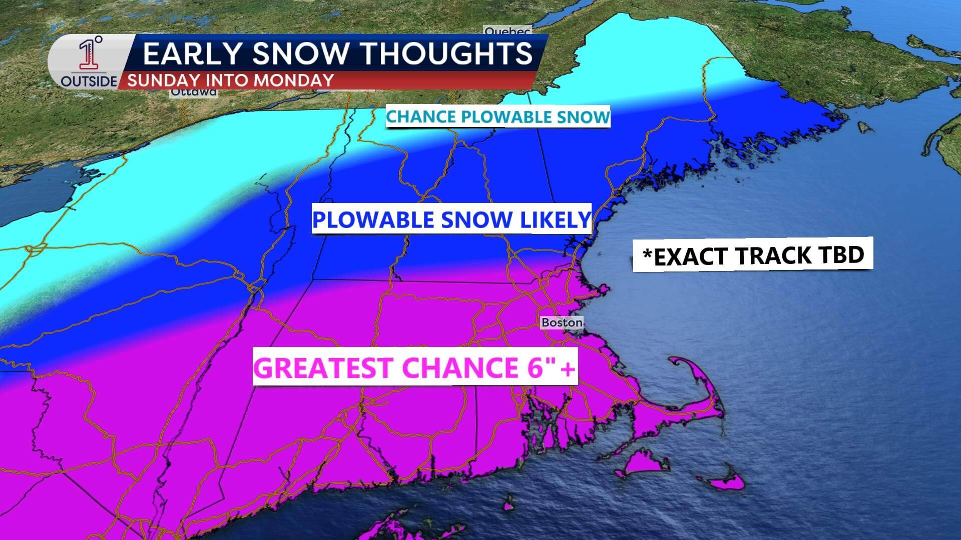
The storm center will pass south of New England Sunday into Monday, but come close enough to deliver snow. Details will need to be ironed out in the coming days, as the exact track of the storm will determine how much snow we receive.
As of midday Wednesday, it looks like snow would break out fairly early on Sunday, continue all day and perhaps linger into Monday. With that, snowfall accumulation of over 6 inches is looking more and more likely, which would make this potentially the biggest storm Boston has had in nearly 4 years. The last storm that brought over 6 inches was back on Feb. 25, 2022, when snowfall measured 8.5 inches at Logan Airport.
As winter tightens its grip on the nation, there’s no shortage of atmospheric drama to talk about.
The real headline-grabber this week is the surge of arctic air pouring in from the north. That in turn has set the stage for a winter storm that could grind to a halt parts of the Southern and Central U.S., with ripple effects stretching from Texas to the Gulf Coast, the Carolinas and the Mid-Atlantic.
At the heart of all this is the polar jet stream, a fast-moving river of air five to seven miles above our heads, which acts like a thermostat and storm track. This week, it'll drag frigid Canadian air deep into the Plains and South. That dip sets up a classic battleground between cold, dense Arctic air plunging south and moist, warmer air pushing up from the Gulf of Mexico.
That kind of setup is meteorological rocket fuel for winter storms.
Impact from Texas to the Carolinas
By late Thursday into Friday, the storm ramps up in intensity.
Northern Texas, Oklahoma, Arkansas, and into Missouri and Tennessee: Widespread snow, sleet, and freezing rain could be enough to snarl interstates and threaten power grids in Northern Texas, Oklahoma, Arkansas, Missouri and Tennessee.
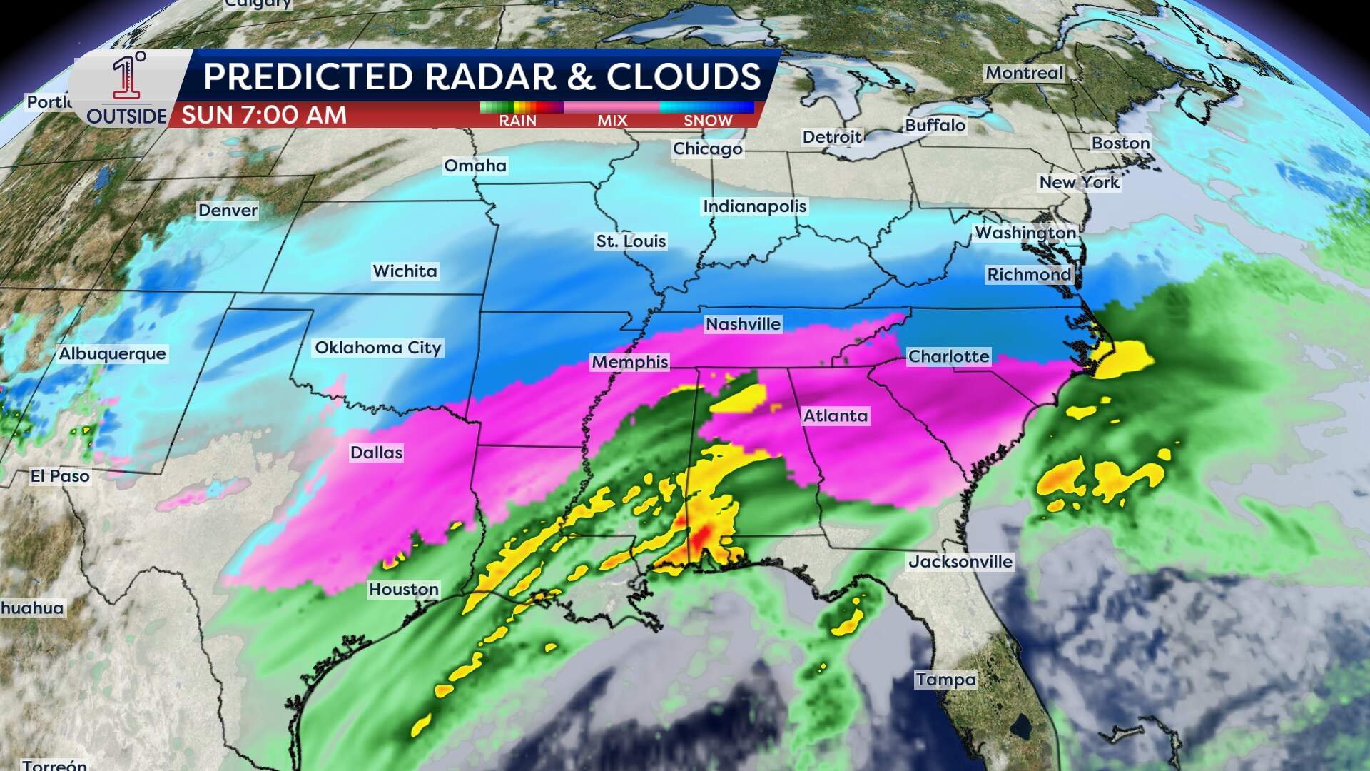
Farther south and east, in Mississippi, Alabama, Georgia, and the Carolinas, a dangerous icing scenario unfolds, where freezing rain will coat surfaces in a thick glaze. This isn’t just a frost-on-your-windshield type of ice. This is power-line-snapping, tree-limb-breaking, travel-halting ice that could lead to days without electricity in some areas.
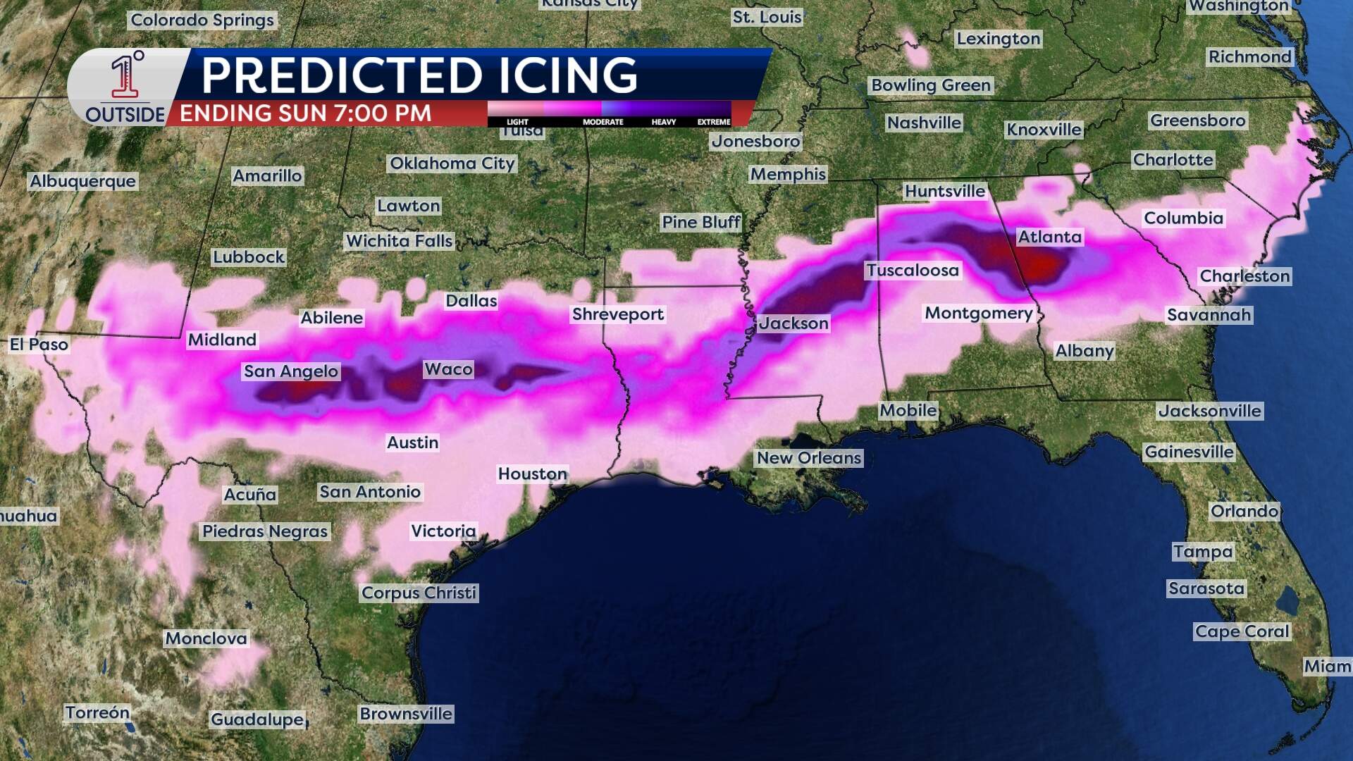
On the southern edge of the storm, where the warm air wins, severe thunderstorms, including strong wind gusts and isolated tornadoes, are not out of the question.
This storm stretches out from Friday through the weekend on the Eastern Seaboard.
Could it reach us in Boston?
Yes, but not with the same ferocity our southern neighbors will endure.
The main energy of the storm should slide to our south late Sunday into Monday but New England could be grazed by the system's northern fringe. While the heaviest snow likely stays south of us, a few inches of accumulating snow can’t be ruled out, especially if the storm nudges northward just a bit.
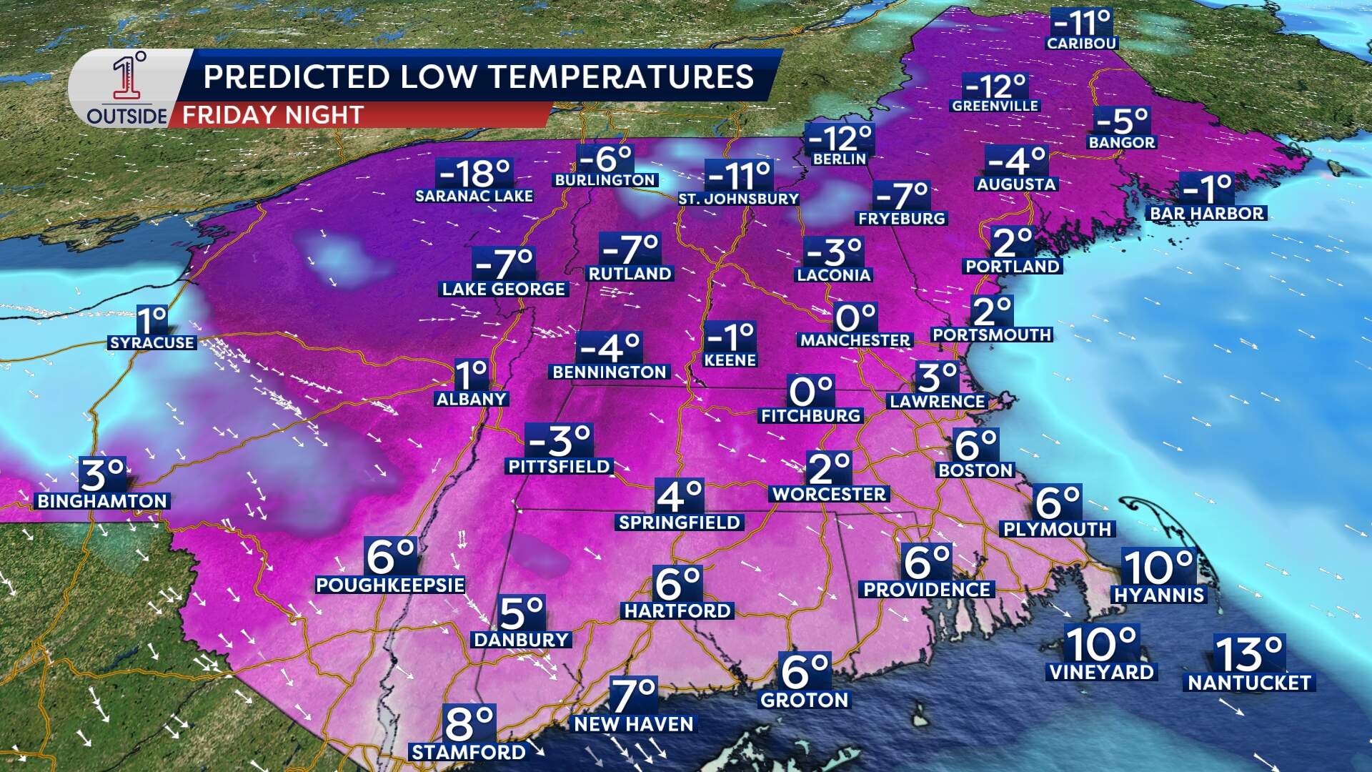
True arctic air arrives
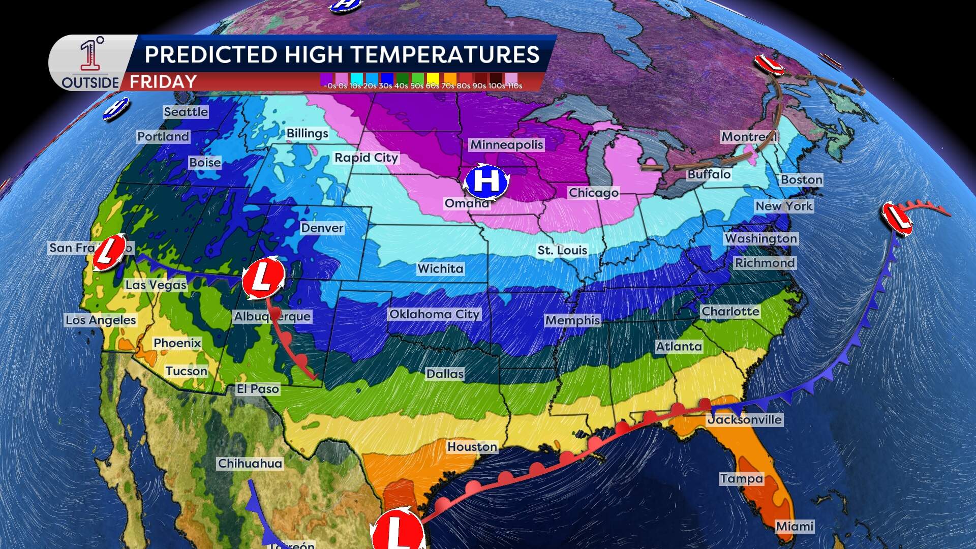
After a relatively mild midweek with pockets of light snow Wednesday evening into the overnight, true arctic air arrives Friday night into the weekend.
Friday Night: Wind chills drop well below zero across the region.
Saturday: Highs will struggle to get into the low teens for daytime highs. Coupled with the wind, "feels-like" values will be around or just below zero much of the day with the most intense cold — 10 to 25 below zero — across northern New England.
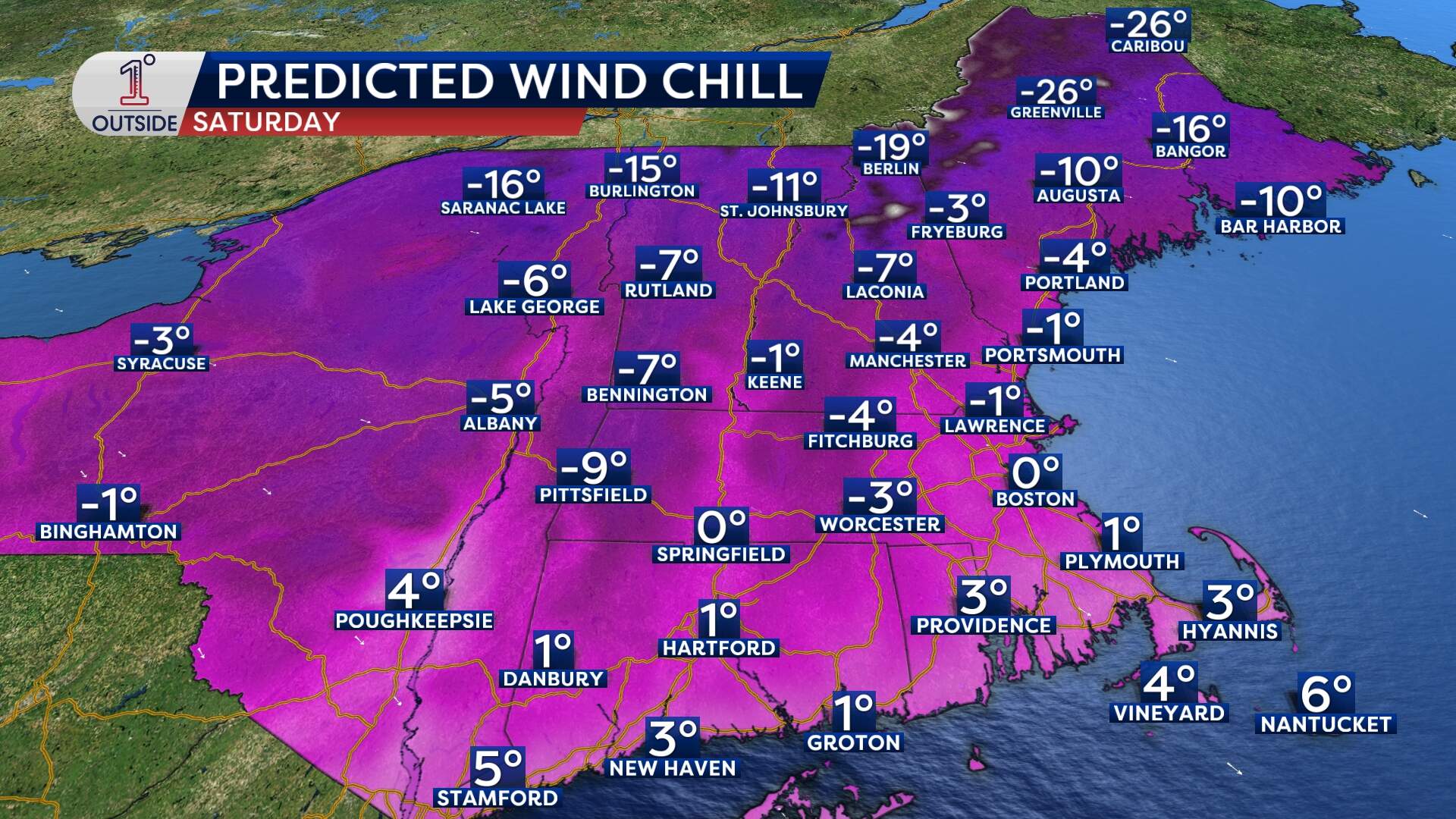
Sunday: Same story. Gusty winds continue. Bitter air holds firm.
The polar vortex is the primary culprit of this cold snap. Usually, the vortex acts like a "keeper" of cold, locking it over the Arctic. This month, a sudden stratospheric warming event caused the vortex to wobble and stretch. Think of it like a spinning top that’s been bumped, and it’s now "leaking" Arctic air down into North America.
On top of that, we are currently in a La Niña phase, which typically pushes the jet stream north. But this year’s La Niña is weak and fading toward "neutral" status. That has led to a more unstable weather pattern, allowing cold air to "dip" much further south than usual.
Is this normal?
Statistically, this winter has actually seen several record-high temperatures across the country. However, the intensity of the current cold is higher than average for this time of year. We are seeing a tug of war between long-term warming trends and short-term Arctic outbreaks.