Support WBUR
What to know about the storm dropping 1-2 feet of snow on New England this weekend
Snow will intensify across southern New England on Sunday after a light start, with heavy snow bands ramping up to 2-4 inches per hour through mid-afternoon and the evening.
Thundersnow will be possible from 6 to 10 p.m. with near-blizzard conditions at the coast and northeast gusts around 35 mph creating blowing snow and whiteouts.
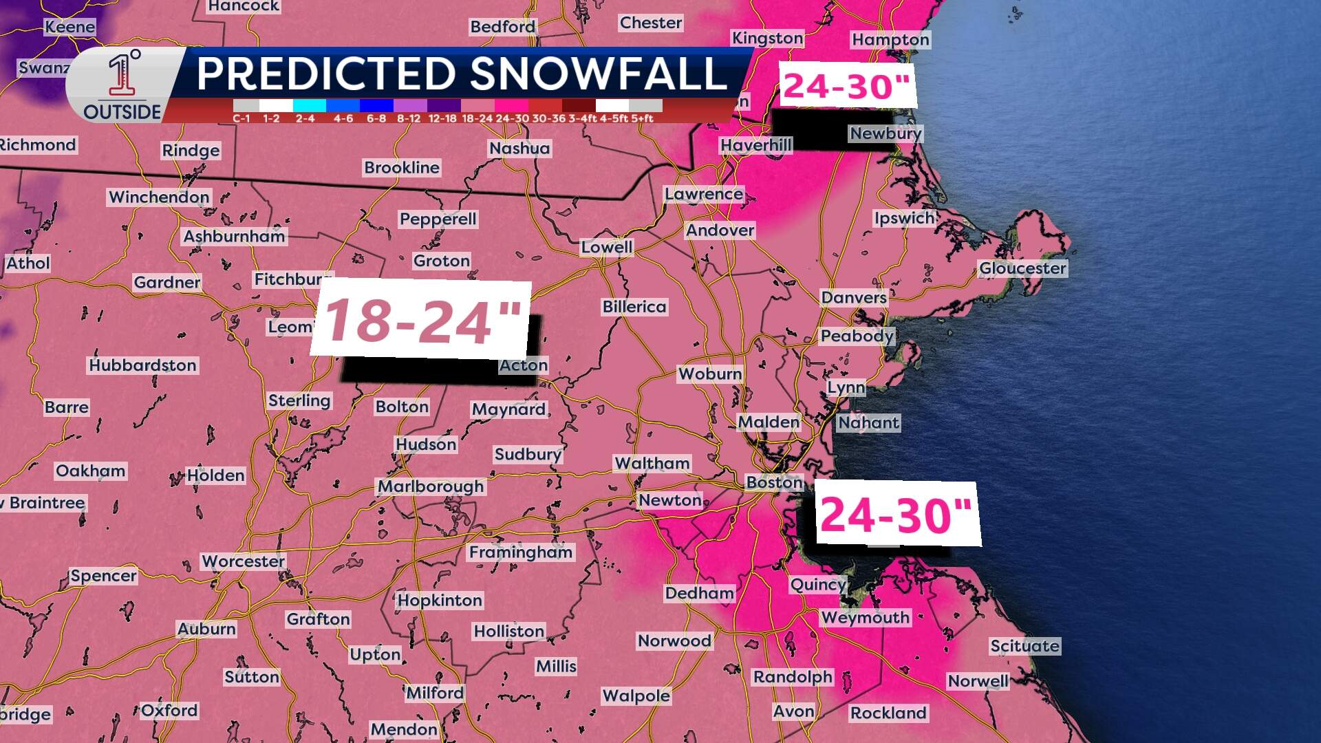
Boston and surrounding towns like Newton, Quincy and Hingham may see 18-24 inches of snow, with localized totals nearing 30 inches.
Snow lightens overnight but continues on and off Monday, adding a few more inches before ending late day.
The Outer Cape and Nantucket may briefly see sleet or rain mix in around midnight, then flip back to snow. Subzero wind chills arrive Monday night. There may be minor coastal splashover during the Monday morning high tide at the most vulnerable spots. Scattered power outages are possible due to wetter snow at the coast and on Cape Cod.
What to know
Snow begins midday Sunday, ramping up to near whiteout conditions by early evening. The heaviest snowfall is expected from 5 p.m. Sunday to midnight, with 2-4 inches per hour snowfall rates possible.
Snow lingers all day Monday, with lighter bursts potentially into the evening. By 9 to 11 p.m., the back edge of the snow will finally move in; strong winds and plummeting temperatures will keep roads icy.
Winds will shift from the northeast to the north then northwest on the backside of this system, gusting 25-35 mph during the storm with single-digit wind chills by Monday afternoon.
What makes this storm noteworthy
Let’s break this down: this isn’t one of those fast-moving storms that drops a quick 6 inches and is gone before you can finish shoveling the first round. Instead, we’re looking at a marathon, not a sprint.
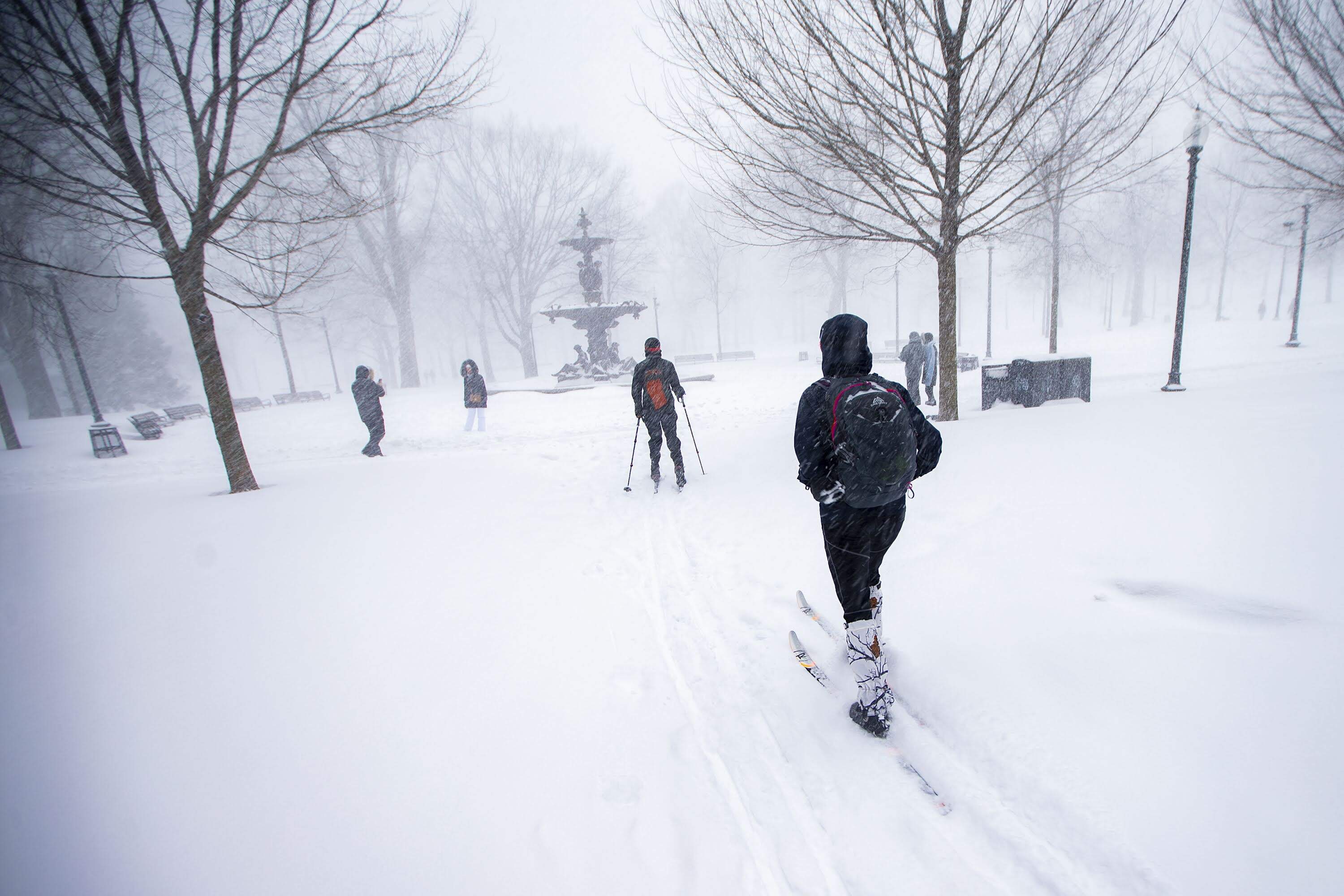
At its peak Sunday evening, snow may fall so quickly that road crews struggle to keep up. Expect reduced visibility, whiteout conditions, and slick, snow-covered roads. If you can stay off the roads Sunday afternoon through Monday afternoon, do it.
The trickiest part of this storm is where exactly the coastal front will set up, which will enhance snow totals right at the coast, including in Boston. Instead of reducing snow totals like many storms with onshore flow, this one may actually bump them up near the city due to increased moisture and dynamic lift.
Another factor to watch? Snow consistency.
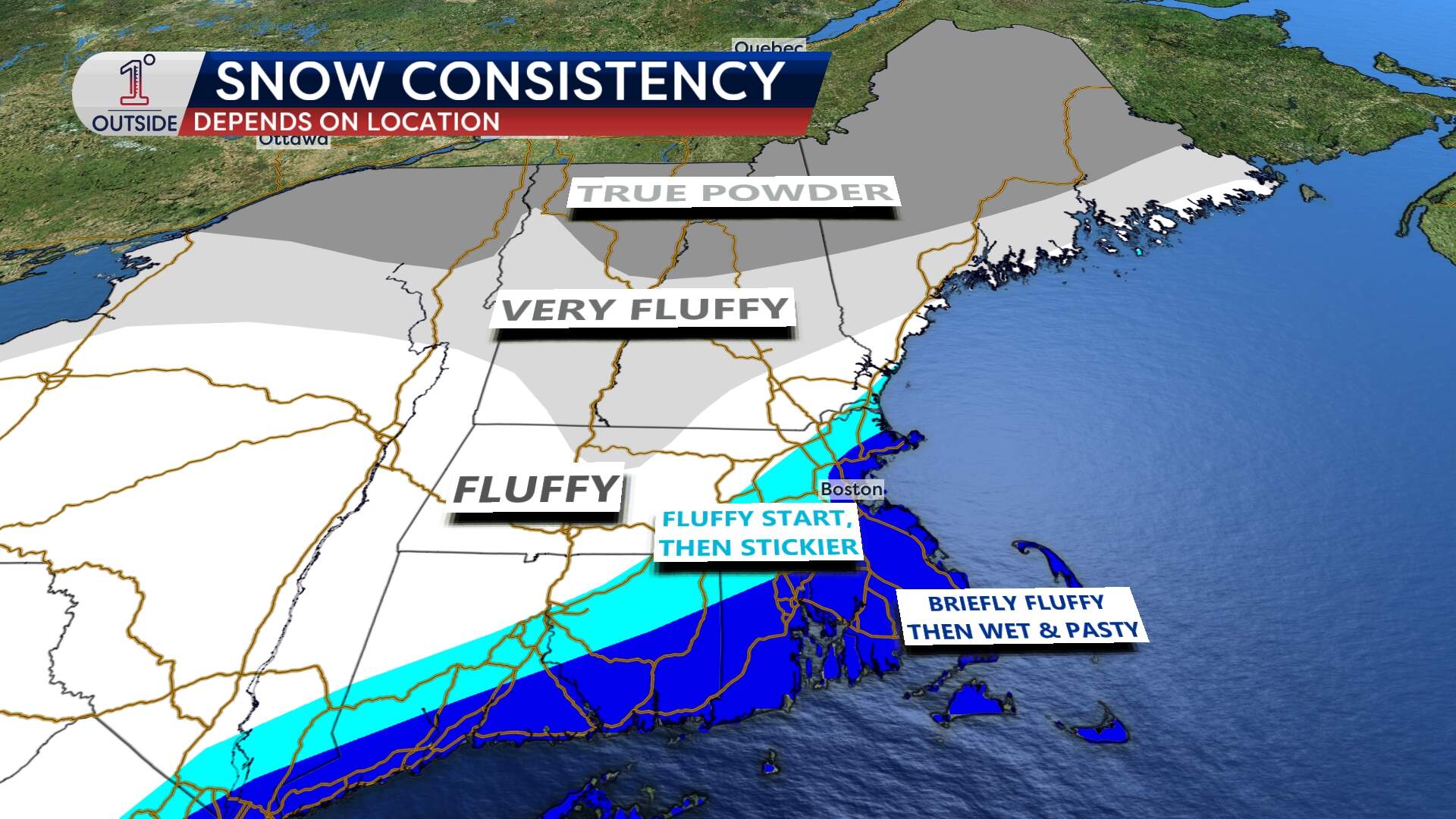
The snow will likely start off light and fluffy Sunday afternoon, but as temperatures rise into the 20s Sunday night, the flakes will become wetter and heavier. That’s bad news for shoveling, and potentially for power lines too.
On Monday, as the temperature drops again, expect a return to fluffier flakes.
The cold that follows
Even when the snow ends, the storm’s impact won’t.
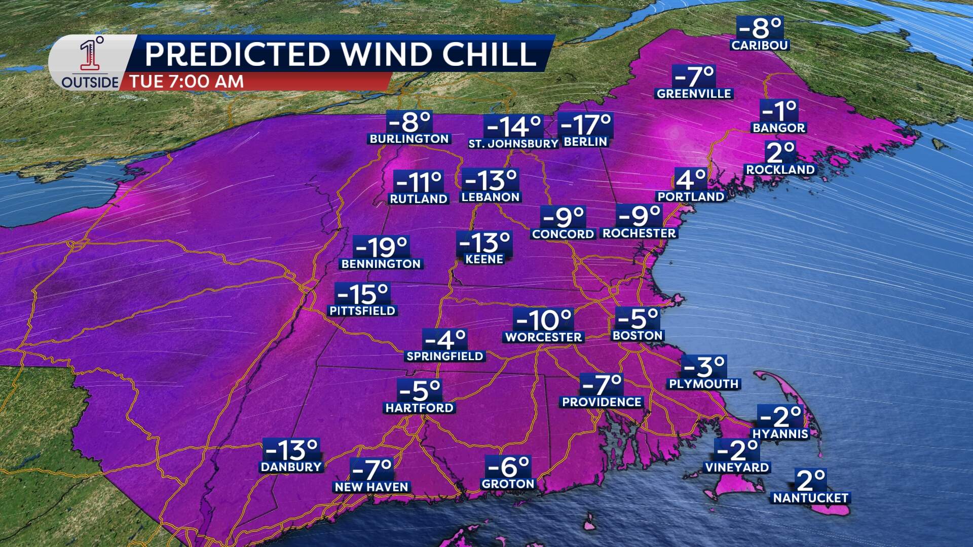
By Monday night and into Tuesday, temperatures dip back into the teens, and wind chills will make it feel even colder — single digits in many areas. That means untreated surfaces will remain icy for some time, and cleanup will be a chore.
How to prepare
- Finish grocery store shopping and errands by Sunday morning. If you need to be on the road during the storm, take a minute to stock up your car: Make sure your gas tank is full, keep extra blankets in your car as well as an emergency kit. Read more tips here.
- Be ready for multiple rounds of shoveling or plowing. Here are tips for how to remove the snow safely. Shoveling can increase the risk of a heart attack. Pace yourself. Keep hands away from a snow blower's moving parts.
- Prevent pipes in your home from freezing by insulating exposed pipes, and letting faucets drip. Here are some other tips on preparing your home for winter weather.
- Charge phones and devices in case of power outages. Check your smoke detectors and carbon monoxide detectors are in working order. If your power goes out, don't use a generator inside a home or a garage due to the danger of carbon monoxide.
- Check in on neighbors, especially elderly or those who rely on power for health-related equipment.
While the exact totals might shift a bit, all signs point to a plowable, disruptive and memorable New England snowstorm.
Get the latest storm updates at 1DegreeOutside.com or on the free 1DegreeOutside mobile app.
This article was originally published on January 23, 2026.
