Support WBUR
Forecast: The massive storm and bitter cold won't quit yet, and Mass. may see more snow soon
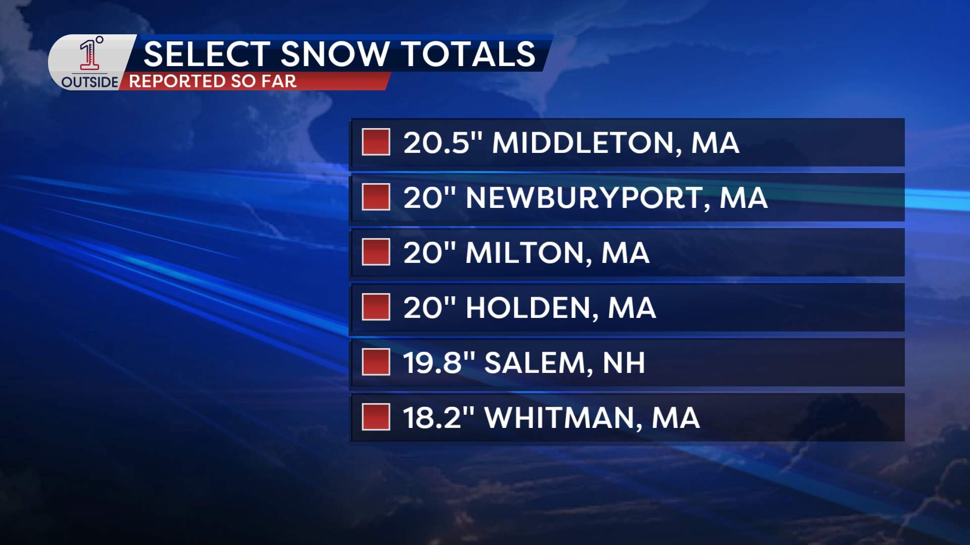
While the worst of the storm has passed, Bostonians are in for another show of snow Monday.
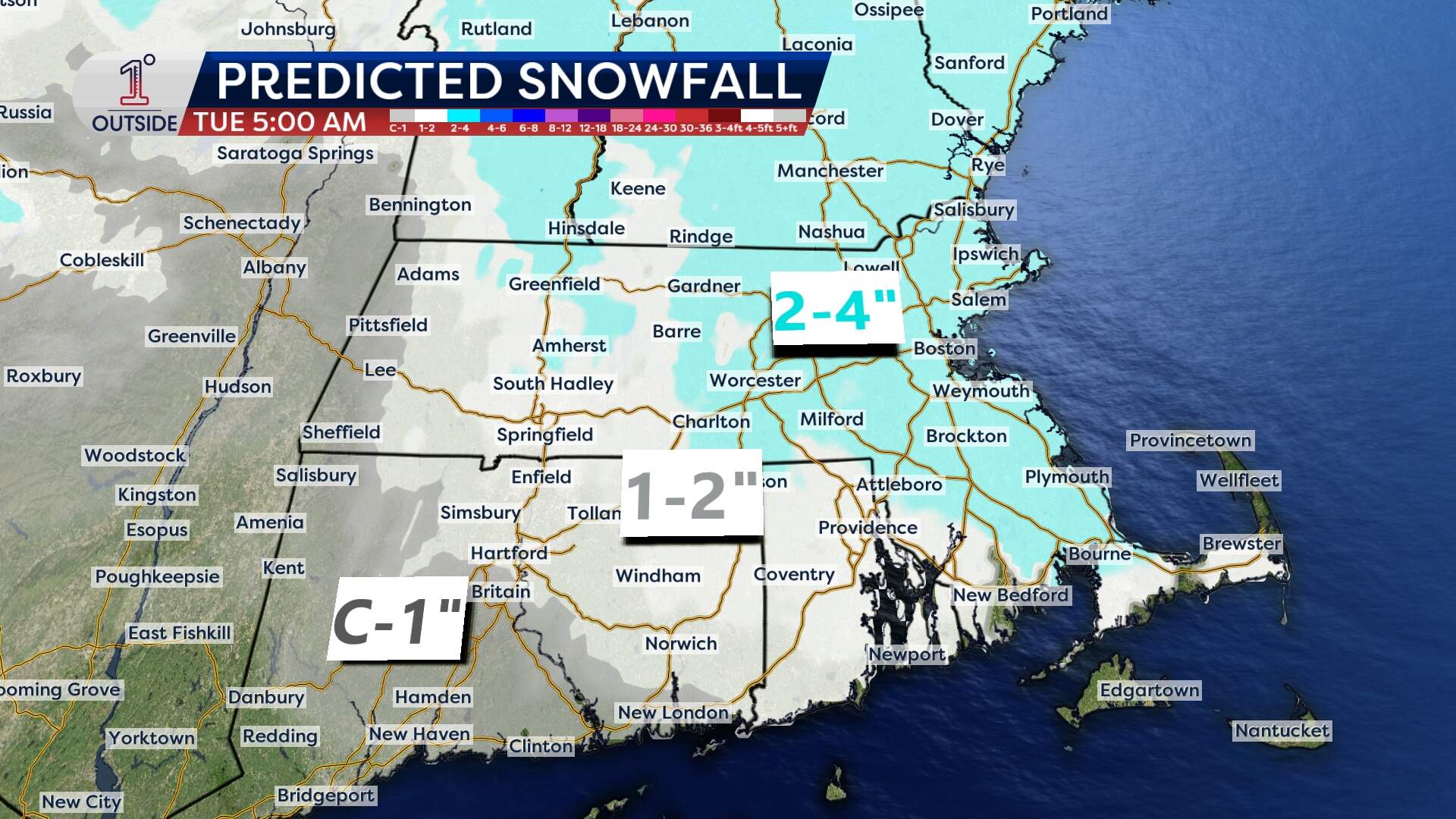
How much more snow?
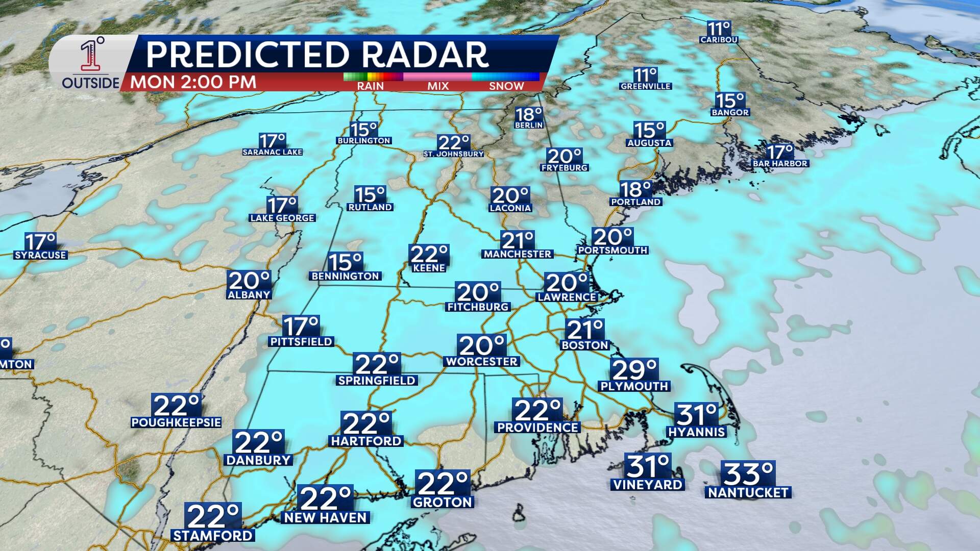
Pockets of light and fluffy snowflakes will fill back in around or just after midday. They'll fall throughout the afternoon. All told, residents should expect another 2 to 4 inches of accumulation through the evening.
When will it end?
Billowing snow thanks to wind gusts between 20–30 mph will reduce visibility on the roads and make travel difficult. Throughout the state, the snow should finally taper off between 8 p.m. and 10 p.m.
What will temperatures be like?
The bigger story for the city is the arrival of dangerous cold Monday night.
As the snow exits, temperatures will drop sharply, with wind chills falling to between 5 and 10 below zero by late evening and overnight across the region.
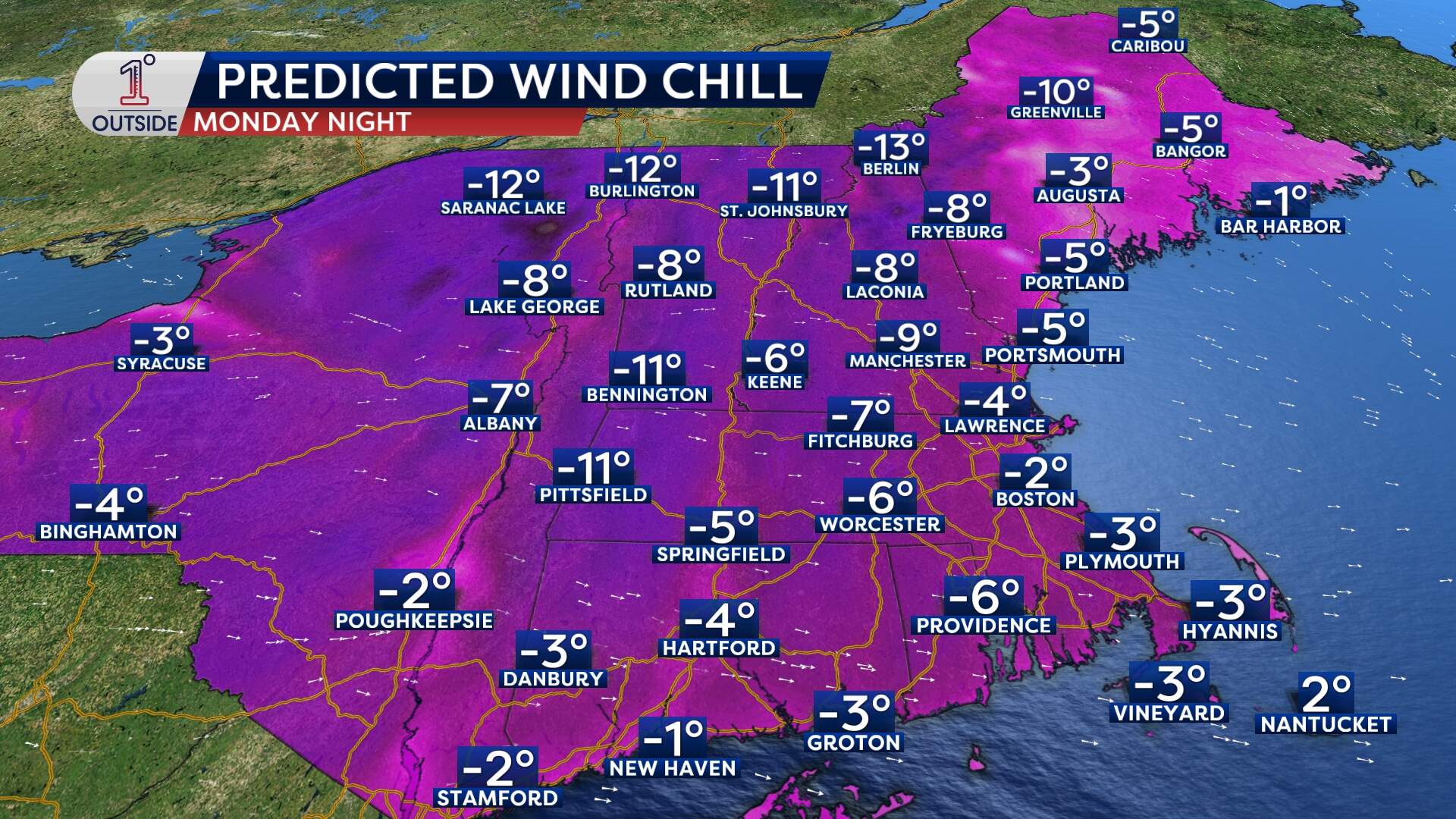
These subzero conditions will persist into Tuesday morning. And the cold is going nowhere this week. You can expect highs in the 20s and overnight lows in the single digits. Temperatures will reach their coldest Thursday night into Friday.
Will it snow again soon?
Another snowstorm is possible this upcoming weekend, moving in as early as Saturday night and lingering into Monday. The storm's exact track and intensity will determine how much snow falls, but it's certainly another one to monitor in the coming days.
Get the latest storm updates at 1DegreeOutside.com or on the free 1DegreeOutside mobile app.
