Support WBUR
Major storm expected to miss Boston, with manageable snow falling on Cape Cod
Bostonians who have been nervously watching weather maps this week can take a breath.
While a powerful storm will develop off the Carolina coast and intensify into a "bomb cyclone" out over the Atlantic this weekend, the brunt of the storm is expected to stay offshore.
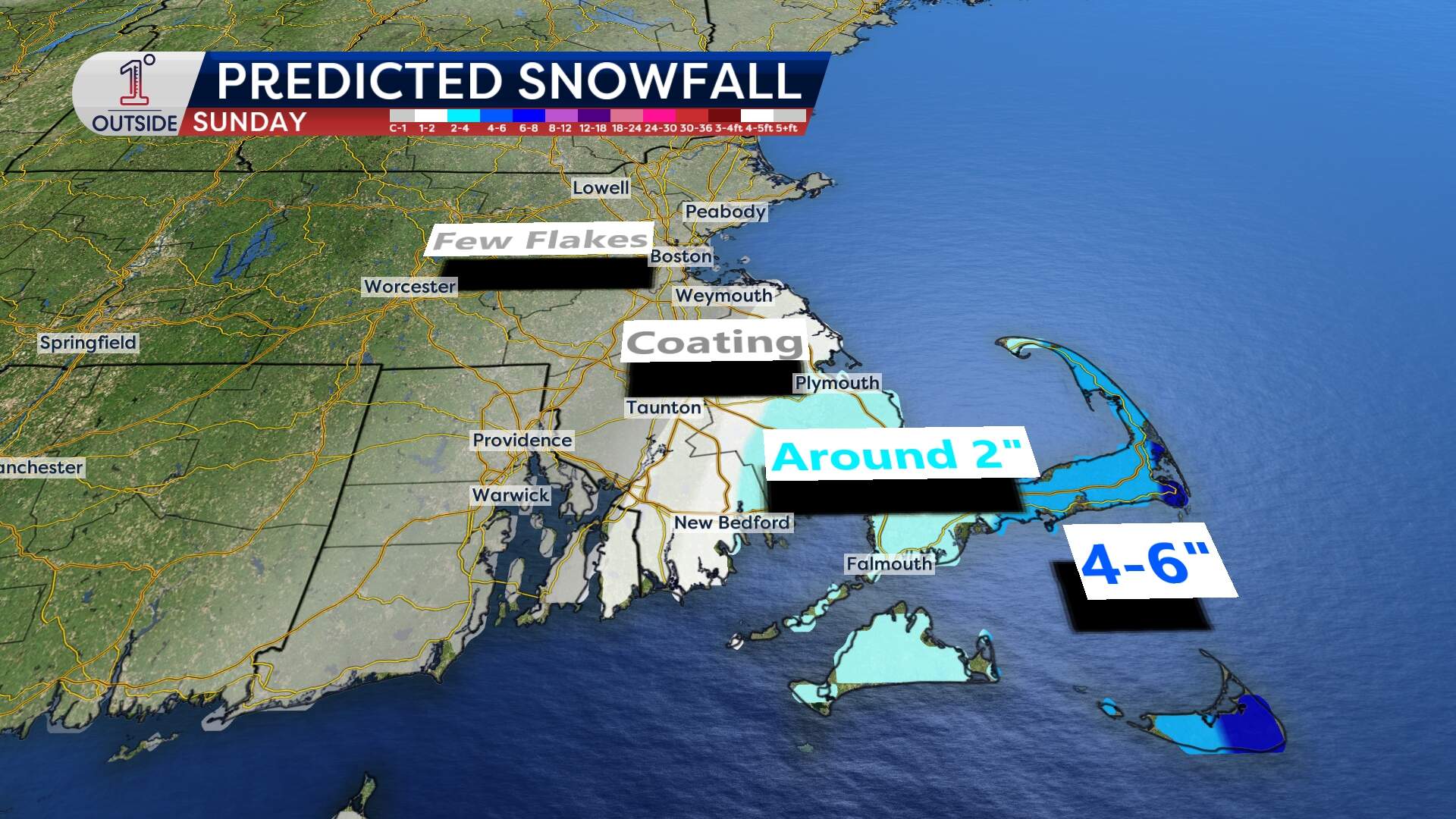
Meteorologists look for the storm to hit certain "benchmarks" to bring heavy snow to Boston. As of Friday, the storm is trending well south and east of those marks. The Boston-to-Providence corridor is looking at a few flakes, if any.
The outer bands of snow are likely to still reach Cape Cod. But even there, the forecast has been dialed back. The Cape should expect a manageable 3 to 6 inches of snow. If the storm continues to trend east, those predictions will lower, too.
It's still possible the South Shore may get into a brief period of snow showers, with some ocean-effect blowing in off the water. A coating to as much as a couple of inches is possible there.
What the storm will bring
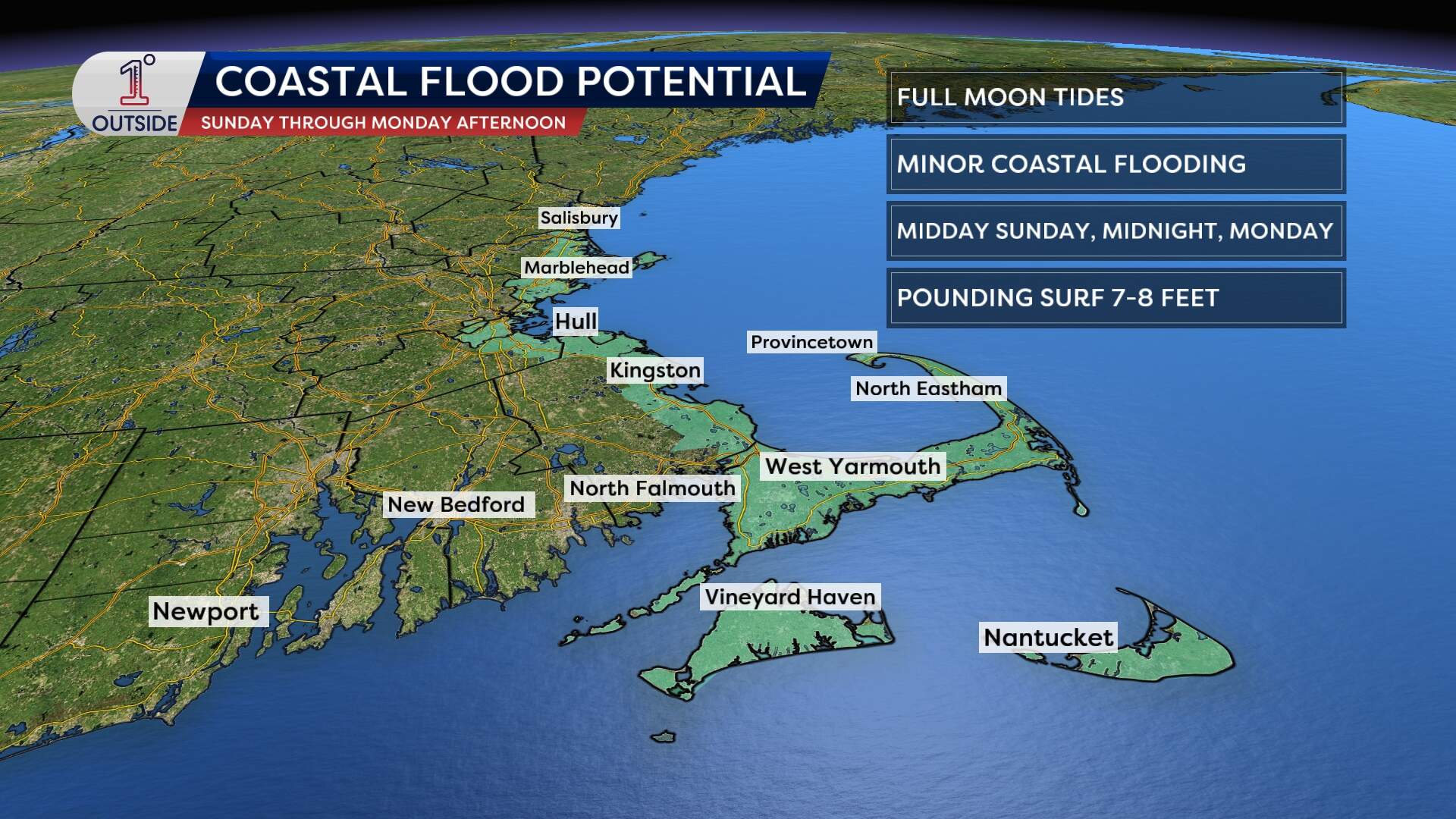
The shoreline is not quite "out of the woods" in this storm. Because of high astronomical tides from the full moon, the storm will push some extra water toward our beaches.
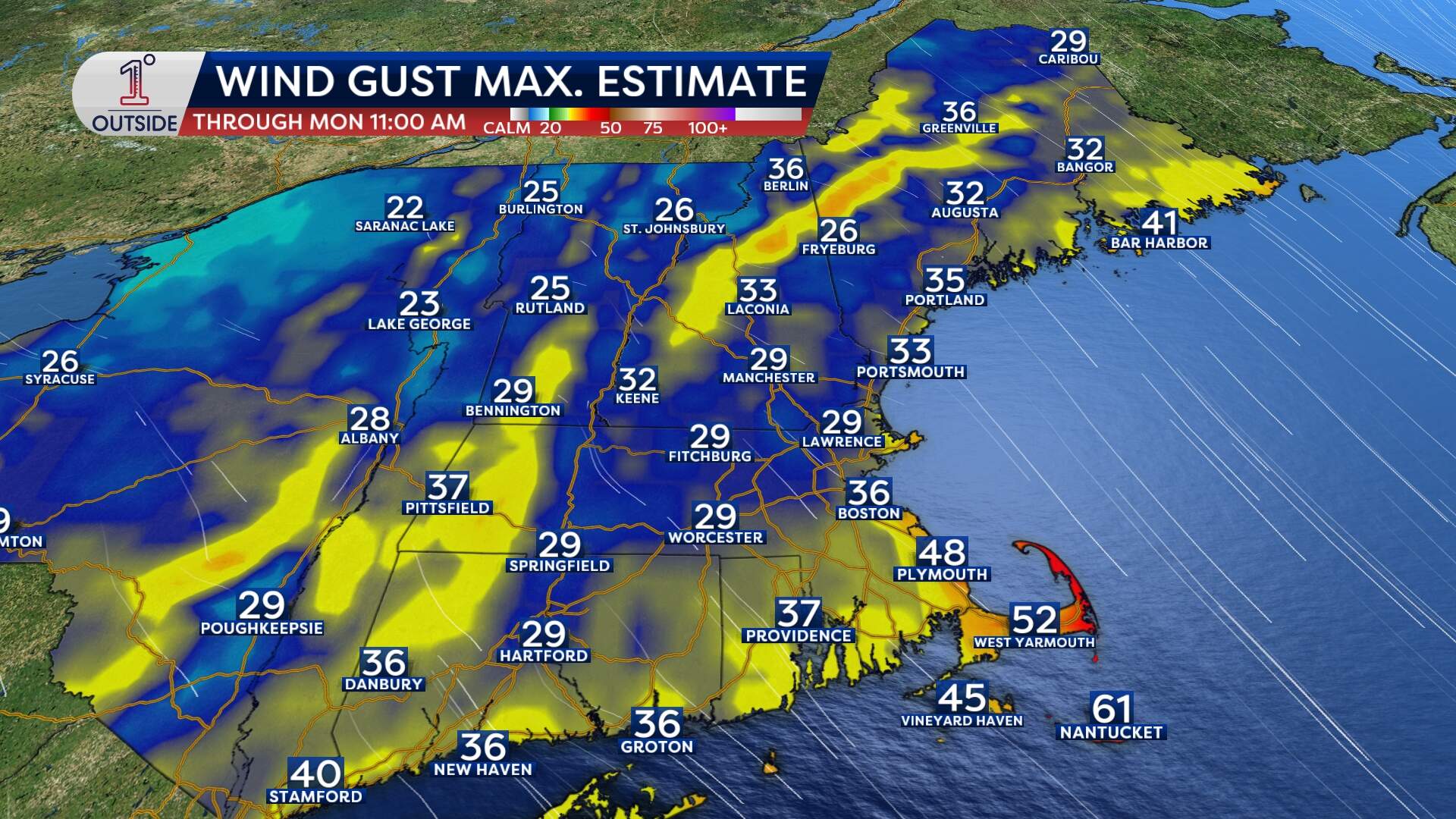
Gusts on the order of 40 to 50 mph are likely along the coast of the South Shore to the Cape Sunday morning through the afternoon. Some locally higher gusts are possible from the Outer Cape to Nantucket from 1 to 5 p.m. Sunday.
Minor coastal flooding during the high tide cycles is anticipated on Sunday and Monday. It’s the kind of flooding that might cause some temporary road closures in the usual spots, but significant issues aren't expected. That said, some chunks of ice may push ashore. Offshore waves will be as high as 20 feet, so this is a dangerous storm for the marine community.
When will the frigid temperatures let up
The other "impact" this weekend isn't actually the storm, it's the temperature. New England is currently shivering through a massive Arctic air mass.
Here's what to expect over the weekend:
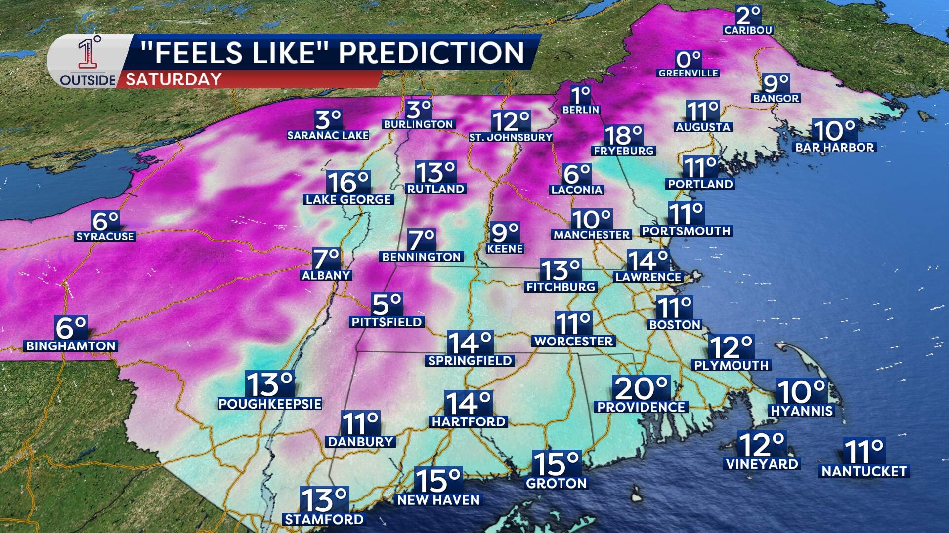
- Highs in the teens: Even with the sun out on Saturday, the wind chill will struggle to get out of the single digits in some spots.
- Icy air: Wind chills have been bottoming out between -5 degrees to -20 degrees across the region, and that will be the case again Friday night
- Saturday night won't be quite as bitter (around 10 degrees). Boston looks like it will be stuck in the 20s on Sunday.
- Start of next week will not be as cold. Highs will be in the low to mid 30s.
