Support WBUR
Forecast: A few inches of snow before a super cold Super Bowl Sunday
It's a good weekend to stay inside — ideally, cozied up next to a fireplace with a mug of hot cocoa.
Luckily, there are plenty of sports to watch, from cheering on our hometown Olympians to watching the Patriots in the Super Bowl for the first time in seven years.
An Arctic airmass from the North Pole is heading toward New England, bringing some snow first and then frigid temperatures and strong winds this weekend.
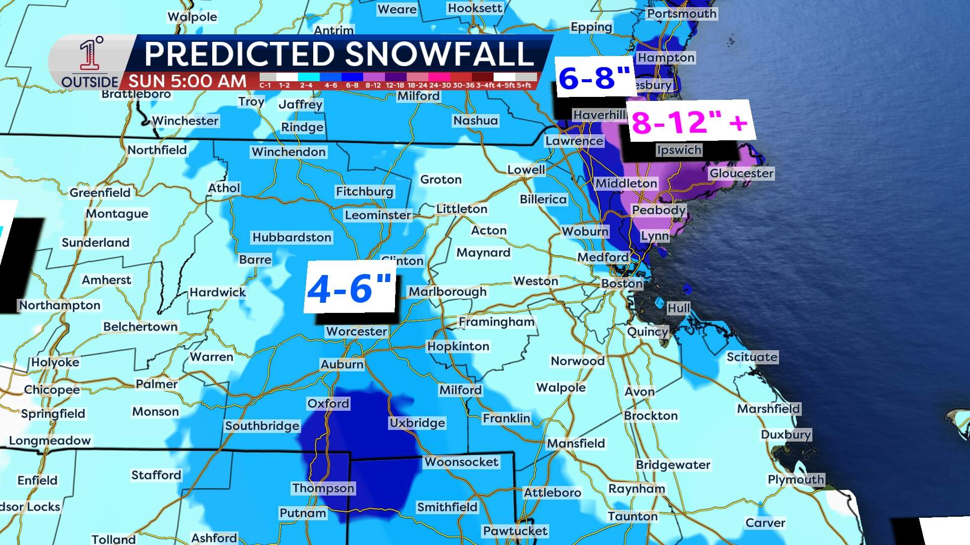
How much snow is coming?
The region won't get walloped at all like in the Blizzard of '78, which happened 48 years ago this weekend. Snowfall totals won't even be close to this season's most recent storm. And that's a good thing, as Boston and many other communities are struggling with where residents would even put more snow.
Still, there's enough snow in the forecast that it could disrupt your plans for Saturday. It's best to get your Super Bowl beer-and-snack run done on Friday.
Snowfall totals and rates of snow are highly variable thanks to a couple different narrow, but very localized bands of snow. One will rotate through central Massachusetts, and the other from the North Shore through Cape Ann. Underneath the heaviest pulses of snow, 2 to 3 inches per hour of fluffy snow will pile up. In between, there will be lulls and lighter snow amounts.
Road conditions are highly variable as well — from completely snow covered in spots to wet pavement in others.
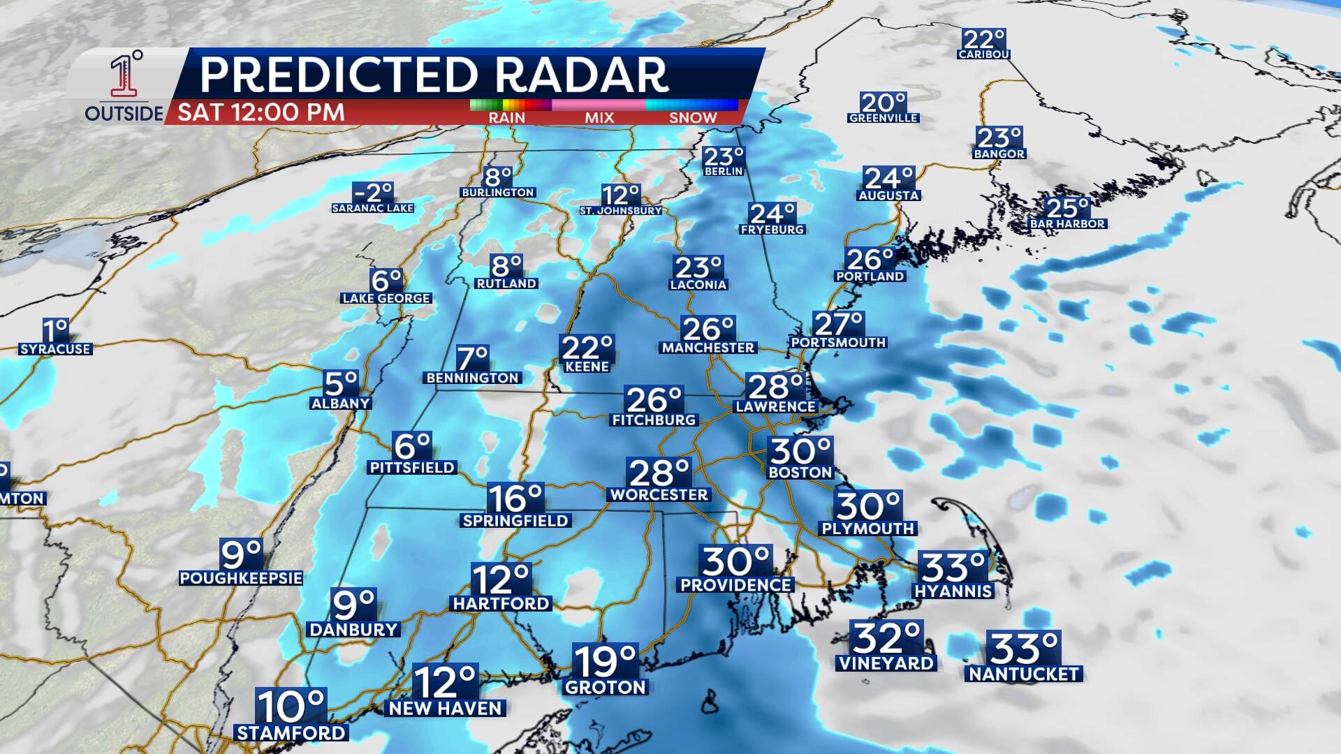
When will the snow start?
Expect the flakes to start flying around 1 a.m. Saturday.
The steadiest rates (up to an inch per hour) will be between 11 a.m. and 2 p.m. Saturday.
Snow winds down from late afternoon to early evening, with a few lingering snow showers on Cape Cod until evening.
Dangerous cold
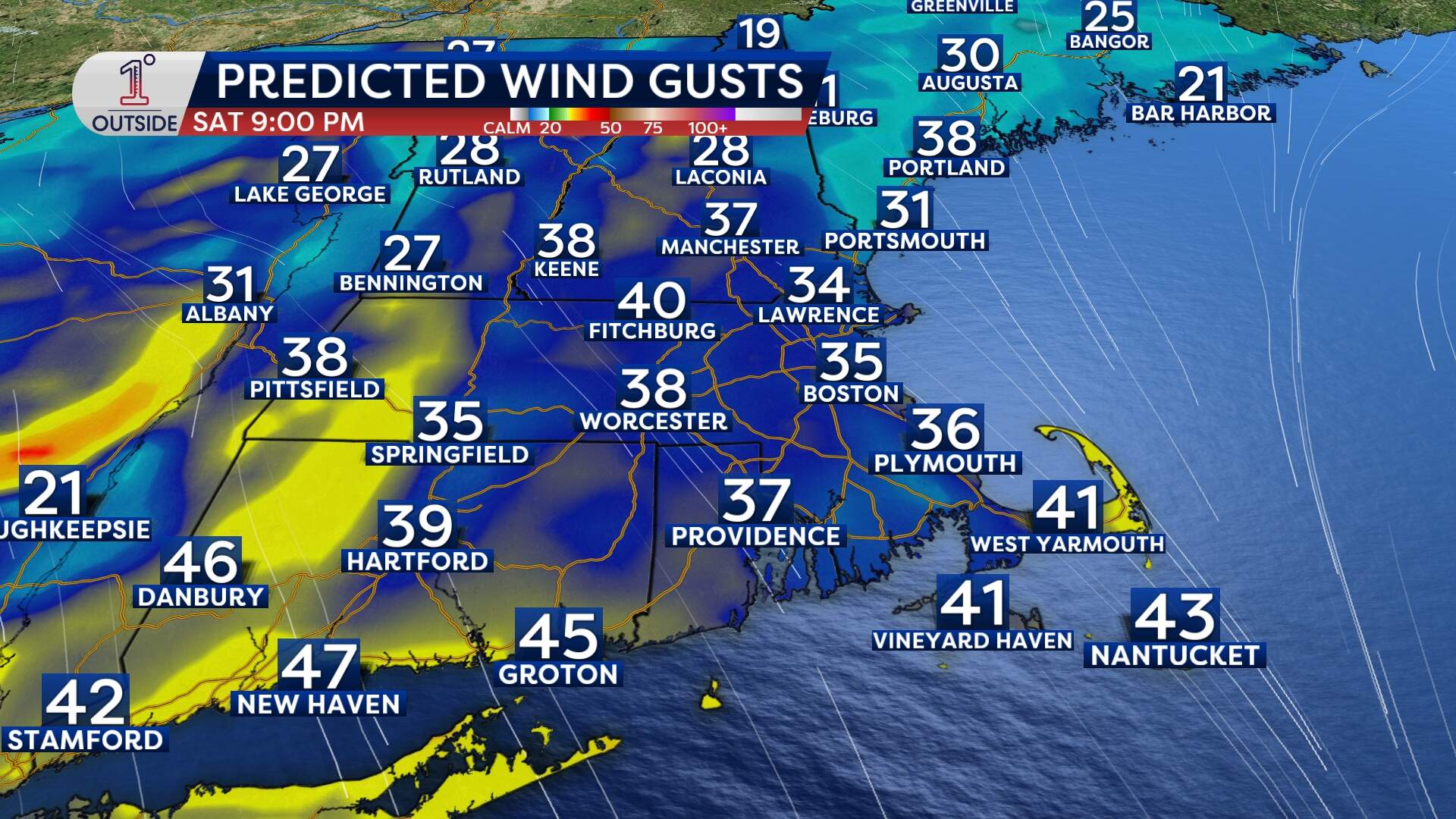
The real story is the plummeting temperatures, followed by dangerously cold wind chill values.
Temperatures will hover in the 20s for most of Saturday before taking a nose dive through the teens and into the single digits by the evening, eventually hitting a low of 3 degrees at night.
Wind gusts will be between 30-40 mph from Saturday evening into the overnight.
By 6 p.m. Saturday, wind chills will drop below zero, bottoming out near -20°F overnight. This is the kind of cold that can cause frostbite on exposed skin in just 30 minutes — make sure to cover up if going outside.
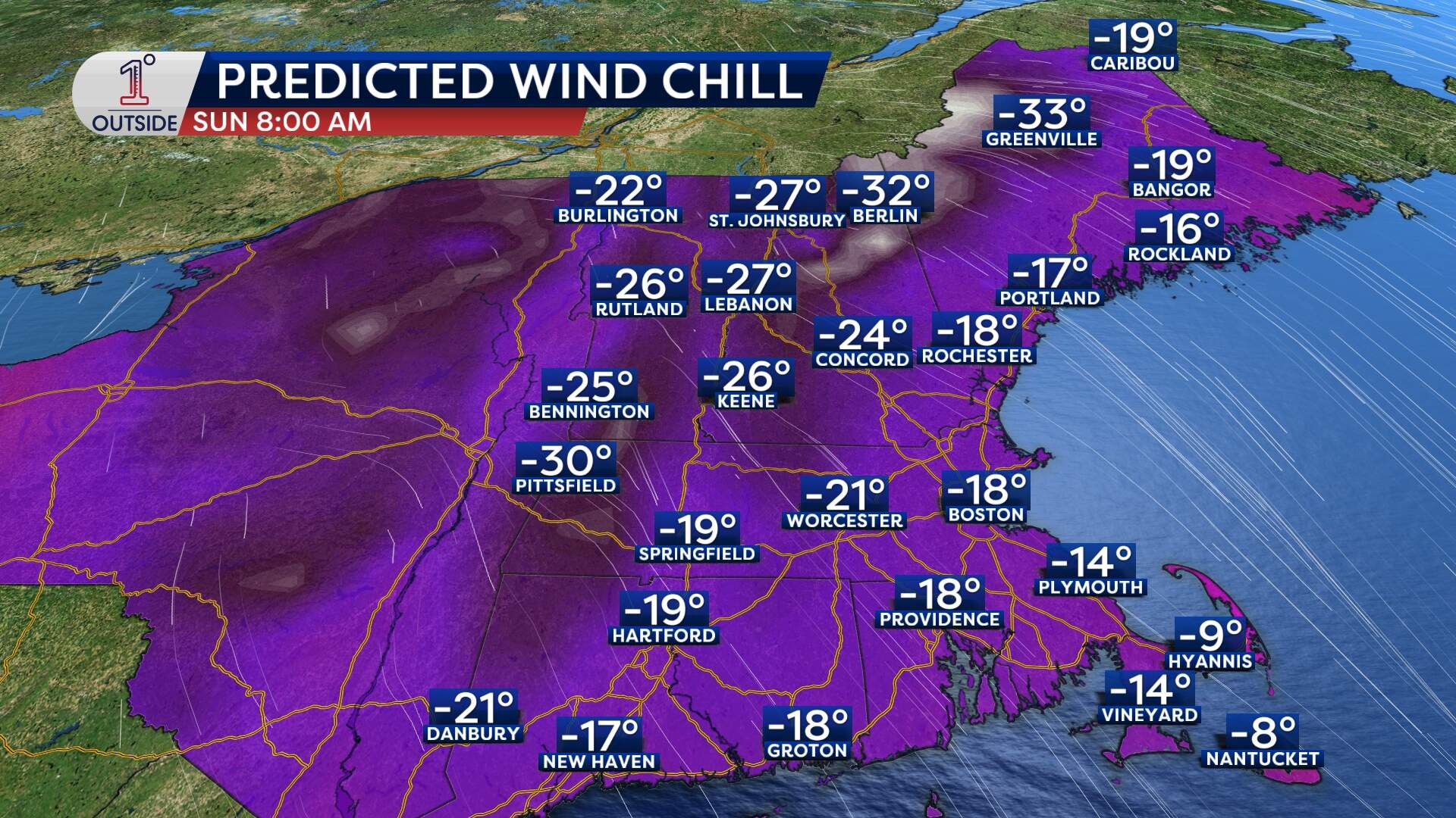
The lowest record high temperature for Feb. 8 in Boston is 14 degrees, set back in 1985. It's possible this Sunday will break that record with highs expected to be only in the low- to mid-teens.
Practical prep: the quick checklist
As shared earlier this week, here are a few ways to prep for a cold snap:
- Cars: This is battery-killing cold. If a car battery is already weak, this is when it may end up dying.
- Pipes: Keep indoor temps steady. Consider opening cabinet doors under sinks on exterior walls to help warmer air circulate.
- Space heaters: Use them safely — keep heaters clear of anything flammable and never leave them unattended.
- Pets: Quick trips outside are fine, but don’t leave them out for extended stretches.
Get the latest updates at 1DegreeOutside.com or on the free 1DegreeOutside mobile app.
This article was originally published on February 06, 2026.
