Support WBUR
Caution commuters: Snow expected during evening rush hour
Boston is starting the day with bright skies, but things are going to look a lot different by the evening commute.
A fast-moving clipper system is trekking in from the west today, and it's arrival is timed perfectly to mess with part of the evening rush. Here is what to know to navigate the day:
When will it start?
The morning and lunch hours should be smooth sailing. Expect clouds to increase and thicken as temperatures climb into the upper 20s and low 30s.
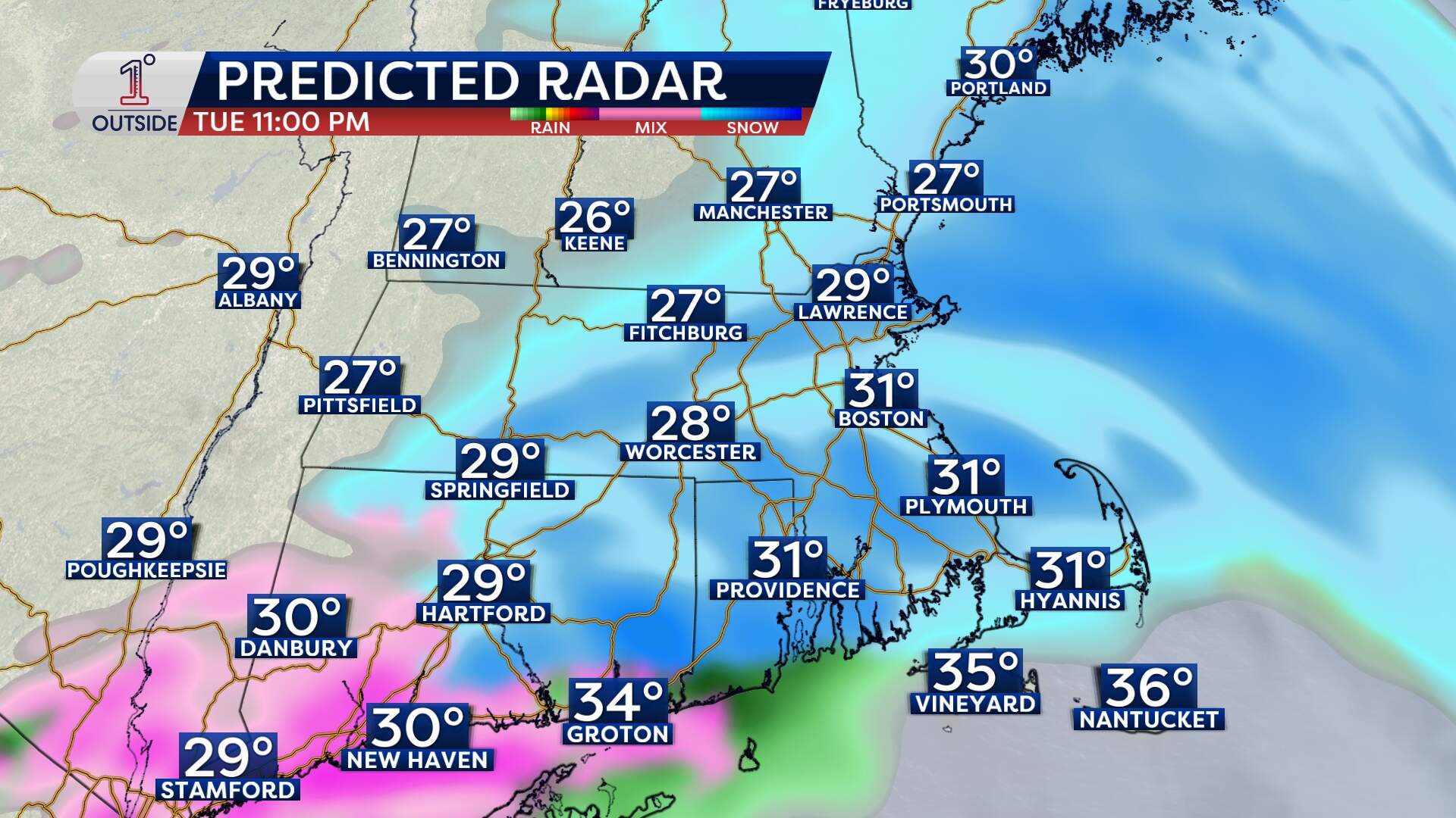
The first flakes will hit the western part of the state between 1 to 2 p.m. But for those in central and eastern Massachusetts, the snow really starts to fill in between 4:30 and 5:30 p.m. Because temperatures will be hovering right around the freezing mark at the start, road treatments should work well initially, meaning the pavement will just look wet at first.
- 5:30 p.m. to 7:30 p.m.: Expect steady pockets of snow: Visibility will drop, and the roads will start getting slick.
- 9 p.m. to 11 p.m.: A cold front will push through, bringing a second "burst" of snow, which will be heavier intensity. Temperatures will dip slightly during this window, making it much easier for the snow to stick to the roads.
- 1 a.m.: Snow wraps up
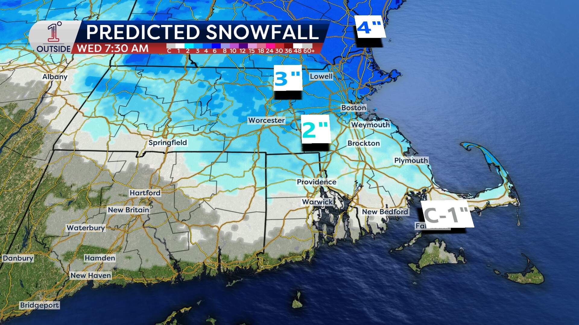
How much are we getting?
This isn't a "shoveling for hours" type of storm for the city, but it's enough to be a nuisance. Here's what is expected:
- Boston and the around the Mass Pike: Generally around 2 inches.
- North of Route 2 to the Merrimack Valley: Expect slightly more around 3 inches.
- South Shore and Cape Cod: 1 to 2 inches, mixing with rain at times on the Cape.
Warming up
By tomorrow morning, some localized slick spots are likely. The conversation over the coming days will shift to melting/refreeze cycles. That's because it's actually going to warm up a bit!
Highs will be around 40 degrees on Wednesday, in the mid to upper 30s on Thursday and Friday, and in the low 40s this weekend, too. That will promote melting of the snowpack each day and refreeze during the overnights. There will be a storm off to the southwest on Sunday, but the track and placement will be key in determining if we get another round of snow on Monday.
Get the latest updates at 1DegreeOutside.com or on the free 1DegreeOutside mobile app.
