Support WBUR
A rare 'super' El Niño may be brewing. Here's what it means for New England
While much of the recent weather chatter has centered on the cool spring stretch, a much larger signal is beginning to emerge thousands of miles away in the tropical Pacific Ocean.
Meteorologists are closely monitoring the potential for a "super" El Niño to develop by late 2026 — a phenomenon that could affect New England's summer and the upcoming hurricane season.
The current state of play
As of late April, the atmosphere is in a bit of waiting stage. We are officially in an ENSO-neutral phase, having recently moved away from the weak La Niña pattern that influenced our past winter. Meanwhile, the oceanic engine is already revving up.
Subsurface ocean temperatures in the Pacific are rising rapidly. Current models suggest that a full-fledged El Niño will emerge by early summer. The term "super" isn't just hyperbole — it’s a specific designation used when sea surface temperatures in a key region of the central Pacific (known as the Niño 3.4 region) reach 2 degrees Celsius — or more — above historical averages.
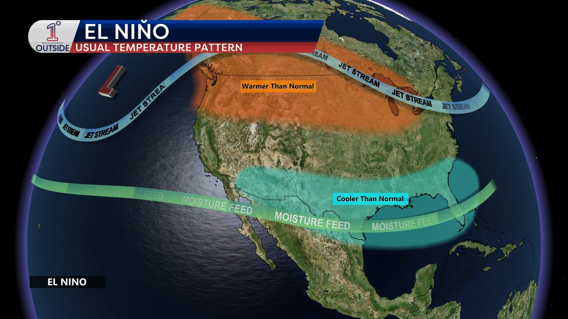
What this means for New England summer
Even before El Niño reaches its projected peak late this year, its development will exert a pull on our local weather.
- Global context: With the added heat of an emerging El Niño, 2026 is currently expected to be one of the warmest years on record globally.
- Local impact: For the Northeast, El Niño summers are often characterized by high humidity. Rather than dry heatwaves, we tend to see more tropical air masses. This moisture keeps the atmosphere active, often leading to a higher frequency of heavy rain events and afternoon thunderstorms rather than long-term dry spells.
An Atlantic hurricane 'shield'
Perhaps the most notable impact of a developing El Niño is its role as a natural regulator for Atlantic hurricanes. When the Pacific warms, it re-routes the jet stream, creating an environment of vertical wind shear over the Atlantic basin.
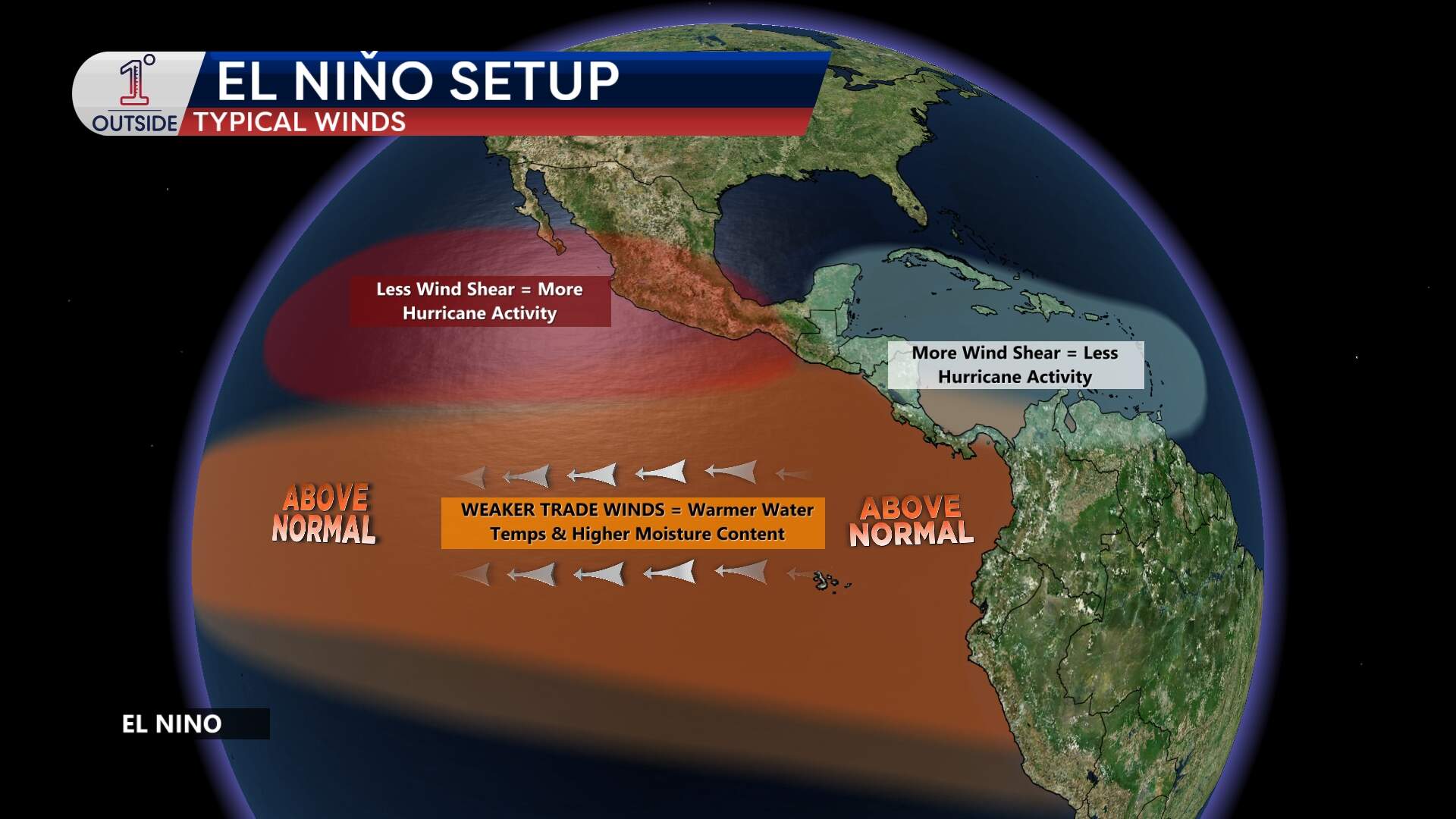
Think of a hurricane like a delicate, upright chimney. A strong El Niño creates high-altitude winds that act like a giant fan, essentially blowing the top off these storms before they can intensify. Because of this, early outlooks for the 2026 season lean toward a below-average number of storms. While Atlantic water temperatures remain at record highs, this wind shear acts as a critical counterweight that makes it much harder for storms to organize.
A tale of two oceans
The story is quite different on the West Coast. While the "shield" protects the Atlantic, the shift in the jet stream often leaves the Pacific wide open for development. For residents in Hawaii, Mexico, and even Southern California, a super El Niño typically signals a much more dangerous and active hurricane season.
Get the latest updates on the free 1DegreeOutside mobile app.
