Support WBUR
Rare, powerhouse storm system sweeps into Boston Saturday
A seasonally rare and high-energy storm system diving straight out of Quebec is set to arrive Friday night into Saturday.
This isn’t a typical "moving west-to-east" system; it’s a powerhouse diving from north to south, and it's bringing some very un-May-like conditions.
For those with outdoor plans, here is the breakdown of what to expect.
The jet stream is currently performing a dramatic dip right over New England. While storms often lose steam as they cross the country, this storm center is strengthening as it moves overhead Saturday morning. This a "seasonally rare" event because of the sheer amount of energy dropping directly into the region from Eastern Canada.
Friday looks nice for a while with a mix of sun and clouds and comfortable temperatures near 70 degrees.
- Afternoon: Scattered showers and a few downpours will start to pop, first in Northern New England and then sliding south.
- Evening: For those with Friday evening plans, keep the wet weather gear handy. Expect rounds of showers and rain between 8 p.m. and 11 p.m.
Saturday: A raw, chilly feel
Saturday is the "day of the beast." As the storm center sits right over us, it will drag down incredibly cold air from aloft.
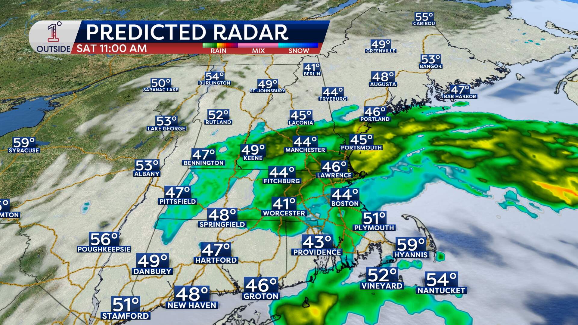
- The temperature drop: High temperatures on Saturday will likely occur at midnight. By the afternoon, many of us will only be in the 40s to low 50s. That is a staggering 20 to 30 degrees below average for this time of year.
- Snow in May? It’s cold enough about 6,000 feet up (where temperatures are in the mid-20s) snow could accumulate in New Hampshire's White Mountains. Mount Washington could see several inches, and even lower peaks might see a coating.
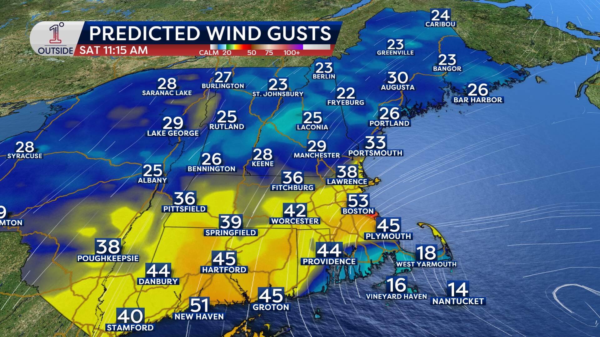
- Wind and seas: Watch out for the wind Saturday morning. Northeast gusts of 40 to 50 mph are expected along the coast and through the interior, potentially leading to isolated pockets of wind damage. A few higher gusts (50-60 mph) are possible from Cape Ann to the South Shore and Cape Cod. On the water, seas will ramp up sharply to 8 to 11 feet by Saturday late morning.
Sunday: The better half (with a catch)
Move any outdoor plans to Sunday, if possible. It will be the pick of the weekend, though it isn't a total washout-free guarantee.
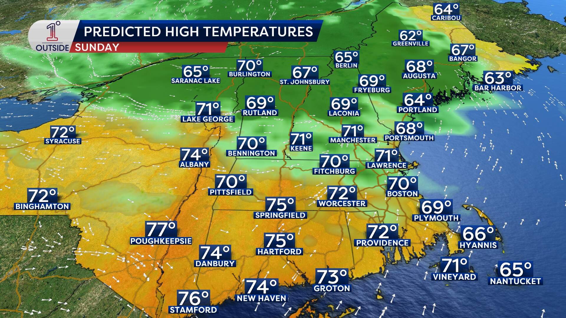
- The good news: Temperatures will rebound back into the 60s and low 70s.
- The catch: Another system rotating around that upper-level low will keep the risk of showers alive, especially later in the day as moisture sinks south from Northern New England. It won’t rain the whole time by any means, but keep an eye on the radar.
An unsettled start to June
Expect unsettled weather to linger through the start of next week. It doesn't look like a total washout for those days, but a pop-up shower or thunderstorm will be a daily possibility, especially for inland areas away from the cooling ocean influence. Highs in the 50s and 60s will be common.
There are some signs that warmer air will try to return by the end of next week
For the latest timing on the rain and updated forecasts, download the free 1DegreeOutside app.