The Seaport Cost Billions To Build. What Will It Take To Save It?
When former Boston Mayor Marty Walsh took the stage at a 2017 ribbon-cutting in the Seaport District, he spoke with pride of a neighborhood “hitting its stride.” He spoke of new retail, housing, entertainment venues, and green space. He spoke of job creation and “smart growth.” He spoke of an area that represents “our future economy here in Boston.”
“The Seaport,” Walsh said, “tells the story of our city.”
Where Walsh saw a story of vision and innovation, others — including some city officials, scientists and environmental advocates — see something else.
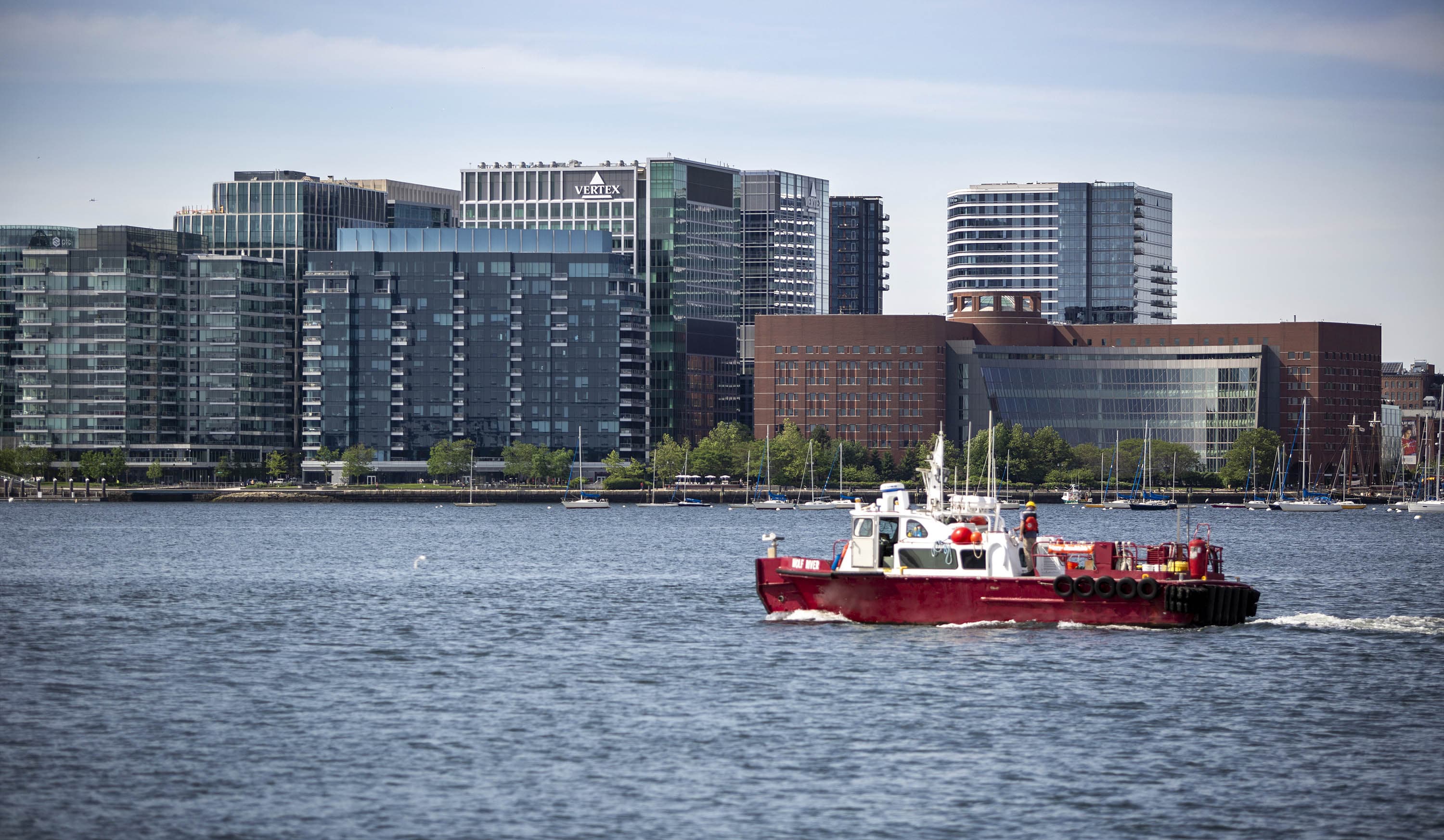
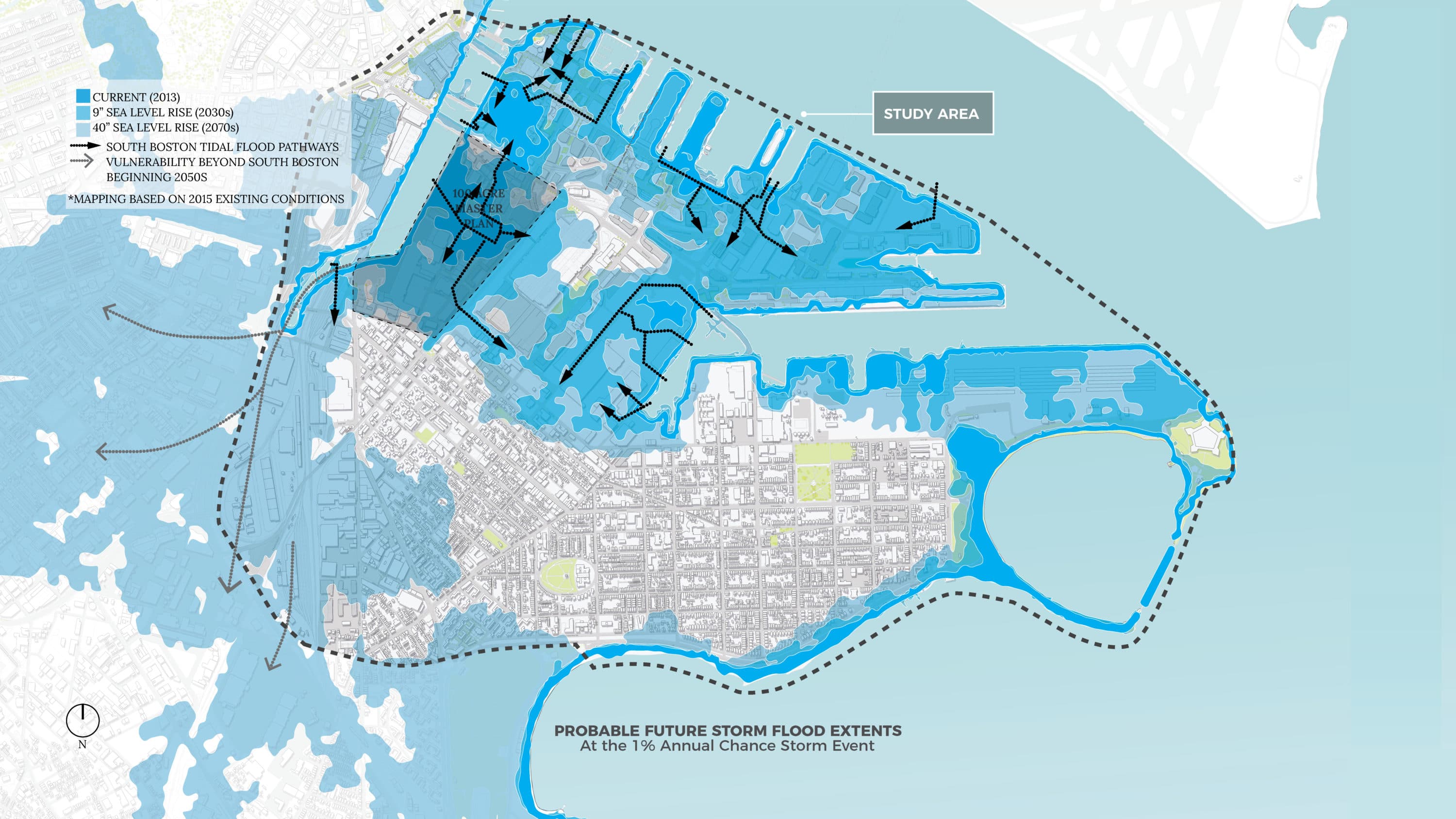
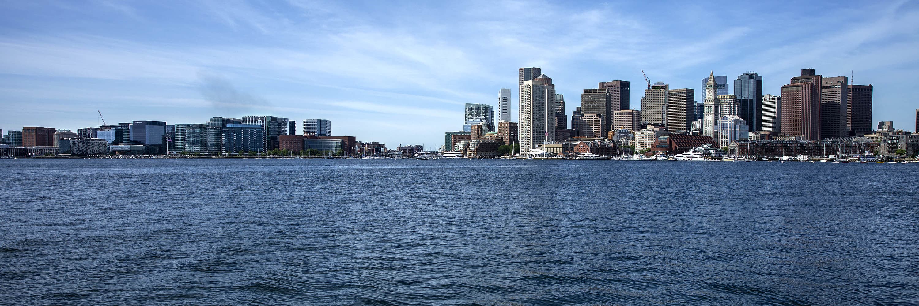
Over the past two decades, the city, state and federal governments have invested billions of dollars developing a new gleaming financial hub above what was once mudflats and salt marshes, without much planning for sea-level rise. Now, the Seaport is one of the most vulnerable waterfront areas in Boston.
By the 2030s, sea levels around Boston are projected to rise 9 inches above what they were in 2013. When that happens, a single nor’easter could potentially cause $1.2 billion worth of damage in South Boston, where the Seaport sits at the head of a number of major flood pathways.
There are plans to protect the area but little coordination — and big questions about who will foot the bill.
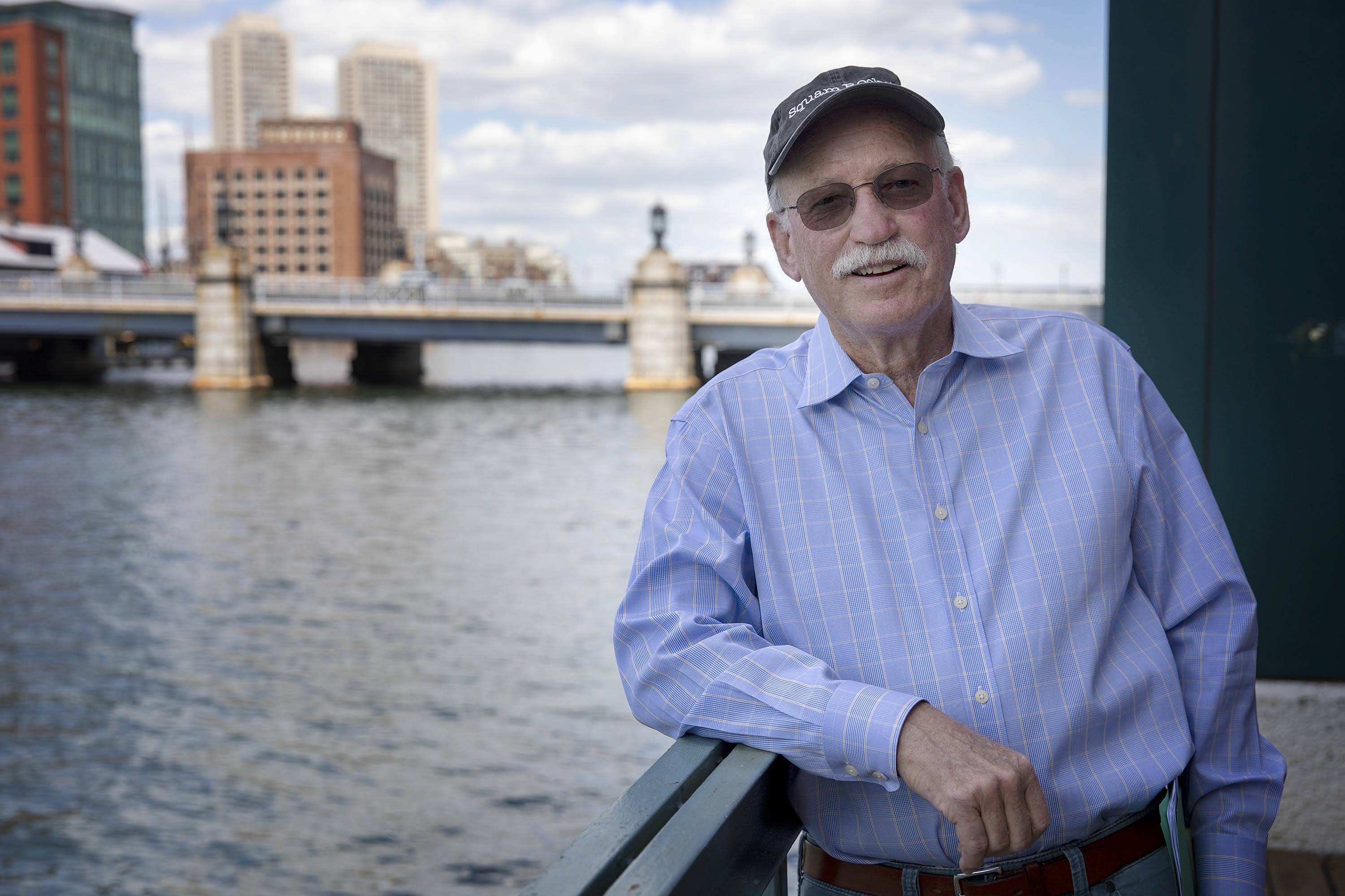
"We've got to get clear how we are going to sort that out, and not leave it to chance," said Bud Ris, senior advisor to the Boston Green Ribbon Commission.
The Seaport wasn’t built for the higher seas coming with climate change.
For centuries, the area now called the Seaport was mostly tidal marshes and mud flats. In the 19th century, investors constructed sea walls and filled land there to build a massive shipping yard. They built the new land just above the level of the highest high tide — a level that sea-level rise is making obsolete.
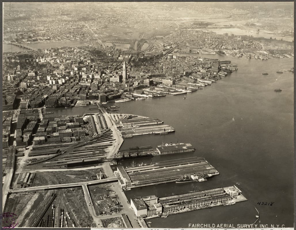
By the 1990s, the space had become a desert of parking lots and warehouses. Then-Mayor Tom Menino saw promise in the desolation, and set out to develop it.
“These 1,000 acres are among the most prized real estate in the East Coast,” Menino said in 1997, “and we intend to put them to good use.”
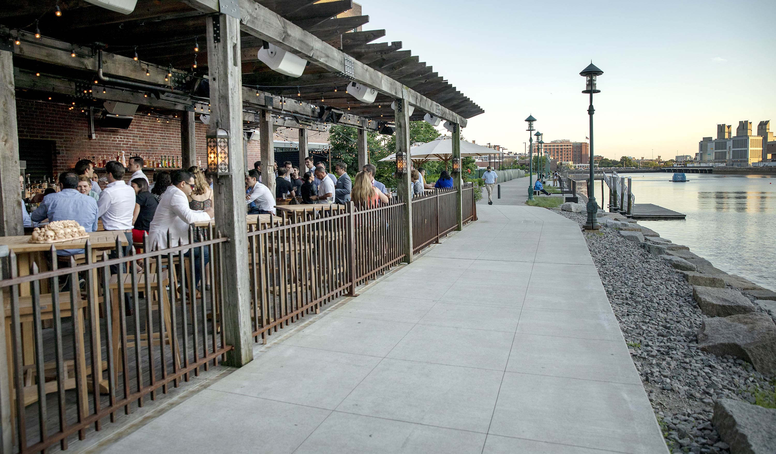
Twenty years and about $20 billion of city, state, and federal investment later, the Seaport is now a destination.
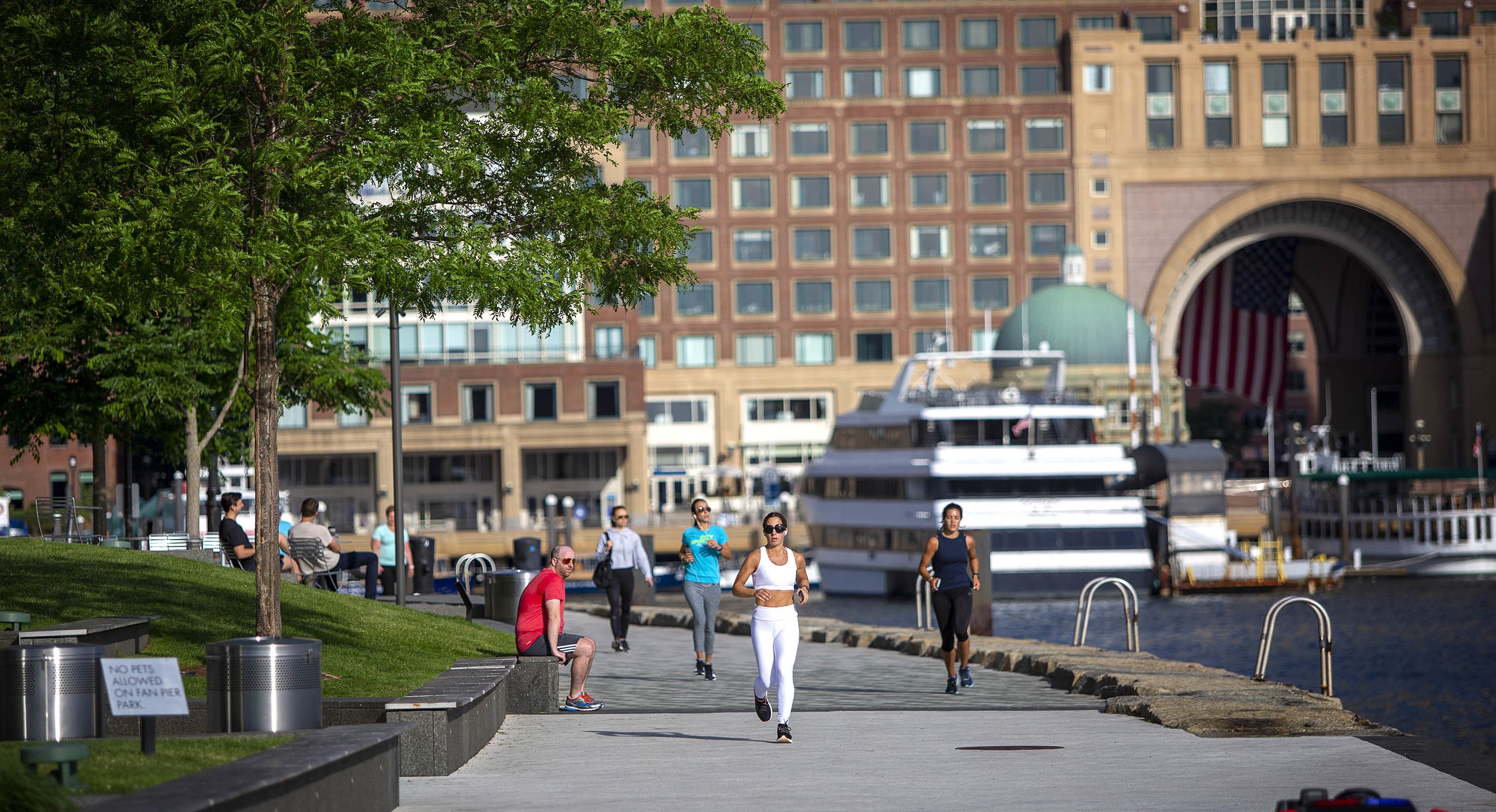
There are beer gardens, restaurants, and museums. There are waterfront parks overlooking sailboats and the Boston skyline. There are luxury apartment complexes filled with residents with a median household income of $153,545 — the highest in the city and more than double Boston's median income.
And there are glimmering glass towers filled with some of the biggest businesses in the world, including Amazon, Vertex, and General Electric.
[The Seaport] could have been a shining example of how to do it right, but it became a shining example of how to do it wrong.
Paul Kirshen
Richard McGuinness, deputy director for climate change and environmental planning at the Boston Planning and Development Agency, said investments in the Seaport have brought a range of public benefits to Boston, including jobs, housing, and tax revenue.
Since 2000, a total of 63 development projects have been approved in the South Boston Waterfront area, which includes the Seaport and Fort Point Channel, according to data from the Boston Planning and Development Agency.
The parameters for waterfront development in the Seaport were originally set by the South Boston Waterfront Municipal Harbor Plan, published in 2000. Bob Durand, the former Massachusetts secretary of environmental affairs who chaired multiple public hearings on the plan, said he doesn’t remember sea-level rise being much of a concern in early Seaport planning discussions.
“Nobody was making the connection at the time,” he said.
McGuinness said that it wasn’t until 2016, when Climate Ready Boston published an extensive report projecting a maximum possible sea-level rise of 10.5 feet by the end of the century, that his agency really understood the extent of the problem and began to incorporate climate resiliency into their development work.
By that point, 40 development projects in the Seaport had already been approved, according to the BPDA.
Boston Planning and Development Director Brian Golden said the BPDA made the best possible decisions in the Seaport with the information they had at the time — primarily outdated Federal Emergency Management Agency (FEMA) flood plain maps. In 2014, the city petitioned FEMA to redraw the maps because officials were concerned they didn't appropriately consider the impacts of climate change and sea-level rise.
Paul Kirshen, professor of climate adaptation at the University of Massachusetts Boston and director of the Stone Living Lab, said city officials could have done a much better job planning for sea-level rise. Even though the sea-level projections did improve substantially in 2016, climate change has been a known threat since at least the 1980s and officials should have assumed predictions would increase over time.
“[The Seaport] could have been a shining example of how to do it right, but it became a shining example of how to do it wrong,” Kirshen said.
City Councilor Michelle Wu put it even more bluntly at a recent mayoral candidate forum: “The Seaport is one of the starkest examples of what’s wrong with our development system overall.”
The city has stepped up its resiliency efforts in the Seaport, and across Boston, in recent years.
In 2017, the BPDA began requiring all new development projects complete a Climate Resiliency Checklist, outlining their strategies to adapt to sea-level rise. In 2019, the agency published Coastal Flood Resilience Design Guidelines with recommendations for existing buildings and new construction on how to protect their buildings for the up to 40 inches of sea-level rise Boston could experience by the 2070s.
WBUR reached out to companies and developers in the Seaport about their sea-level rise adaptation plans including Vertex, MassMutual, and Cronin Development. All declined to grant interviews.
This year, the BPDA proposed a new zoning overlay district that will require new developments and renovated buildings comply with the resilience design guidelines.
But numerous district-wide coastal resiliency projects are needed to fully protect South Boston over the next 50 years, according to the 2018 Climate Ready South Boston report. Those plans were initially estimated to cost up to $1 billion, but Ris, who helped author the report, said that number could double.
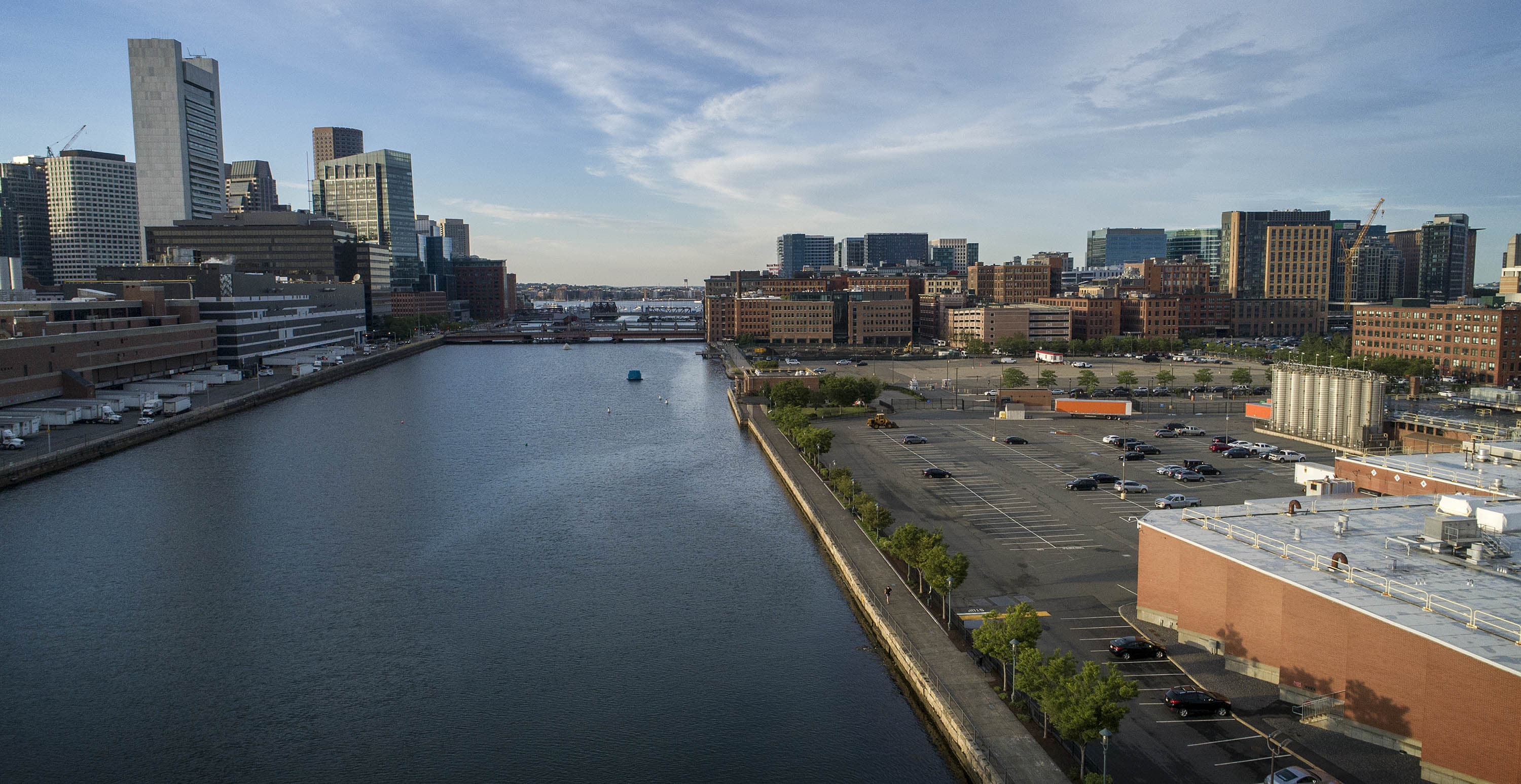
The most urgent projects, according to the report, are along the southern side of the Fort Point Channel, the long harbor inlet that separates South Boston from Downtown. The channel gives flood waters a pathway into the Seaport and has some of the lowest lying land.
Two projects are currently in the works towards the end of Fort Point Channel, near the Gillette Headquarters.
The projects will raise the existing harbor walk along the Channel a few feet and turn it into one continuous berm to hold back high water.
One is expected to be funded by a $10 million FEMA grant, which the city will match, according to the BPDA. The other — a climate resilient park, with a waterfront amphitheater and a possible floating stage — will cost an estimated $15 to $20 million. Developers Related Beal and National Development, who are constructing buildings on nearby parcels, will foot the bill for the park, according to the BPDA.
Ris said those projects are examples of how resiliency efforts could both improve public access to the waterfront and make Boston’s wealthiest neighborhood a little more welcoming.
“But we have two things here that you don’t have elsewhere: We’ve got empty land and big developers where the cost of resilience will be a fraction of their overall costs,” Ris said.
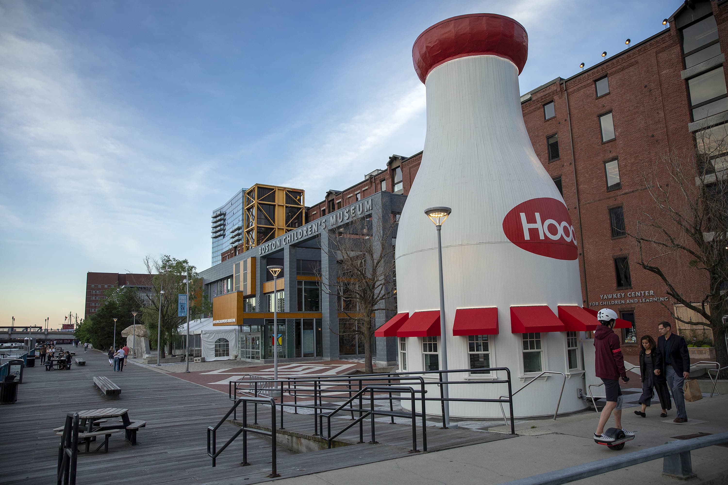
That’s not the case just a few blocks up the channel, at the Boston Children’s Museum.
The museum, the only nonprofit on the channel, began planning its own flood defense beneath its famous Hood Milk Bottle after a nor'easter in 2018 brought flood waters up over the harbor walk and surrounded the building.
"The museum was essentially an island," said Carole Charnow, the museum's president and CEO. "That was a major wake up call for us."
The museum’s plans – expected to cost around $30 million – are in line with the goals of Climate Ready South Boston and would benefit not only the museum, but many buildings behind it, Charnow said. And yet, they’ve received little support from their neighbors or the city so far.
There needs to be “a coordinated effort on the part of the state and the city,” Charnow said, “and it’s just not happened yet.”
Golden acknowledged that the current strategy — pulling resources from development projects, grant funding and city tax revenue — will likely not be enough to afford all the protections the Seaport will need. By 2070, almost the entire Seaport Seaport could flood on a monthly basis, or possibly more often.
But the current approach, he said, allows the city to deal with the issue over time.
"We do not have to solve the problem today," he said. "But we do have to begin to incrementally address the problem every single year for multiple decades to come so that we're ready for the significant sea-level rise we’re expecting."
Even the Seaport's critics say it must be protected — not just for its own sake, but for the rest of Boston.
For one thing, the Seaport is the first line of defense against flooding into all the South Boston neighborhoods behind it, said Deanna Moran, director of environmental planning at the Conservation Law Foundation.
"Flood waters don't respect municipal boundaries and they don't respect neighborhood boundaries," she said.
Climate resilience needs to become a core government function, just like roads and schools, or we’ll end up with islands of resilience and wealth surrounded by people suffering who shouldn’t be.
Julie Wormser
Seaport flooding could potentially send ripples through the local economy as well.
"It's a big part of the city's tax base now, which ultimately pays for schools and infrastructure and services elsewhere in the city," Ris said.
Despite the obvious need, questions remain about how the Seaport's protection will be paid for.
That’s the crux of the problem, according to Ris. Right now, he said, the responsibility for implementing resiliency plans is scattered among multiple agencies and the private sector. And, while he thinks private developers in the Seaport have responded to the challenge well in recent years, that's not sustainable.
“We have to make a clear decision about who should pay," Ris said.
But calculating the fair-share costs among different property owners is complicated, McGuinness said. Stakeholders would have to determine how much of the Seaport’s property tax revenue could realistically be dedicated to neighborhood resiliency projects without diverting too much from other essential government services.
The BPDA has successfully negotiated with real estate developers to add flood protection to individual development projects and pitch in for district-wide solutions, according to Golden. And that tailored approach, he said, works better than a one-size-fits all solution.
"We've always been concerned that a formulaic approach may not be nuanced enough to address the particular needs of each parcel in each neighborhood," he said.
But to Moran, the current strategy is still too "piecemeal."
“This ad hoc, parcel-by-parcel, project-by-project resilience approach is not a long-term solution,” she said, asking instead for "a better strategy" to bring the development community into conversation and leverage new development to build protections that benefit the entire neighborhood.
Moran said she's worried some buildings in the Seaport could ultimately get subsidies to retrofit because of their economic influence at the expense of older, low- and moderate-income housing that needs it more.
Moran agreed that Boston has some of the best climate resiliency plans in the country, but said that implementation has lagged behind, partially because climate resilience is a relatively new discipline for municipal governments. While there have been plenty of discussions on long-term funding strategies, she said, the city just hasn't "been able to crack that nut."
That's worrisome, said Julie Wormser, the deputy director of the Mystic River Watershed Association, because the city and state don't have enough public funds to pay for all the projects needed to buffer the city against the effects of climate change.
In 2020, Boston committed 10% of its annual capital budget — about $20 million annually — to climate resilience efforts, according to the Boston Green Ribbon Commission.
“That’s by far the most public funding available for these projects,” Wormser said, and yet it still won’t be enough to afford all the projects planned in Boston. And other sources of public funding, like state and federal grants, are highly competitive.
Because of those constraints, Wormser said it makes sense that resilience projects in the Seaport will need to rely on private funding from big developers with deep pockets. However, a city-wide strategy that relies too heavily on private funding could lead to serious equity issues in other neighborhoods, potentially pushing out existing communities to bring in development projects that can afford to protect themselves.
The only solution, she said, is to generate more public wealth. In other words: the government — at all levels — needs more tax revenue, which is not generally a popular proposition.
"Climate resilience needs to become a core government function, just like roads and schools," she said, "or we’ll end up with islands of resilience and wealth surrounded by people suffering who shouldn’t be."
Ris, who has been watching the Seaport develop for decades, said he understands it will take time to figure out a long-term financing solution that combines public and private dollars equitably. But the sea is quickly approaching, and Boston needs to move with urgency.
For starters, Ris said he'd like to see the city create a new cabinet-level position dedicated to implementing Boston's more than 70 resiliency projects — some of the first of which are in the Seaport.
“The clock’s ticking,” he said. “It’s going to come back to bite us if we don’t get really serious.”
This segment aired on June 16, 2021.