Support WBUR
Citizen Scientists In The Fukushima Fallout Zone
He's telling me about the spring of 2011, when he drove into one of the most contaminated places in the world: the fallout zone around the Fukushima Daiichi nuclear power plant.
"Chernobyl was the last and only comparable accident," he says.
Franken is founder of a group called Safecast. Its mission: to monitor radiation in the Fukushima fallout zone.
Franken says many people believe the Japanese government’s measurements are inadequate, and they don't understand which areas are safe and which are dangerous.
At first, Franken just wanted to distribute Geiger counters to people across the region so they could map the radiation themselves. But in the days after the accident, the world’s entire supply of Geiger counters sold out.
"We then got together in Tokyo and we came up with the idea of using the few Geiger counters that we did have to make them mobile by putting them on a car, very much how Google collects their streetmaps."
A week later, Franken and his fellow volunteers hacked together a car-mounted gadget that combined a Geiger counter and a GPS.
Franken pulls open a laptop and shows me the online map created with the radiation measurements taken by Safecast volunteers.
"Now we are looking at the area in Fukushima and around Fukushima prefecture," Franken says. "You can see what are the levels in front of the Daiichi power plant.
The evacuation zones established by the Japanese government in spring of 2011 were in the shape of circles. If you lived within a 12-mile radius of power plant: mandatory evacuation. Between 12 and 19 miles from the plant: voluntary evacuations.
But Franken and his fellow volunteers quickly realized that the patterns of radioactivity didn’t conform to those neat circles.
"It had to do with the fact that there were mechanisms to how the stuff traveled after the accident, that had to do with wind and rain and how the mountains were probably funneling the thing through," Franken says. "That really inspired us to do measurements at more granular level. And that created the map you’re looking at, which has close to 10 million measurements on that."
Safecast’s data is important right now because the Japanese government is reopening evacuation zones for habitation. Joe Moross, another Safecast volunteer, says that so far, people are staying away.
"I haven’t seen on my trips any evidence that people are actually living there. The traffic lights are on, there are a few signs of life, but if you drive around at 8 o’clock, 9 o’clock at night, just after dark, there aren’t any houses with lights on," Moross says.
I ask Moross if he thinks it’s too dangerous for people to move back to the towns in the fallout zone. He tells me danger is a relative concept.
"Let’s say you believe one study of the levels of danger and say you’ve got an increase of 20 percent of getting cancer over the next 20 years," Moross says. "If you’re 70 years old, probably that’s just not going to factor into your decision and you can go back there with a clear conscience. But if you’re a young mother with toddlers or grade school children, that’s a much different risk."
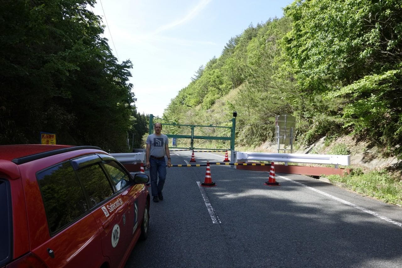
A few days after my visit to Safecast headquarters in Tokyo, a few of the volunteers visit sites the Japanese government says have been successfully decontaminated in order to verify the government’s radiation measurements. I hop in the car with Joe Moross volunteer Azby Brown, as they plot out a route.
When we reach the Fukushima evacuation zone, the roads are empty. Stores are shuttered, and every post office box carries a sign announcing that mail is no longer collected here. Still, the scenery is surprisingly beautiful. Cranes stand in a fallow rice paddy and irises bloom by the side of the road.
We’re driving to a school in the town of Iitate, just outside the mandatory evacuation zone. Brown says in the first days after the accident, Iitate’s residents thought they were safe. Then they got bad news.
"About a week or so later, some measurements came, partly from DOE, the United States’ Department of Energy aerial monitoring, which became available, also from independent groups like Safecast," Brown says. "And then a professor at the University of Kyoto provided more detailed measurements and showed the town of Iitate, which was not evacuated initially, had some of the highest levels of contamination. So people stayed there longer. It was not fully evacuated until June."
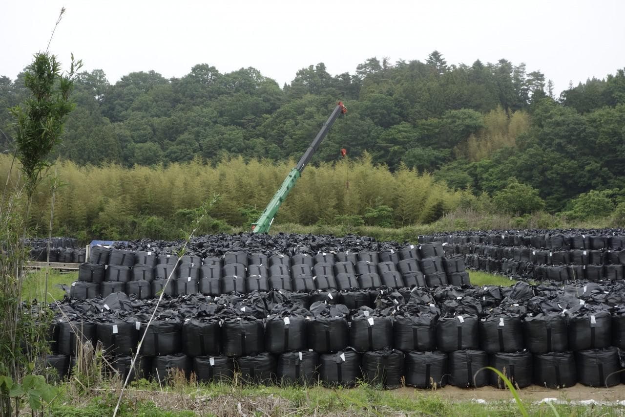
Today Itate remains deserted. The Japanese government has begun decontamination projects here. At the school we’re headed for, the government has replaced all the topsoil in the playground and published radiation measurements showing the area is now safe. The Safecast volunteers want to verify that claim.
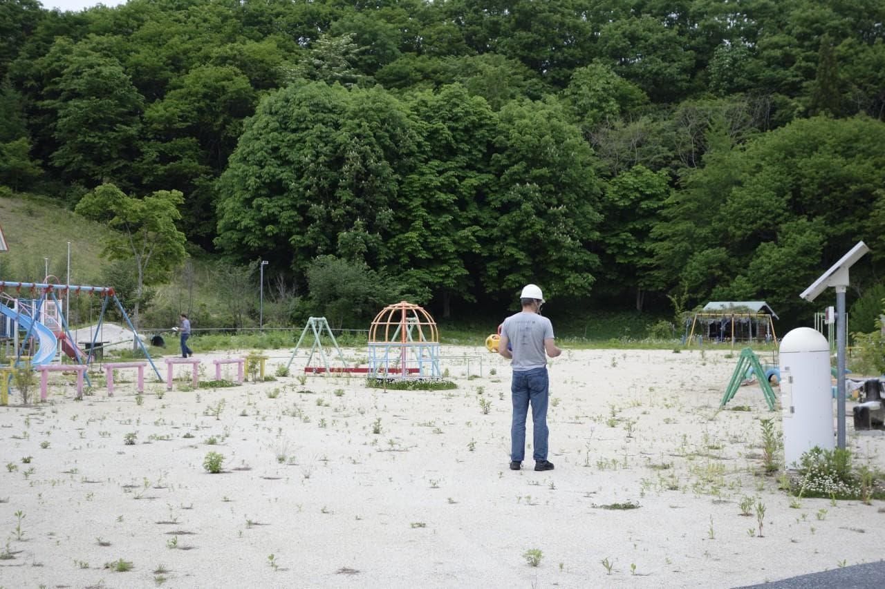
We arrive at the school, and Moross and Brown crisscross the playground, measuring radiation under the swingsets and the monkeybars. We’re the only human beings here. It's eerily quiet.
Once Brown has his measurements, he compares them to the government’s radiation readings for this spot.
"It was pretty close to what they’re claiming, but on the high end," he says.
Brown says that in the playground itself, where workers replaced the topsoil, the radiation levels weren’t too bad.
"But on the fringes are these low hillsides and its covered with undergrowth, and they did not decontaminate there, so as soon as you go there, the levels are much higher — noticeably higher."
Brown says the government data isn’t false, but he thinks it’s not comprehensive enough to allow Iitate’s residents to make an informed decision about whether or not to return to their homes.
"Many parents in this situation don’t just want to know what the level is in the center of the playground," Brown says. "Kids will run to the edges, they will run up into these hills, they will climb through bushes. If those levels are higher, they want to know that."
If Iitate’s residents decide the risks are acceptable and move back, this playground will come alive again with playing children. Until then, it’s a playground in a ghost town.
Eliza Strickland is an associate editor for the international technology magazine IEEE Spectrum. She tweets @newsbeagle.
This segment aired on August 23, 2013.