Advertisement
MBTA Updates Maps
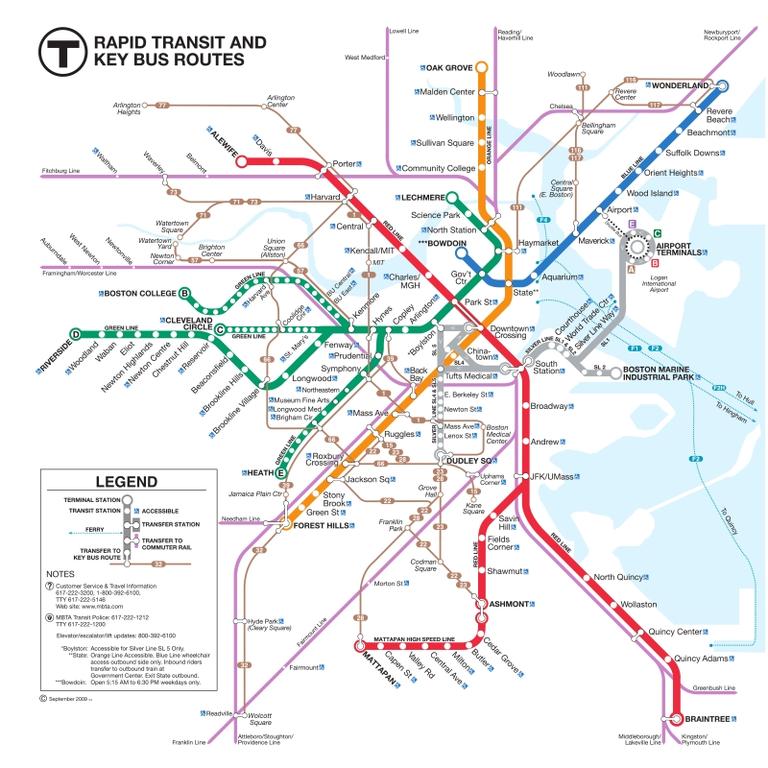
 Navigating through the city using public transportation became a little easier on Monday, as the MBTA updated its maps.
The most noticeable change is a new light brown line, which represents connections to bus routes to and from subway stations.
The Government Center station was the first to be updated.
Instead of a 40-year-old map, commuters can now see the new version, which also displays places of interest in the area.
The changes are part of an effort by the MBTA to provide riders with the necessary tools to better plan their commute.
This program aired on September 21, 2009. The audio for this program is not available.