Advertisement
Forecast: Nor'easter Arrives Monday With Strong Wind And Rain
Typically in January I would be forecasting snow and wind — not rain and wind — from a storm moving up the coastline, but the lack of cold air means our upcoming storm will bring lot of rain, not snow.
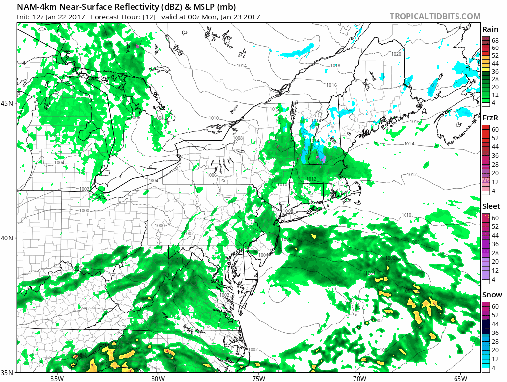
During the next 24 hours a storm will move up the coastline becoming stronger along the way and bringing primarily wind and rain. The lack of cold air means snow and ice are not a big factor in this storm. If temperatures were more typical of late January I would be forecasting a one to two foot snowstorm, but this hasn't been a cold winter, so rain is what we are about to get.
The one benefit of the upcoming rainfall is some drought alleviation. 1 to 2 inches of rainfall, without frozen ground, will definitely help recharge soil moisture levels at a time of the year when this often doesn't occur.
Any precipitation before Monday afternoon will be light. A few showers, some mist or even a few sleet pellets inland are not out of the question. Later in the day Monday the heaviest rain will move into the area. The timing means the evening commute Monday and the morning commute Tuesday are both going to be impacted.
Wind is another aspect of this storm. Winds will be strong enough along the coast to create some tree damage and subsequent power outages. Neither will be widespread but both can occur Monday afternoon and the first part of the overnight when the storm is most intense. This could impact flights at Logan Airport in Boston as well.
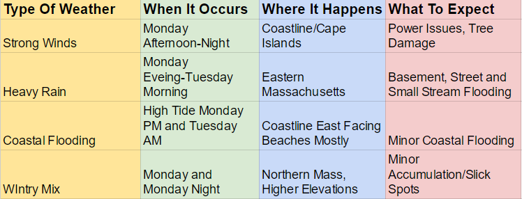
I am expecting 1 to 2 inches of rainfall during the period from Monday to Tuesday morning. This is enough for street, basement and urban street flooding. I would recommend giving your basement sump pump a quick check if you have one and are prone to flooding.
The storm ends early Tuesday with two much better and pleasant days on Wednesday and Thursday. Temperatures will still be quite a bit above normal as we close out the final full week of January.
You can follow David's weather updates on Twitter at @growingwisdom
Sunday: Cloudy with some mist, drizzle or a few showers. Highs in the low to mid 40s.
Sunday Night: A few showers or some mixed sleet and rain. Lows in the low to mid 30s. Becoming breezy.
Monday: A windswept rain developing. A few hours of snow and sleet in the higher elevations of Worcester county. Highs in the mid 30s to mid 40s north to south.
Tuesday: Morning rain ends then cloudy. Highs in the 43-48 degree range.
Wednesday: Sun and clouds. Highs 45-50.
Thursday: Mostly sunny and pleasant. Highs in the mid to upper 40s.
