Advertisement
Forecast: Unusually Warm February Day As Temps Likely To Be In The 60s
Yesterday, temperatures reached the mid 50s to near 60 with plenty of sunshine. This morning readings are back to the 30s, which is chilly but not nearly as cold as you'd expect for the final week of February.
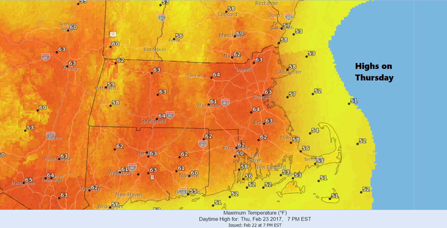
Today will be sunny as a warm front lifts to our north. This allows the exceedingly warm air that has been to our south and west to invade the area. Boston will reach at least the lower 60s.
The record for the area on this date is 65 degrees, and because of some cooler air from the south, it's not likely we hit it. Of course, using the words "cooler air" when it's going to be in the lower 60s in February seems rather silly anyway.
All this warm air might be comfortable and exciting, but you don't want this to last. Too much early warmth will cause buds to break open and important crops like apples and peaches could again be damaged if cold weather returns in March. Last year's entire peach crop was destroyed in Massachusetts and surrounding states, and we don't need a repeat.
Clouds along with cooler air (though, again, still quite mild for February) are with us Friday. I can't rule out a shower or two, but there's a better chance things stays dry all day.
Another weather system brings very mild air, showers and perhaps a few thunderstorms Saturday evening. This should further erode much of the remaining snow pack. I have about 7 inches of snow left on the yard, and it will be interesting to see if the warmth over the next few days makes it disappear.
Sunday is a cooler, sunny day. Lastly, I don't see any prolonged cold or snow in sight.
You can follow my updates on Twitter at @growingwisdom
Thursday: Clouds and then sunny periods. Very pleasant. Highs 58-68.
Thursday Night: A few showers, otherwise just cloudy with patchy fog. Lows 39-46.
Friday: Lots of clouds, may shower. Highs around 50-58.
Saturday: A few showers by the end of the day. Maybe nighttime thunder. Mild. Highs in the upper 50s and lower 60s.
Sunday: Becoming mostly sunny and cooler. Highs 41-45.
Monday: Mostly sunny and seasonable. Highs in the mid-40s.
