Advertisement
Forecast: Warmer This Weekend As Jose Finally Falls Apart
The tropical storm known as Jose finally became post-tropical on Thursday, ending a nearly 17-day run as a named tropical storm. It's the seventh longest-lived Atlantic named storm since satellite-tracking began around 1966.
While the storm is no longer tropical, it is still present and creating wind and rough seas. These conditions will continue throughout the day along with a lot of clouds and a few showers over Cape Cod and Nantucket. Some of these showers could rotate up to Boston and the immediate suburbs.
Temperatures will be on the cooler side with the northeast flow of air, but the cool weather isn't going to last into the weekend. Actually, by the time we get to Sunday many of you have the need to put the air-conditioners back on as inland temperatures reach the mid-80s.
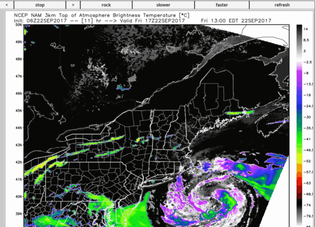
The weekend itself looks quite nice. We need to clear out the clouds first, though. That clearing will take place on Saturday morning. The loop below shows the cloud mass associated with Jose spinning over us today and then moving east on Saturday. As the image becomes black, that is an indication of clear skies.
If it is cloudy when you awake early Saturday, the trend will quickly allow for the sun to take over and temperatures to warm into the 70s to lower 80s over inland areas.
It turns even warmer on Sunday with highs well into the 80s. I would not be shocked to see some inland areas hit 90 degrees by Monday as this late-season warmth really takes hold. It turns cooler by the middle of next week.
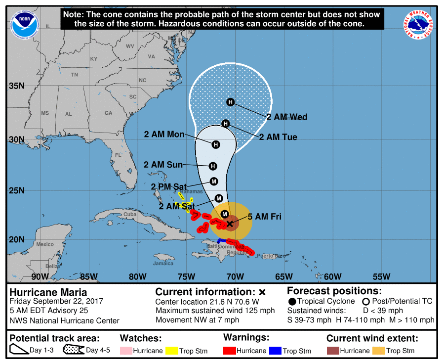
Maria remains a hurricane, but is likely to take a path off the coast of the United States. This could bring some rough seas back to our coastline later next week.
Have a great weekend!
You can follow my updates here and on Twitter @growingwisdom.
Friday A period of showers or a steady rain over Nantucket and the Cape. Chance of brief showers elsewhere. Cloudy. Breezy to windy on Cape Cod.
Friday Night: Cloudy with a small risk of a shower. Best chance of precipitation is over Cape and the Islands. Lows 61-65. Diminishing winds.
Saturday: Becoming sunny from west to east after any morning clouds depart. Highs around 70 on the Cape and Nantucket, with temperatures around 80 just west of Boston.
Sunday: Sunny and warm. Highs 80-87; cooler Cape and the Islands. Highs 70-77.
Monday: Mostly sunny. Highs in the mid to upper 80s. Cooler on the Cape and the Islands.
Tuesday: Mostly sunny and warm. Highs in the 80s. Cooler on the Cape and Nantucket.
