Advertisement
Forecast: Up And Down Temperatures Continue
As expected, showers and thunderstorms crossed the area yesterday evening and ushered in a new air mass of cooler marine air.
Today will feature a lot of clouds, but sunshine will develop throughout the day, especially the further north you go. Skies may brighten up everywhere this afternoon.
I am expecting temperatures to be 20 degrees cooler than yesterday, with highs in the upper 50s to lower 60s. It will be especially cool over the northeast coast.
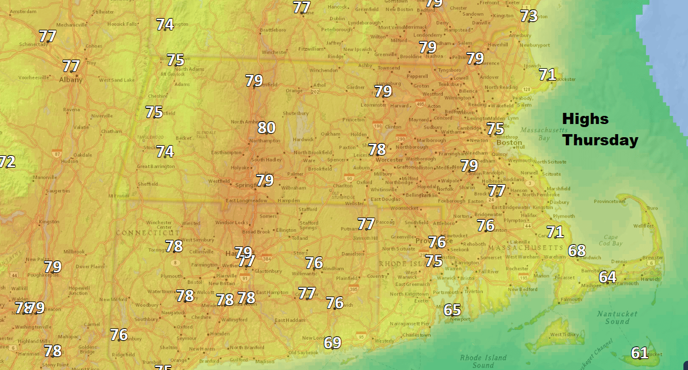
We are going to be plagued by a frontal system over the next several days, which will bring more shower activity as we head into the weekend. The Boston area will be on the southern side of the front Thursday. That means that after today's chilly temperatures, Thursday we'll be back near 80 degrees by the afternoon. There will also be quite a bit of sunshine and even a bit of humidity.
The front slips south again on Friday, putting us on the cool side with temperatures once again only in the upper 50s and lower 60s. A wave of low pressure will develop along the front and move into New England on Saturday, bringing scattered showers and even a period of steady rain especially in the morning.
It's back to the warmer air for Sunday. It will be a better day, but I'm not seeing a ton of sunshine. Next week looks seasonably warm without any prolonged rain events.
You can follow my updates here and on Twitter @growingwisdom.
Wednesday: A morning shower. Clouds and some sunny breaks north. Highs 57-64.
Wednesday Night: Cloudy and cool Turning cool. Lows 50-55.
Thursday: Sun and clouds. Highs 75-80. Cooler Cape Ann/Cape Cod.
Friday: Clouds, some sun, a shower. Highs 60-65.
Saturday: Cloudy with showers. 58-63.
