Advertisement
Forecast: Unseasonably Cold Into Saturday, Then Milder With Rain
Very cold arctic high pressure over the Northeast today will lose its grip on the region this weekend. In fact, temperatures will make it above freezing Saturday and stay warm enough for the next precipitation event to be rain.
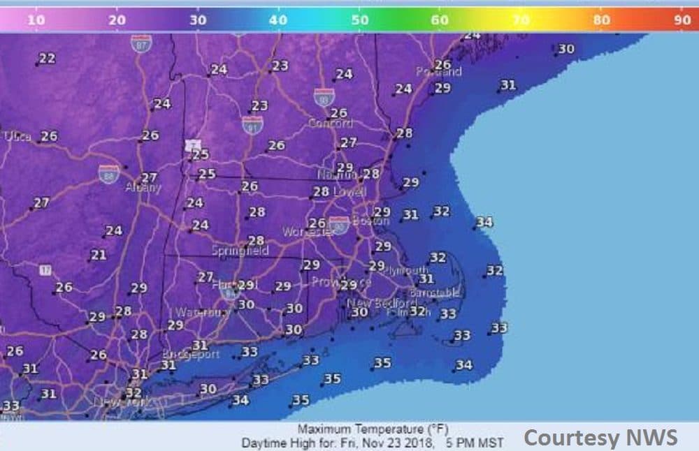
Plenty of sunshine will be with us Friday with temperatures still well below normal. Temperatures will struggle to reach the upper 20s while our normal highs should be in the upper 40s. Readings will rise through the 30s Saturday as winds turn more southwesterly with increasing clouds by evening.
The second half of the weekend will turn rather wet as a storm moves at us from the southern states. Clouds will increase rapidly Saturday evening with rain overnight into Sunday.
About a half inch of rain is expected before ending by daybreak Sunday. Another storm will approach Monday night with more rain but with slightly colder air on the backside of that system for the midweek period.
Today: Sunny, breezy. Still much colder than normal. High of 28.
Tonight: Mostly clear. Low 22.
Saturday: Sunshine with increasing clouds late. High 40.
Saturday night: Cloudy. Rain overnight, some downpours. Temperatures rising through the 40s.
Sunday: Mostly cloudy. An early high of 48, dropping to the low 40s in the afternoon.
Monday: Morning drizzle and fog. Rain redeveloping Monday night. High of 48.
Tuesday: Becoming pretty sunny. High of 44.