Advertisement
Today's Weather: Overnight Storm Brings More Than 10 Inches Of Snow To Boston
It's a beautiful day across southern New England with plenty of sunshine and seasonably cool temperatures. Many areas will reach the low 40s this afternoon and this will provide a bit of melting. You may be surprised how much snow actually melts in areas that are exposed to full sun all day.
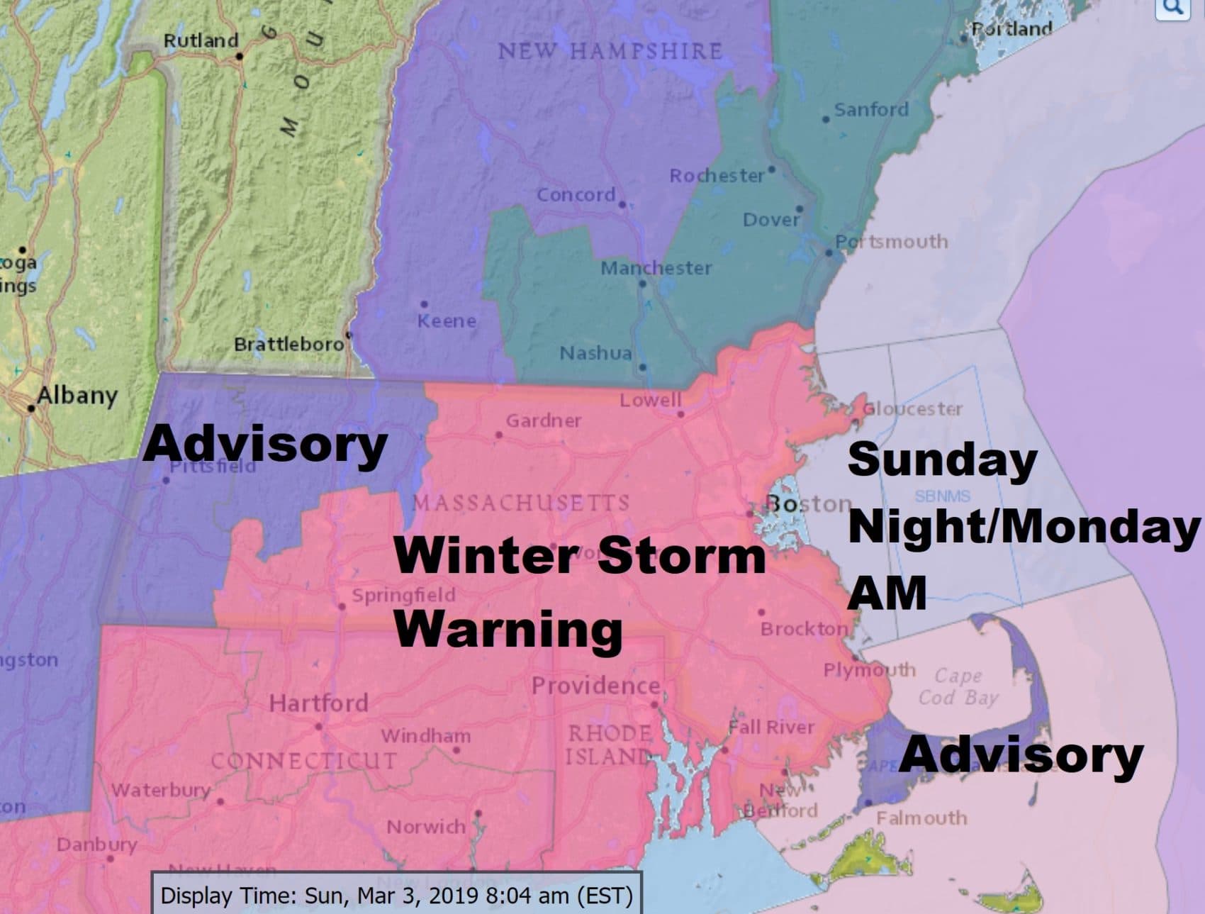
Our next storm system is quickly moving toward the region.
Snow will break out this evening and continue until around sunrise tomorrow morning. It looks as though most areas will see between 4 and 8 inches of snow, with less as you head toward central and western Massachusetts, as well as northern New England. There will also be less snow on Cape Cod and the Islands. That is the area with the least confidence in the snow totals.
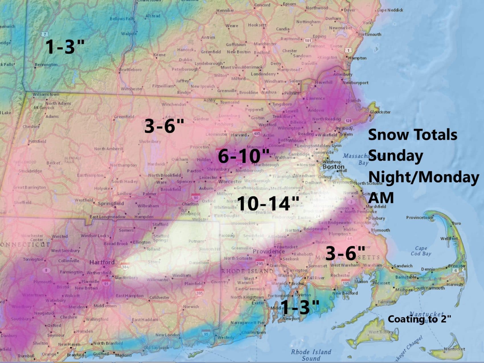
The rain-snow line will be cutting through parts of Cape Cod. This means that area will see the greatest difference in snowfall over the shortest distance. It's very difficult to predict exactly where the rain-snow line is going to set up, but some areas could see all rain while 20 miles away has 3 to 4 inches of snow. For those of you in that region just be prepared for a wide range of conditions late tonight and tomorrow morning.
The snow will be on the wetter side and it's also going to come down quite heavily between roughly midnight and 5 in the morning. I think they'll be some 1-inch rates per hour of snow. Obviously this amount of snow in a short time will be more difficult for DPW crews to keep up with. This will likely lead to cancellations and delays tomorrow morning.
Behind this system cold air from Canada filters south. Temperatures tomorrow won't be that cold but by the time we get to Wednesday, readings will struggle to get even near 30 degrees. This is more than 10 degrees below average and will be the trend the rest of the week. I don't see any milder-than-average weather on the horizon.
You can follow my updates here and on Twitter @growingwisdom.
Sunday: Sunshine and clouds. Highs near 40.
Sunday Night: Snow, could be heavy. Mixed with rain south. Lows 28-34.
Monday: More snow early, then ending by 7-9 a.m. Clearing and seasonable. Highs 35-40.
Tuesday: Partly sunny and cold. Highs under 30.
Wednesday And Thursday. Mainly sunny. Highs in the mid 20s.
Friday: Sunny. Highs around 30.
