Advertisement
Weekend Weather: Sunshine And More Seasonable Weather Through Saturday
High pressure over the northeast will dominate our weather through Saturday. This means plenty of sunshine to end the week with a rather nice start to the weekend. Temperatures should approach 40 in some towns Saturday, which is still a few degrees
below normal.
The pleasant weather will not last long, however. It will be quickly interrupted by an approaching storm Saturday night. This next system will track into the Great Lakes region Sunday with a secondary low passing over southern New England. This storm
track is not favorable for snow as milder air surges northward. Although some mixed precipitation is likely at the start Sunday morning, the switch to all rain will occur during the day.
This system does not have a lot of moisture and is moving quickly. By Monday, it will be to our east with some partial clearing taking place. Unlike past systems that were replaced with bitterly cold air, the temperatures following this one may edge above normal during next week for a change.
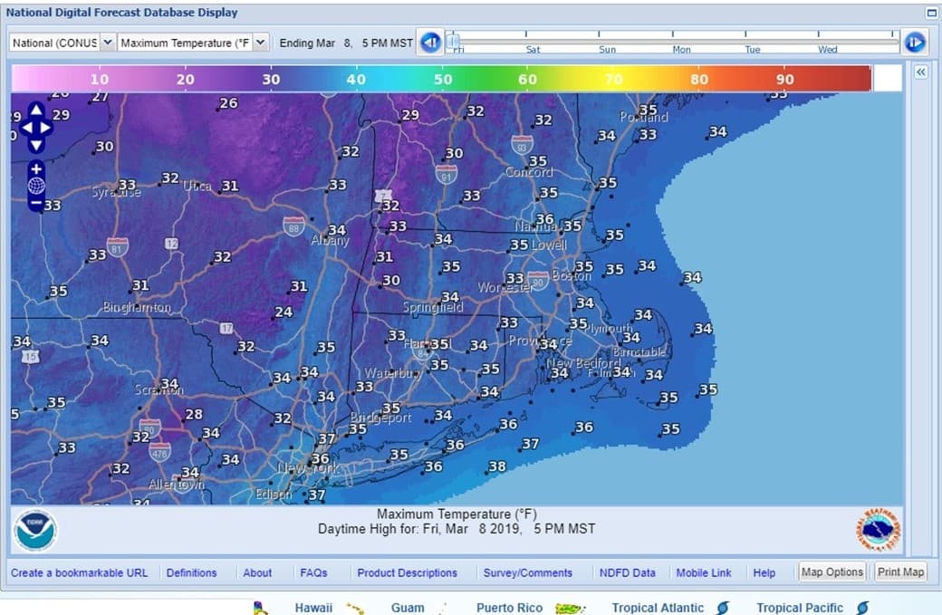
Today: Sunshine with some high clouds this afternoon. Not as cold. High 35.
Friday Night: Clear and chilly. Lows 20-25.
Saturday: Sunny and dry with light winds. High 38.
Saturday night: Increasing clouds late. Low 28.
Sunday: Snow or sleet starting around 8 a.m., but changing to rain before noon. Little or no accumulation expected. Temperatures rising to the low 40s at night.
Monday: Becoming partly sunny, more seasonable. High 47.