Advertisement
Today's Weather: A Touch Of Spring
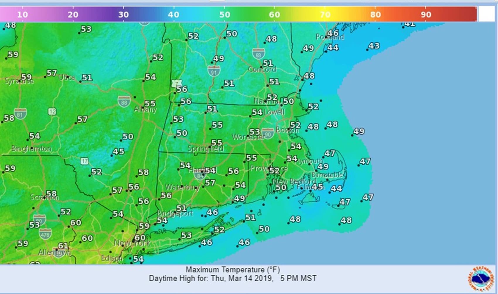
A high pressure system moving east of the region today will allow our winds to turn more southerly. Temperatures will rebound to around 50 in most locations this afternoon, which is above normal, for a change. Lots of clouds will accompany the influx of milder air and even warmer temperatures Friday.
A large storm which brought blizzard conditions to the western plains will track into the Great Lakes. Its associated cold front will cross the Boston area late Friday night. Showers will develop along and ahead of the front, but the rain should end by daybreak Saturday.
Colder air will again return for the balance of the weekend.
On this date 131 years ago, in 1888, one of the biggest blizzards in the northeast was winding down. The National Weather Service estimated as much as 50 inches of snow in parts of Connecticut and Massachusetts. But lucky for us, there are no big storms showing up on the long-range models as the first official day of spring is just one week away.
Today: A mix of sun and clouds. Milder. High 52.
Tonight: Becoming mostly cloudy. Some drizzle and fog late. Low 40 then temperatures rising.
Friday: Mostly cloudy, breezy and mild. Shower in the afternoon and at night. High 58.
Saturday: Becoming partly sunny and windy. Highs 45-50.
Sunday: Partly sunny. Seasonably cold. Highs in the lower 40s.