Advertisement
Today's Weather: Warm And Seasonable, Though Not Quite Spring
Weak high pressure will be in control of our weather through Wednesday. The good news is plenty of sunshine can be expected, along with dry conditions and temperatures at or slightly above normal.
The high will move off the coast Wednesday with an increased southerly flow. Clouds will tend to be on the increase Thursday.
Meanwhile, jet stream energy diving to our south will cause a storm to form off the South Carolina coast Thursday. Yesterday, it appeared as though this system would be weaker and track out to sea. However, the energy is much great than anticipated, so expect the system to be stronger with a track that should directly affect our weather at the end of the week.
The storm is expected to intensify and track northward up the coast. At this point, temperatures appear too warm for any frozen precipitation. But rain is in the forecast, and some of it could become heavy at times Friday, depending on the exact track of the low.
A quick shot of colder air will follow the storm Saturday.
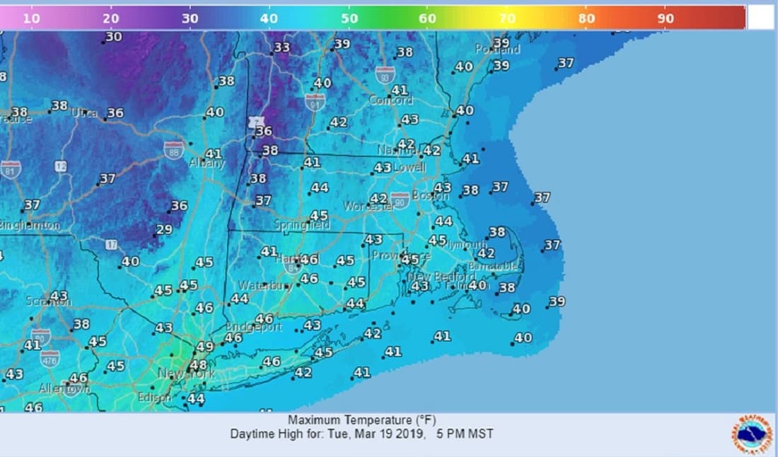
Today: Morning sun, partly cloudy in the afternoon. High: 44.
Tonight: Mainly clear. Low: 32.
Wednesday: Mostly sunny, few afternoon clouds. High around 50.
Thursday: Partly sunny. High around 50. Becoming cloudy overnight with rain developing late.
Friday: Cloudy and breezy with rain, possibly heavy. Highs in the 40s.
Saturday: Partly sunny, windy, colder. Highs around 40. Northwest winds up to 30 mph.