Advertisement
Today's Weather: A Preview Of Summer With Temperatures Likely Reaching 80
With the exception of a few small showers Sunday, the weekend turned out fabulous with abundant sunshine and comfortable spring temperatures.
The start of the work week features a day that will feel more like July than May. I'm expecting plenty of humidity, as well as the chance for showers and thunderstorms. A broad southwesterly flow of summertime air is set up over New England for about 24 hours. If you're not ready for heat and humidity just yet, the good news is this won't last very long.
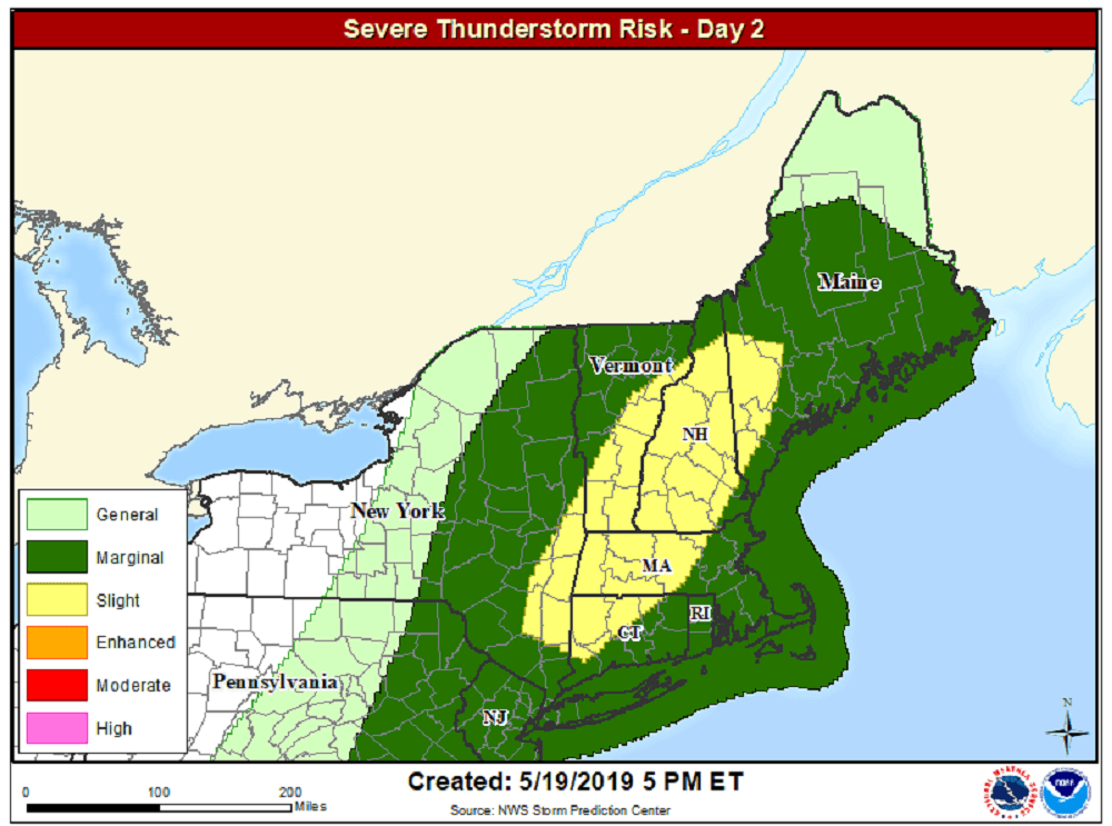
The transition between the warm weather today and the cool weather tomorrow and the rest of the week comes in the form of a cold front, which will bring showers and perhaps a few strong storms. Some of these storms could be accompanied by torrential rain and gusty winds this afternoon and evening. There is the risk for severe weather especially over central and western New England this afternoon.
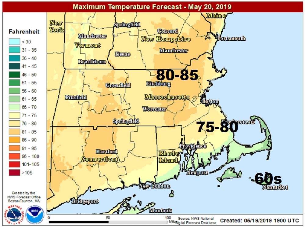
Typically, the first 80-degree day in Boston is reached the first week in May. We should reach that milestone this afternoon — late this year, here in the third week of the month.
Tomorrow features lower humidity and seasonal temperatures back to the 60s. The rest of the week looks rather tranquil, although there may be another round of showers to end the work week or begin the holiday weekend. Presently, I don't see any washout days, nor do I see any major heat heading into the unofficial start of summer.
You can follow my updates here and on Twitter @growingwisdom.
Monday: Warm and humid with scattered showers and afternoon storms. Some could be strong. Highs 65-75 Cape and 80-85 inland.
Monday Night: Showers end, then clearing. Lows 52-56.
Tuesday: Sunshine and clouds. Highs 63-66.
Tuesday Night: Clear and cool. Lows 50-55
Wednesday: Sunny and pleasant. Highs in the mid-60s.
Thursday: Sun and clouds. Highs 65-70.
Friday: Partly sunny, may shower. Highs in the mid to upper 60s.
Saturday: Partial sunshine. May shower. Highs 72-76.
