Advertisement
Weekend Weather: Storm Brings Showers, Turning From Rain To Wet Snow
A storm system will be tracking from the Ohio Valley to the New York City area by Saturday afternoon and will intensify east of Cape Cod Sunday.
The southwest flow ahead of this will bring an increase in clouds to the area today. A few scattered showers will occur Friday, but it should be dry most of the time.
The main batch of moisture will slide in Saturday. For the most part, the precipitation will be rain, but as the colder air moves in, a change to wet snow is likely before daybreak Sunday. Some spots could get a quick inch, followed by rapid clearing with blustery conditions Sunday afternoon.
The next system will quickly approach Sunday night and Monday. With cold air in place, some light snow is possible, but with very little accumulation.
Meteorologist: Dave Goldbaum for Dave Epstein
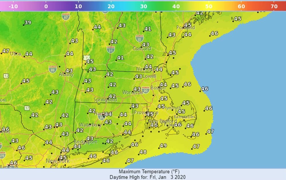
Friday: Mostly cloudy. Chance for a shower or two, especially on Cape Cod and the Islands. High of 45.
Tonight: Cloudy. Low of 39.
Saturday: Cloudy with light rain, mainly in the afternoon. High of 45.
Saturday night: Rain changing to wet snow and ending by daybreak Sunday. Lows 32-35.
Sunday: Clearing and windy. High of 38.
Monday: Mostly cloudy. Chance for a period of light snow or flurries. High of 38.
Tuesday: Partly sunny. High of 42.