Advertisement
Today's Weather: Storm Will Bring Up To An Inch Of Snow To Greater Boston Overnight
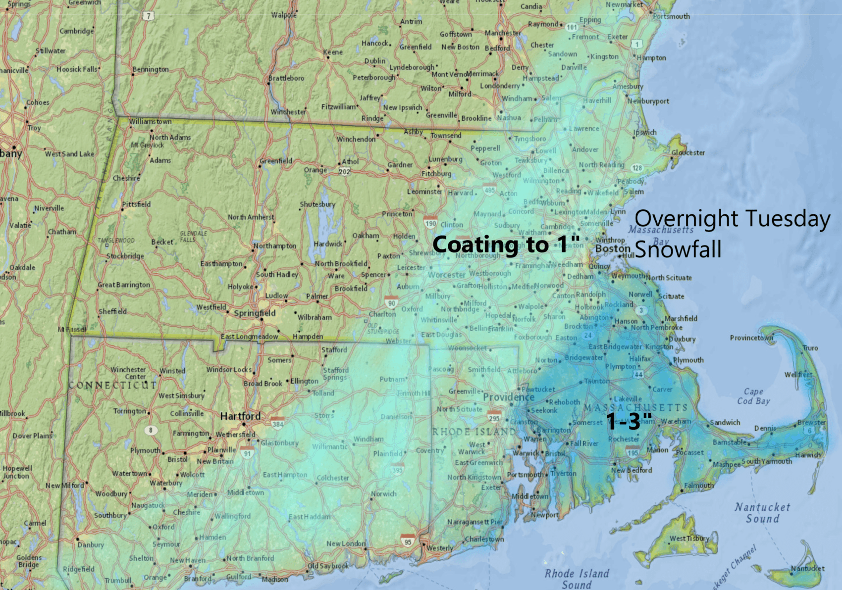
This morning, we find some sunshine over southern New England. But it will be short-lived as another storm system moves toward the region, bringing snow tonight and early Wednesday.
Low pressure will be passing east of the region tomorrow morning, and with it a few hours of steady snow. There will be some light accumulation after midnight and into the pre-dawn hours Wednesday. The best chance to see enough snow that would need to be shoveled will be just south of the city, but the Greater Boston area could see a coating up to half an inch.
If the storm were to wobble a bit further west, then it's not out of the question that we see over an inch, but this isn't likely to turn into anything more than that.
Sunshine will return during the day Wednesday, but temperatures will be seasonably chilly — generally in the mid- to upper 30s. There will be a brush with Arctic air Wednesday night and into Thursday, as blustery and cold conditions ensue.
The good news is, that bitter cold doesn't last very long. By Friday, readings will be fully back in the 40s, with a couple of showers as a warm front approaches. We could see near record-high temperatures Saturday, which could mark the fifth Jan. 11 of the past seven years in which the temperature reached above 50 degrees.
If you're wondering about the record high for all of January, it was 72 set back in 1950 — and that is not going to be in jeopardy.
You can follow my updates here and on Twitter @growingwisdom.
Tuesday: Sunshine, then clouds. Highs 35-40.
Tuesday night: A period of snow late at night. A coating for most places, but up to 2 inches in southeastern Mass.
Wednesday: Clouds clearing out. Any snow south of Boston ends. Sunshine returns. Highs 35-40.
Thursday: Sunshine and colder. Low wind chill. Highs 25-30.
Friday: Cloudy, late rain showers. Highs 43-48.
Saturday: Mild and wet. Highs in the 50s to near 60.
Sunday: Perhaps more showers. Cooler. Highs in the mid-40s.
