Advertisement
Today's Weather: Showers Will End, But Forecast Remains Unsettled
A wavy frontal system will bring some precipitation today, and as it meanders back and forth through New England, it will bring more Tuesday.
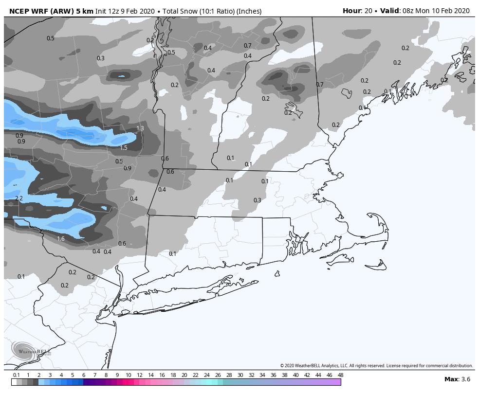
There is some snow over central and western sections of the region this morning, but around Greater Boston, we're just looking at a bit of light rain. Anytime there's precipitation for a Monday morning commute, it does slow things down, so allow yourself extra time. The rains ends by early afternoon.
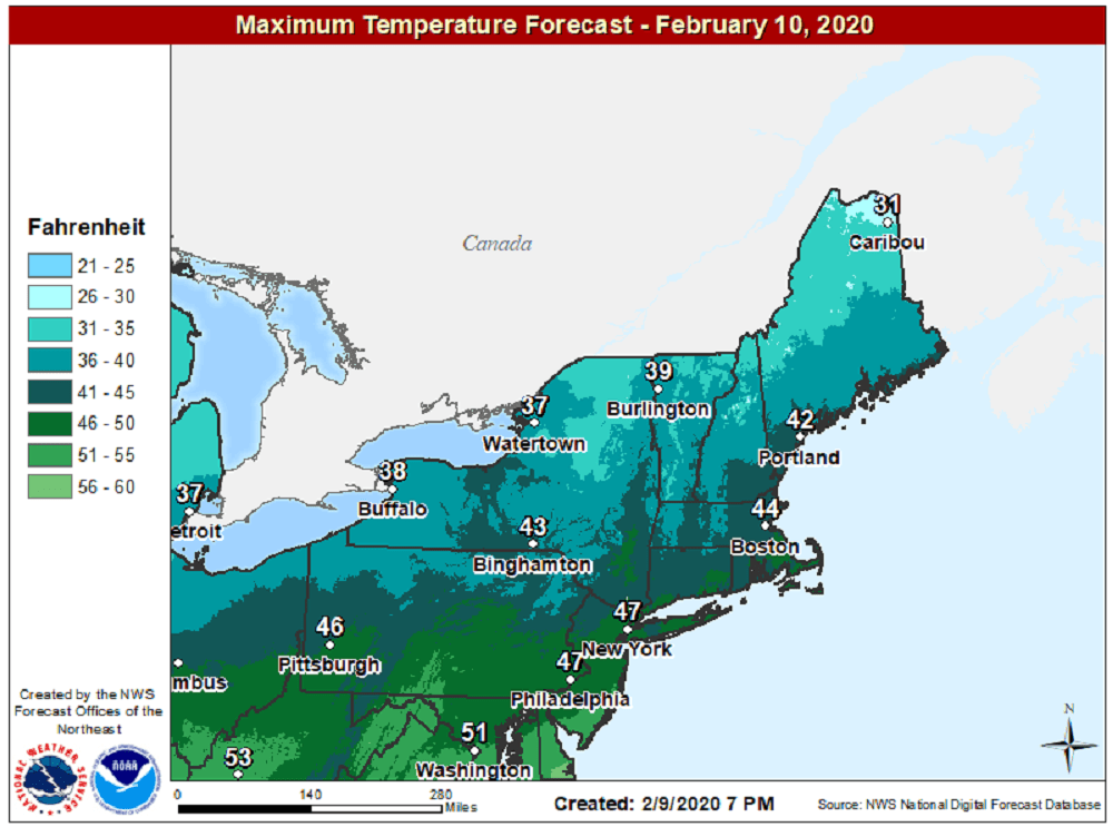
Temperatures will reach into the lower and perhaps mid-40s this afternoon, as the rain comes to an end but we keep the cloud cover. A little bit more light precipitation arrives during the day Tuesday. It could start as a mixed bag of snow and rain, but the trend once again will be for all rain. I'm not expecting much in the way of total precipitation but roads will likely be wet.
We get a break in the action Wednesday, with plenty of sunshine and temperatures a bit above average. This is my pick for the week. It will also be a day you can get outside and take a nice run. Another weather system will affect us Thursday. Right now, it's a little early to say whether or not it's all rain or snow changing over to rain, but this does look like the most significant weather system of the week.
On Friday, Arctic air arrives for a couple of days, with temperatures below average and perhaps the coldest two days we've had so far this winter. You can thank a very fast jet stream for all these changes.
You can follow my updates here and on Twitter @growingwisdom.
Monday: Showers/light rain ending. Mixed bag well north and west also ending. Highs in the low to mid-40s.
Monday night: Some clouds. Lows 28-34.
Tuesday: Mostly cloudy, a few showers, maybe a mix of snow at times. Highs in the lower 40s.
Wednesday: Mostly sunny and highs around 40.
Thursday: Mixed bag of precipitation, then rain. Highs 45-50.
Friday: Sunshine and cold. Highs 25-30.
Saturday: Mainly sunny. Highs near 30.
Sunday: Partial sunshine. Highs near 40.
