Advertisement
Storm Brings A Few Inches Of Snow Tuesday, More Possible In The Next Week
Resume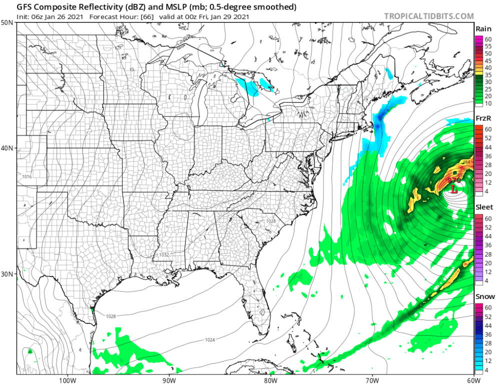
A weather system will move into the region Tuesday afternoon, bringing a burst of light snow and preventing a record-low snowfall for the month of January.
So far in January, we've only had three-tenths of an inch of snowfall at Logan Airport — the least amount to fall at this point in the first month of any year on record. If we didn't see any more snow for the next five days, this would put January 2021 at the top of the list for low snowfall. However, this relatively weak weather system will prevent that.
The snow should overspread the area between 4 and 6 p.m. It arrives first over western areas; last along the coastline.
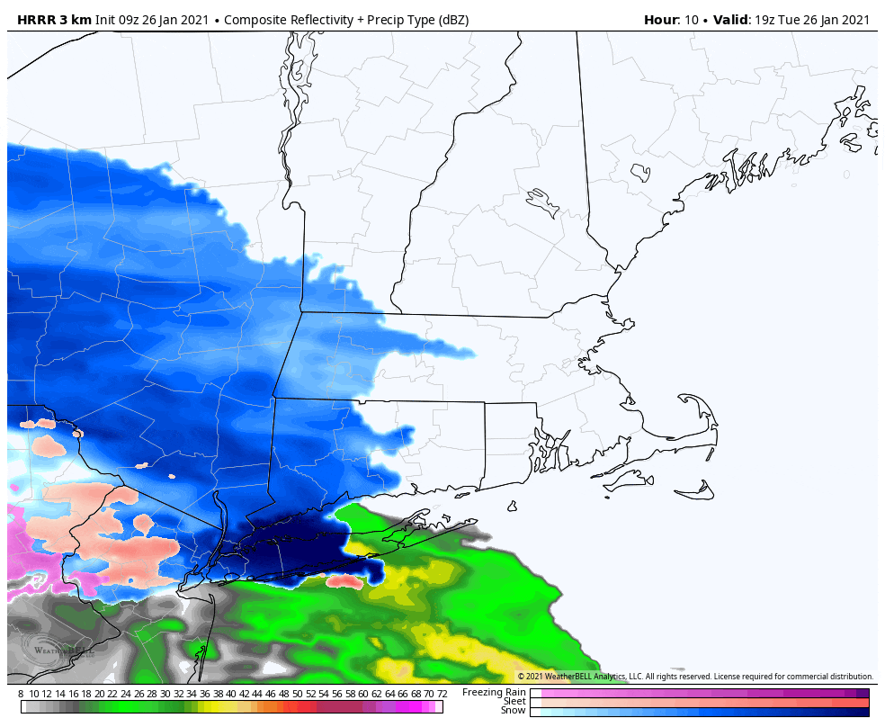
The eastern part of the state can expect one to three inches of snow, while west of Worcester could see up to four inches. The Cape and Islands will likely not see more than a coating up to an inch.
The snow may come down moderately at times once it begins. Expect the roads to be a bit slippery Tuesday evening.
Temperatures are going to rise to around freezing this afternoon, so the snow will take on a somewhat wetter texture, especially in Boston and points south.
Most of the accumulation will have fallen by Wednesday at sunrise. Early commuters will likely see some slippery spots on untreated and poorly treated roads.
The weather continues unsettled later Wednesday. An ocean storm will gain strength far to our east Wednesday night and into Thursday, and some residual moisture is likely to spin on the backside of the storm.
Along eastern Massachusetts, this could bring an additional coating up to an inch of snow. The timing on that would be overnight Wednesday into Thursday, meaning the Thursday morning commute could also be a bit slippery.
Once that system pulls further out into the Atlantic, a quick blast of very cold air will arrive for Friday and Saturday. Temperatures on Friday morning will start in the lower teens, but only rebound by a few degrees. The map below shows sunrise wind chill temperatures Friday morning. If you are headed outside, you should plan on wearing cold weather gear.

It remains very cold and dry this weekend. When you get up in the morning, temperatures will be between 5 and 15, remaining in the 20s in the afternoon Saturday and just under freezing Sunday.
Another storm is likely to impact the area on Monday or Tuesday, in the form of snow and rain. This system looks to contain more moisture and move a bit slower, so for those areas that say all snow, it could be a significant snowstorm.
This segment aired on January 26, 2021.
