Advertisement
With Up To Half A Foot Of Snow Coming Tuesday, Expect A Slower Evening Commute
Resume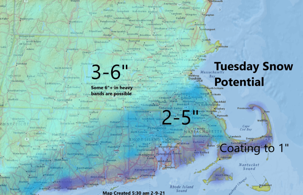
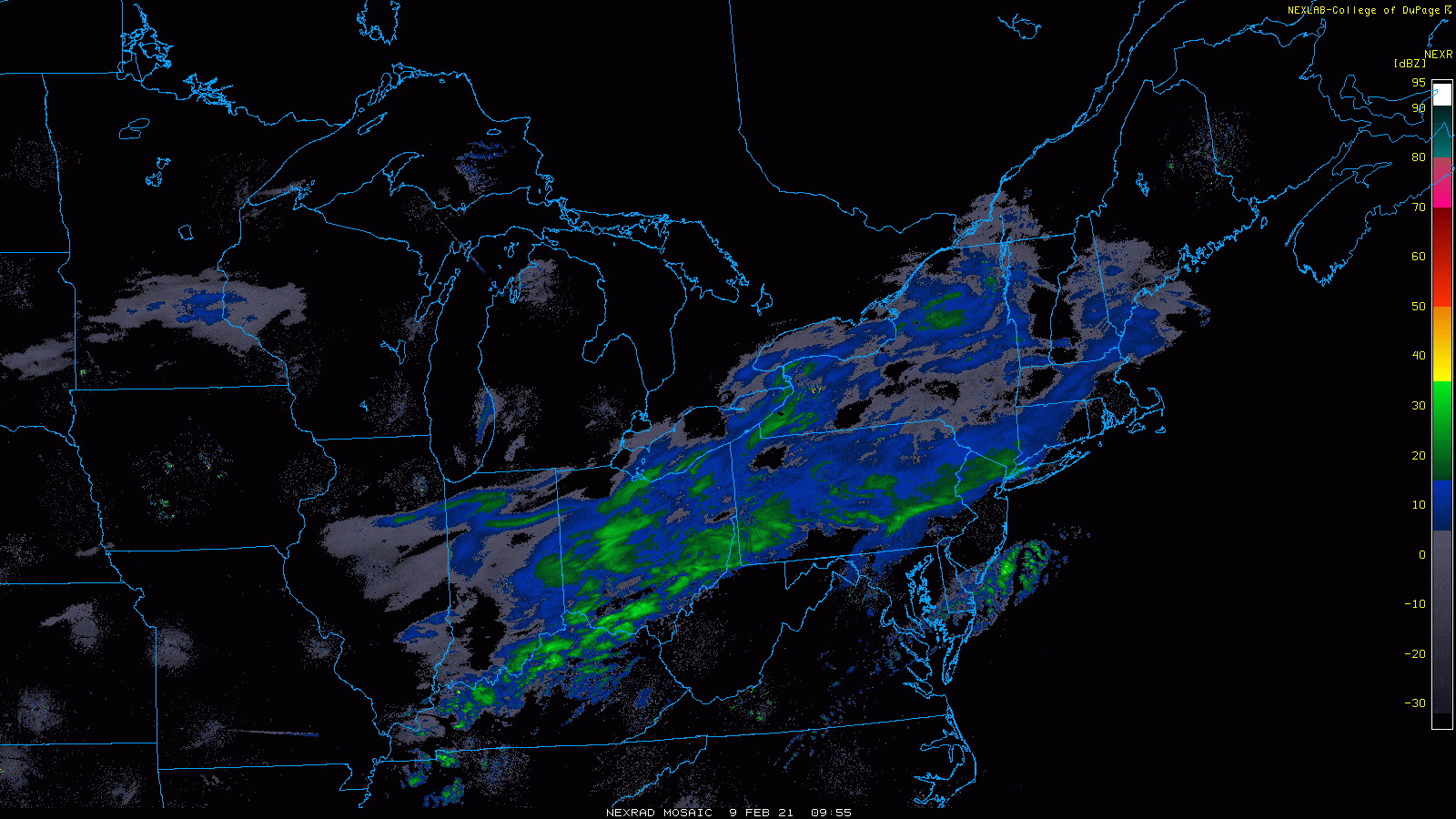
Snow has already broken out this morning in a few spots north of Boston, but the steadier and heavier snow will wait until late morning into the early afternoon.
The radar below shows the precipitation streaming northward.
The bulk of the snow today will fall between noon and 5 p.m., with the heaviest snow likely to fall north of the Mass Pike. It should end around 7-8 p.m.
I think most areas are going to end up between two and six inches of snow, with some places on Cape Cod and the Islands seeing nothing to about an inch. Some places could see more than six inches if heavier bands materialize. There is a winter storm warning north and west of Boston where the likelihood of six inches is greatest.
The morning commute will not be a problem even if there is snow, as it won't be heavy enough to create any issues on the roads.
However, the evening commute is a different story because the snow will have already been falling for a couple of hours. Snowfall rates could get up to an inch per hour; it's the type of snow that does slow things down quite a bit.
This segment aired on February 9, 2021.
