Advertisement
2 Storms Will Hit New England This Week
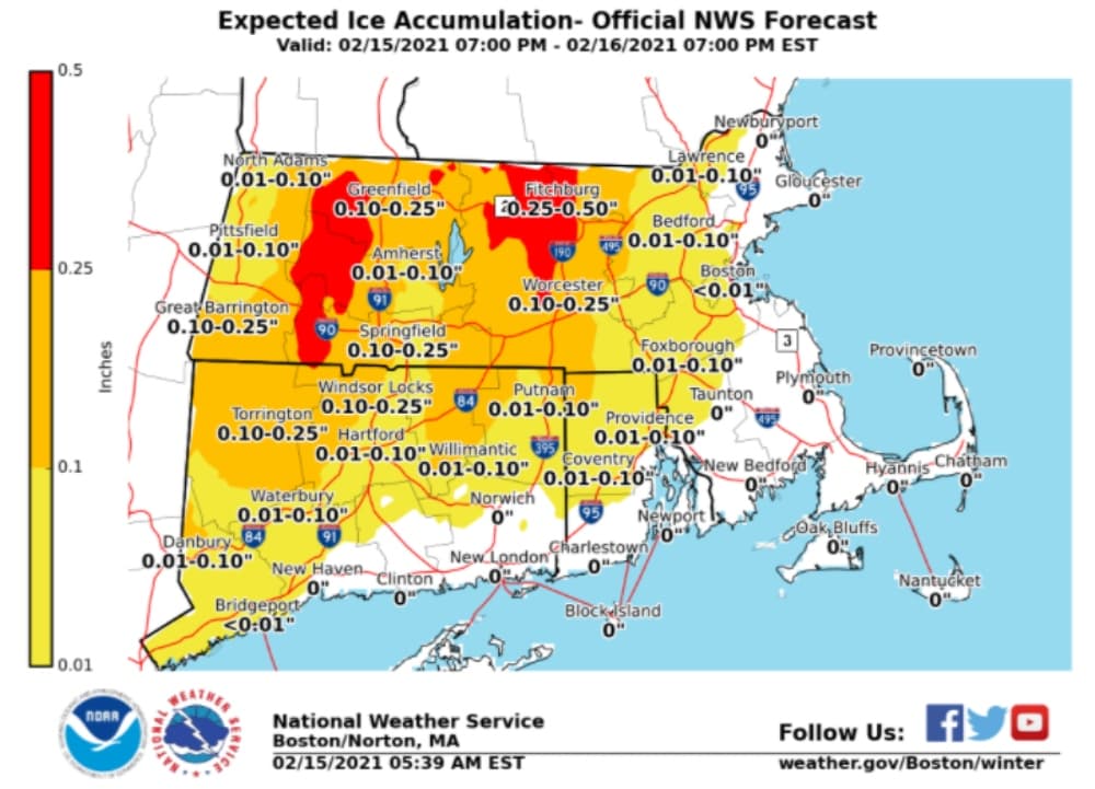
ResumeA storm system will slice right through New England overnight Monday and into Tuesday with a wide variety of precipitation ranging from all rain along the southeast coast to a mixed bag over most of southern New England and snow, sleet and freezing rain up north.
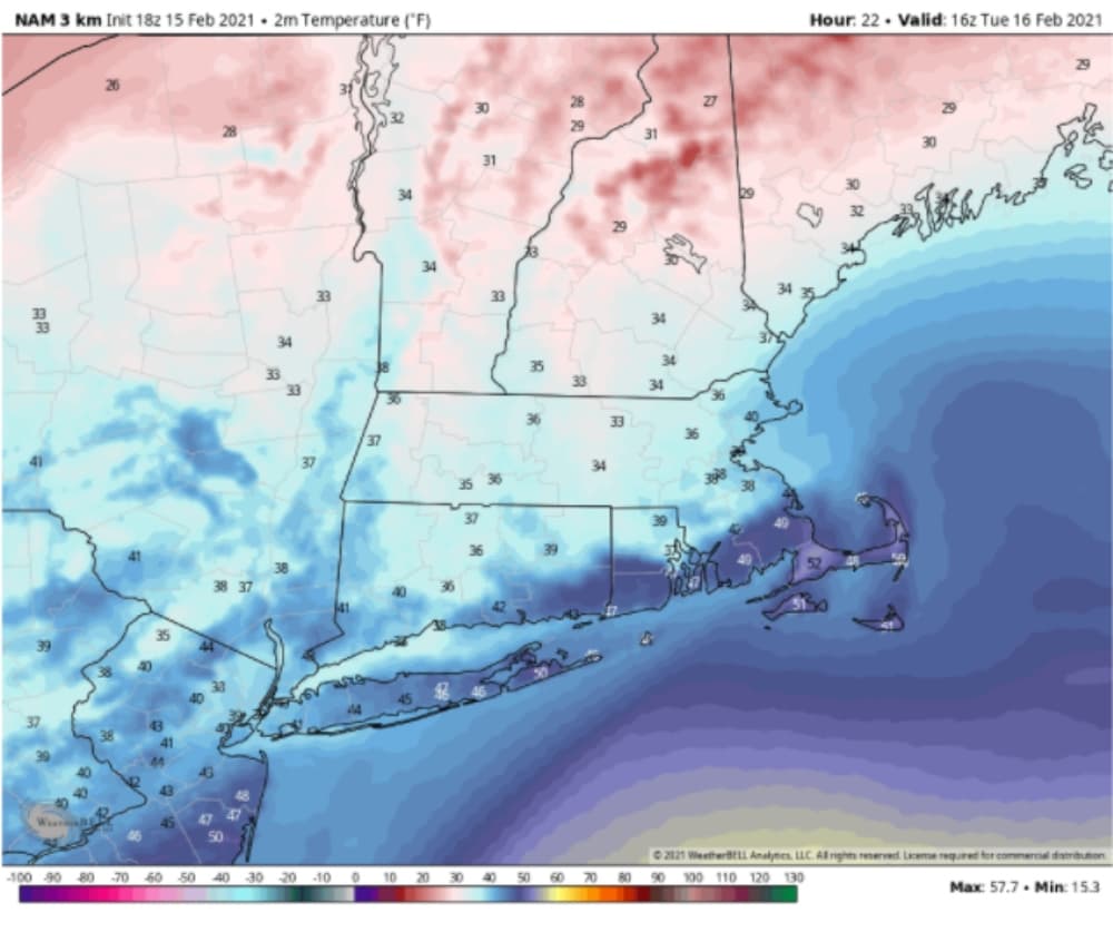
As of late Monday afternoon, Logan Airport's temperature was actually below freezing, but it was above freezing further south along the Mass Pike. Overnight as the rain moves in, temperatures will fall back just enough to create icy conditions.
The worst part of the storm is going to be from after dark through sunrise. By the time most of you get up in the morning along the coast it will be raining and there won't be any icing issues. Across the Worcester hills and other sections of Worcester County, there could be a quarter to perhaps a half an inch of ice.
A few scattered power outages are possible in the areas with over a quarter-inch of ice. This is definitely an inland issue. The good news is that by morning, temperatures should warm so most roads will be okay within 20 to 30 miles of the coast.
The precipitation will come to an end Tuesday as temperatures warm up to the 50s over Cape Cod, around 40 or a little higher in Boston, and stay in the 30s north and west.
We get a break in the action on Wednesday with sunshine and temperatures a little below or a little above freezing north to south. The dry weather won't last as a new storm system quickly approaches on Thursday with a dry morning commute but a snowy evening one. We are likely to see some accumulation before an eventual change over to sleet, freezing rain and maybe even rain.
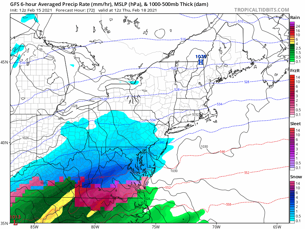
That storm will move out Friday evening and set us up for a dry and cold weekend. The pattern looks to continue somewhat active into next week as our chilly and stormy February continues.
This article was originally published on February 15, 2021.
This segment aired on February 15, 2021.
