Advertisement
Early Spring Storm Brings Light Snow Friday Morning
Resume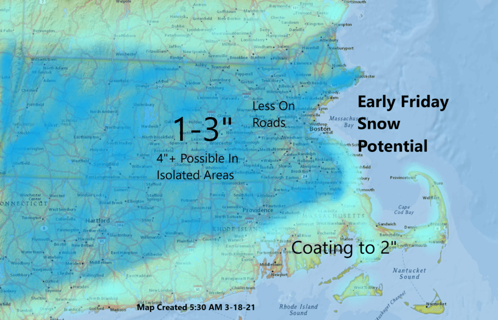
It was a beautiful day Wednesday, with temperatures getting into the 50s. But this morning, after some early filtered sunshine, clouds are going to increase ahead of a storm system.
Mid-March in New England can fluctuate between pleasant days and snowy ones, and we're going to be on the snowy side for a few hours late tonight and early tomorrow morning. This isn't one of our blockbuster spring storms; rather, it's just a light event.
We need precipitation, as it has been the third driest stretch on record, with 16 days without precipitation in what is typically one of our wettest months. A storm will move out of the Ohio Valley and then cut south of New England early Friday morning, allowing cold air to filter in as the precipitation is beginning to end.
The timing of the cold air and the conclusion of the storm are critical to seeing how much snow we end up with on the ground. It's likely most of us fall in a 1 to 3 inch range, but it's also possible that a few areas go over or under that.

The rain begins between 3 and 5 p.m., and the change to snow will occur after midnight. The snow should end between 5 a.m. and 8 a.m. Friday. Most of the accumulation will likely come between midnight and sunrise Friday, and there could be an hour or two when it's coming down quite hard.
By the time most folks are awake on Friday, some of it will have already melted due to the warm road surfaces. If the storm slips further south, we will see even less precipitation.
As the precipitation comes to an end Friday morning, skies will start to clear and you can expect the sun back out by the afternoon. But bundle up — temperatures will stay in the 30s Friday.
Winds will be quite strong, and there is a wind advisory along the south coast and a high wind warning for Nantucket. It's not going to be surprising to see a few scattered power outages.
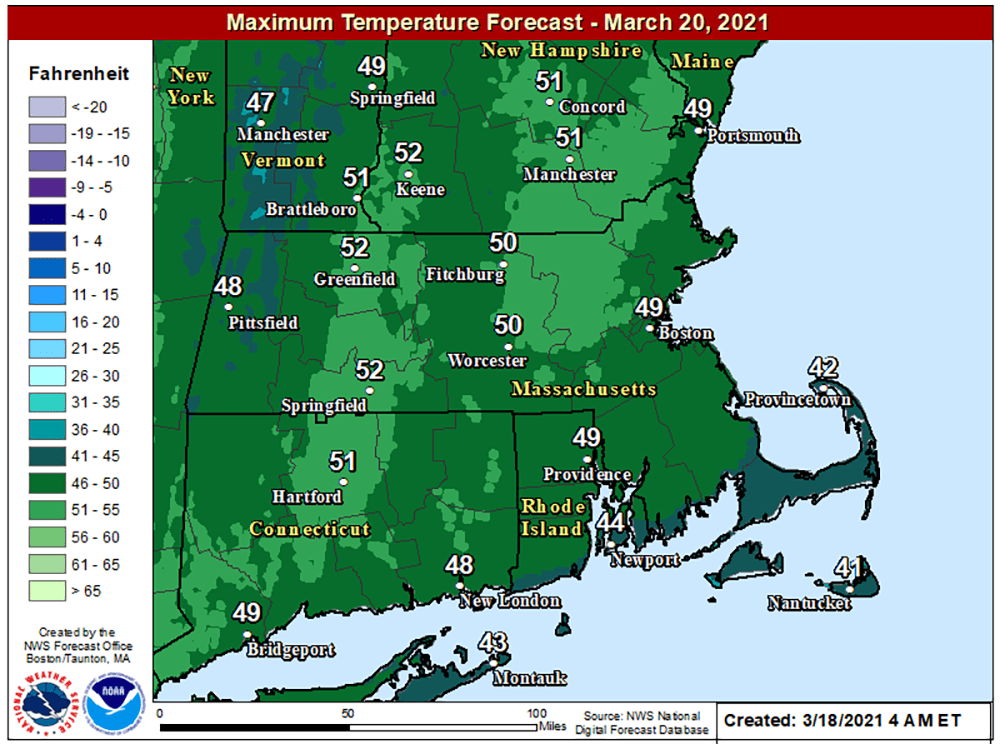
Once the system moves past us, it will turn milder for Saturday with temperatures back into the 40s along with plenty of sunshine and then we are well into the 50s for Sunday — also a glorious day. Plan on getting outside Sunday, it’s going to be amazing.
This segment aired on March 18, 2021.
