Support WBUR
Nor'Easter Could Bring A Few Inches Of Snow To Some Parts Of Mass. Overnight
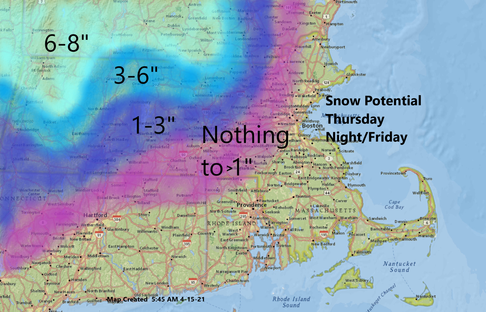
A coating of up to a half foot of snow is possible overnight in some parts of the state as a spring nor'easter moves into the region.
The storm itself is nothing remarkable yet, but will likely become stronger overnight and Friday. This storm will pull down colder air from above, causing the rain to mix with and eventually change to snow over the higher terrain.
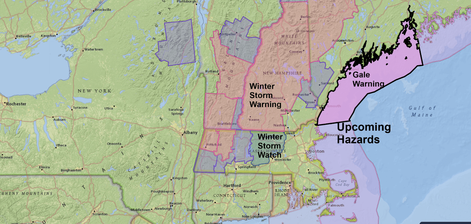
The National Weather Service has issued varying levels of winter storm advisories for different parts of the state. In the northwest part of Massachusetts, the potential for up to 6 inches of snow exists, but it's still questionable whether or not this occurs.
Where there's a Winter Storm Warning, it's much more likely that half a foot or more of snow can fall. The highest totals will be on the grassy surfaces, but even the roadways will become slushy and may need to be plowed.
It's not out of the question that even some of the northern and western suburbs of Boston see a bit of snow.
During the day Thursday, it will be dry, with clouds thickening up and temperatures remaining in the upper 40s and lower 50s along the coastline but getting into the low to mid-50s inland.
There's a chance for a couple of late-day showers, but the real steady rain won't develop until the evening hours. Once the rain gets underway it will become steady and heavy overnight and continue for much of the day on Friday.
Temperatures will stay in the lower 40s Friday along the coast and 30s over the far north. This is way below average.
But the potential snowfall is certainly not unheard of for mid-April in the region.
In fact, last year on April 18, there were several inches of snow in much of the area and over half an inch at Logan Airport. It was gone in a few hours, but it's just a reminder that although it's fun to complain about the cold and the potential snow for some areas, April can deliver the white stuff at any time during the month.
The rain will come to an end later Friday, and there will be a few leftover showers Friday night. Lows will be in the 30s.
Saturday is the least favorable day, as it is still mainly cloudy rather cool with a brisk breeze. Highs will be in the lower 50s. Sunday is my pick for the weekend, with more sunshine and milder temperatures that will continue into next week.
This segment aired on April 15, 2021. The audio for this segment is not available.
