Support WBUR
Today's Heat Could Break A Record In Boston — And Storms Are Moving In
Temperatures rose quickly into the 80s early Wednesday morning and are headed for record territory this afternoon. The record high in Boston for today is 95 degrees, and there's a good chance we're going to break it after tying records the past two days.
Tuesday's high of 99 and low of 79 ended up being the warmest average temperature since records moved to Logan Airport back in the mid-1930s. This is an indication of the depth of the heat the region has been experiencing this week.
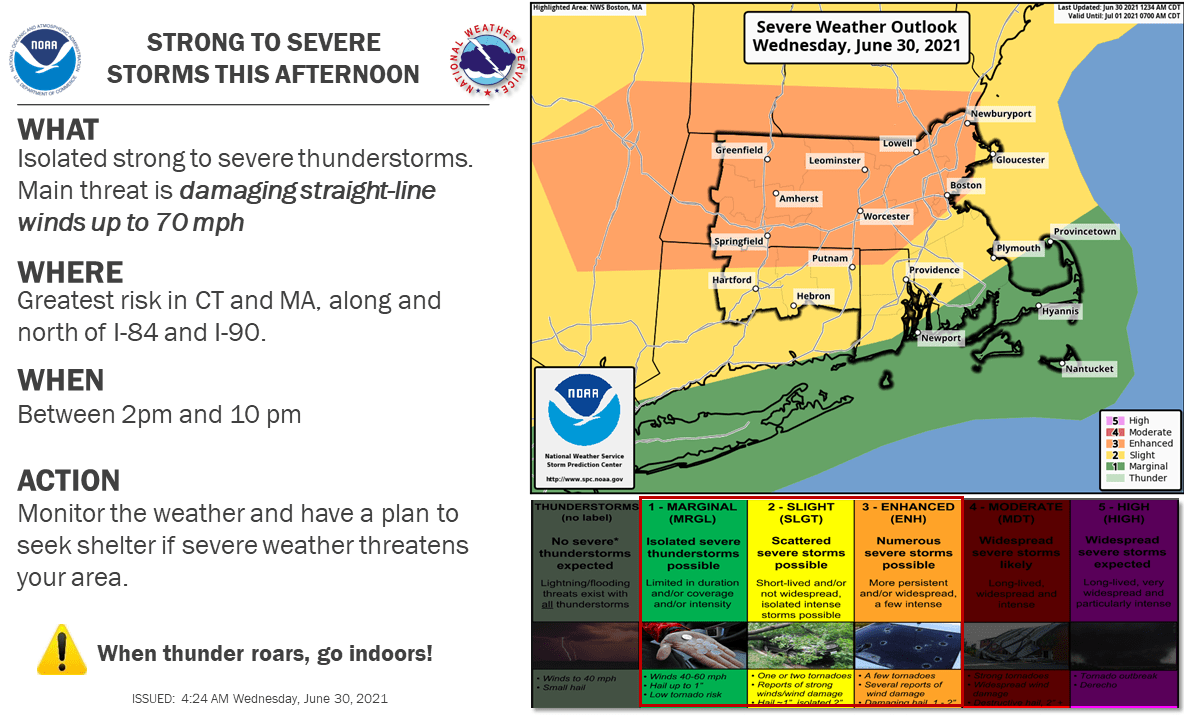
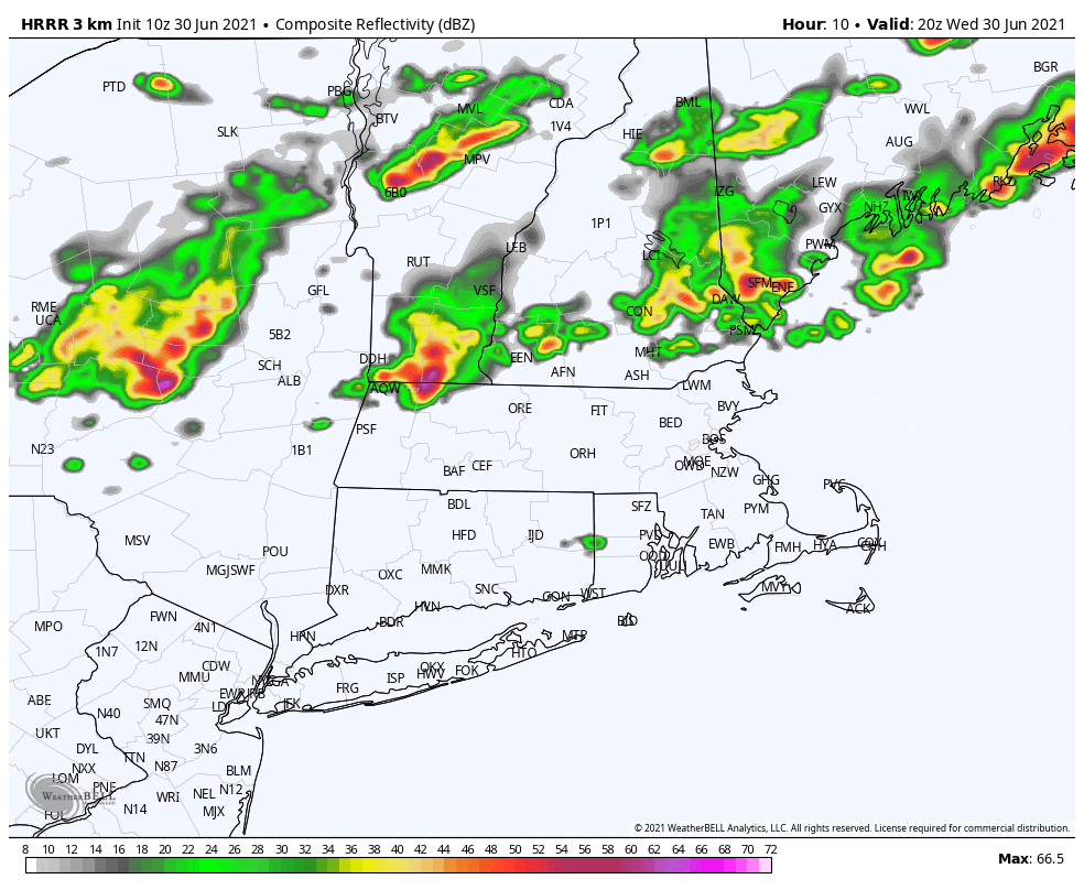
Today will be somewhat different than the last two days, in that we're going to watch showers and storms approach the area this afternoon. Some of these could be strong to severe. The greatest risk will be from gusty winds, although any torrential rain would also make travel somewhat difficult during the storm. There could be over an inch of rain in some storms. It remains dry until after 3 or 4 p.m., and the core of the showers pushes through between 5 and 9 p.m this evening.
There will be a break in the action tonight before more showers and some thunderstorms arrive Thursday and then continue into Friday. It will still be humid Thursday, but temperatures will not be as hot, relegated back toward the 80s.
It'll be a lot cooler Friday, with temperatures in the 70s and humidity levels continuing to drop.
The weekend itself will be unsettled, with showers around for Saturday, along with very cool temperatures for July. Sunday shows some improvement, but still a risk for showers — even if we do see some sunshine. Temperatures continue in the 70s.
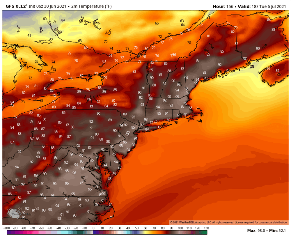
It gets warmer on Monday, and we're heading toward some hot weather for Tuesday, with temperatures well into the 80s. It again turns very hot next week, with more 90-degree weather.