Support WBUR
Tropical Storm Henri Hits R.I., With Threat Of Damaging Wind And Flooding For Region
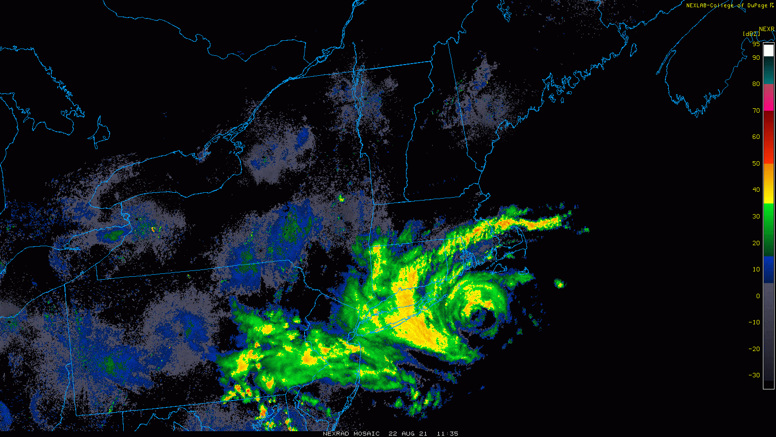
Tropical Storm Henri made landfall on the coast of Rhode Island early on Sunday afternoon.
Although the storm has weakened from hurricane status, it is still capable of producing damaging wind and some coastal flooding.
Gov. Charlie Baker, in a Saturday afternoon press conference, said the state is no longer expecting the direct hit from the storm.
"Eastern Massachusetts should not see the widespread hazardous driving conditions that we were worried about [on Friday]. But this is New England and it is hurricane season. So please continue to pay attention to your local weather alerts as the forecasts do tend to change."
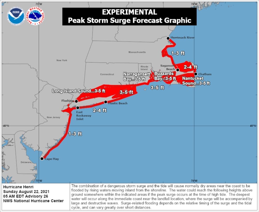
The Rhode Island coastline, perhaps into Buzzards Bay, is most vulnerable for minor to moderate flooding during the highest tide Sunday morning.
State transportation secretary, Jamie Tesler, is warning of roads in some areas that are prone to flooding.
"Drivers should be especially mindful and avoid driving into flood water," Tesler told WBUR. "Waters could be deeper than they appear, have strong currents, and may have hidden hazards like washouts, down electrical wires or tree branches. Just 6 inches of water can stall passenger cars."
Check public transportation schedules before heading out on Sunday. Buses are replacing trolleys on the MBTA's Mattapan Line, and on the D branch of the Green Line. The T is suspending the Charlestown ferry and Hingham-Hull ferry service for the day.
Massachusetts Steamship Authority ferry service between the Cape and the Islands is canceled through at least noon on Sunday because of weather conditions.
Amtrak trains are not running on Sunday between Boston and New York City. Amtrak also canceled service between Boston and Albany, and from Springfield to New Haven.
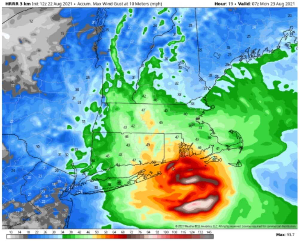
Some areas are going to see wind gusts at nearly hurricane strength. Power outages are going to increase throughout the morning and into the afternoon from south to north, probably peeking in the early- to mid-afternoon time before crews are able to get out and start restoring it.
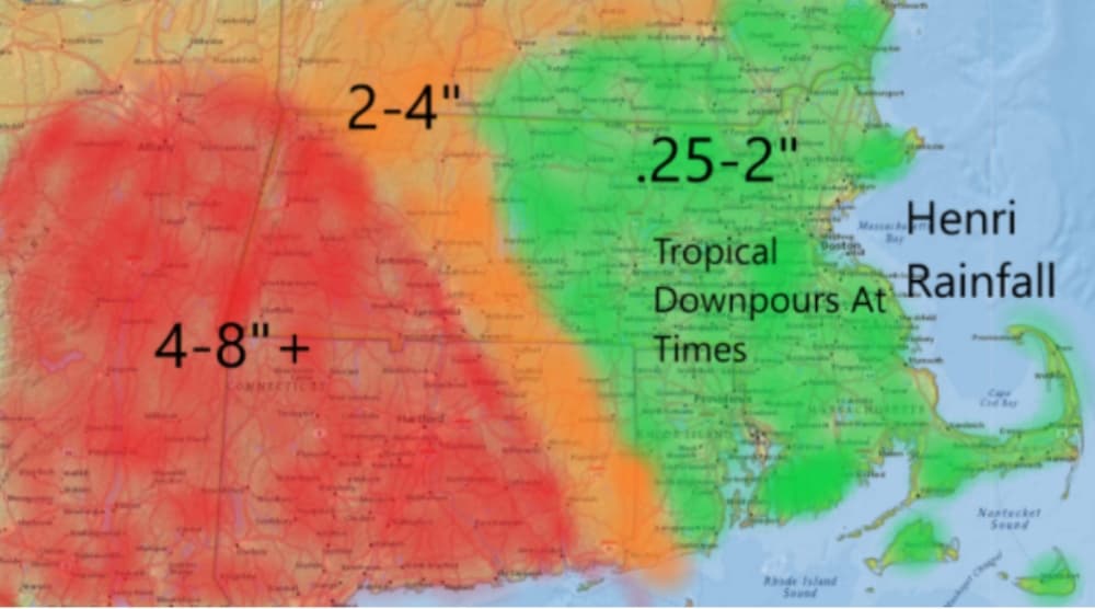
Copious rainfall is predicted especially from Worcester westward with the heaviest rain over Connecticut and western Massachusetts, perhaps extending into parts of Vermont and eastern New York.
Around Greater Boston, the rain will be mostly lighter. Then there will be moments without rain, and even a glimpse a sunshine, before a tropical downpour. There could be scattered severe weather with heavy thunderstorms and a very small chance of an isolated weak tornado.
The threat of showers and storms continues into the overnight hours when it remains very humid and warm, with temperatures staying in the lower 70s.
Monday is also somewhat unsettled with a continued risk of rainfall. Eventually the storm will move far enough away that sunshine will start to return on Tuesday, but it's going to remain very warm with a couple of 90 degree, humid, days this week.
This means that if there are areas with extended power outages, it could be quite uncomfortable. Those that depend on electricity for things like oxygen or to keep medicine cool should definitely think about alternative arrangements if possible.
The weather does turn a bit more comfortable heading into the upcoming weekend.
This segment aired on August 22, 2021.
