Advertisement
Hurricane Ida Remnants Bring Floods, Heavy Rains To Massachusetts
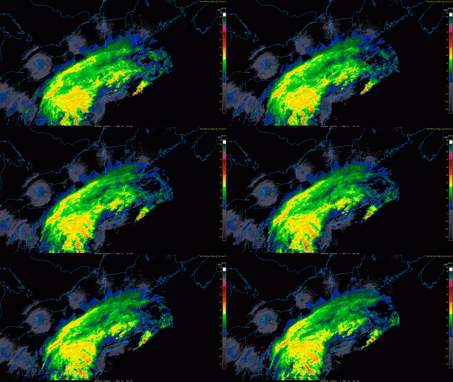
Rain overspread the area Wednesday afternoon, and now it’s becoming heavier and steadier. There has even been some severe weather south of Nantucket. The trend will be for more and more rain overnight, with tropical — even torrential — downpours at times. Some severe weather is also possible into the evening. Travel in the heavy rain will be difficult overnight up through about sunrise tomorrow.

When tropical storm Henri hit New England, we knew it wouldn't affect Greater Boston too much. But the remnants of Hurricane Ida are taking a very different approach.
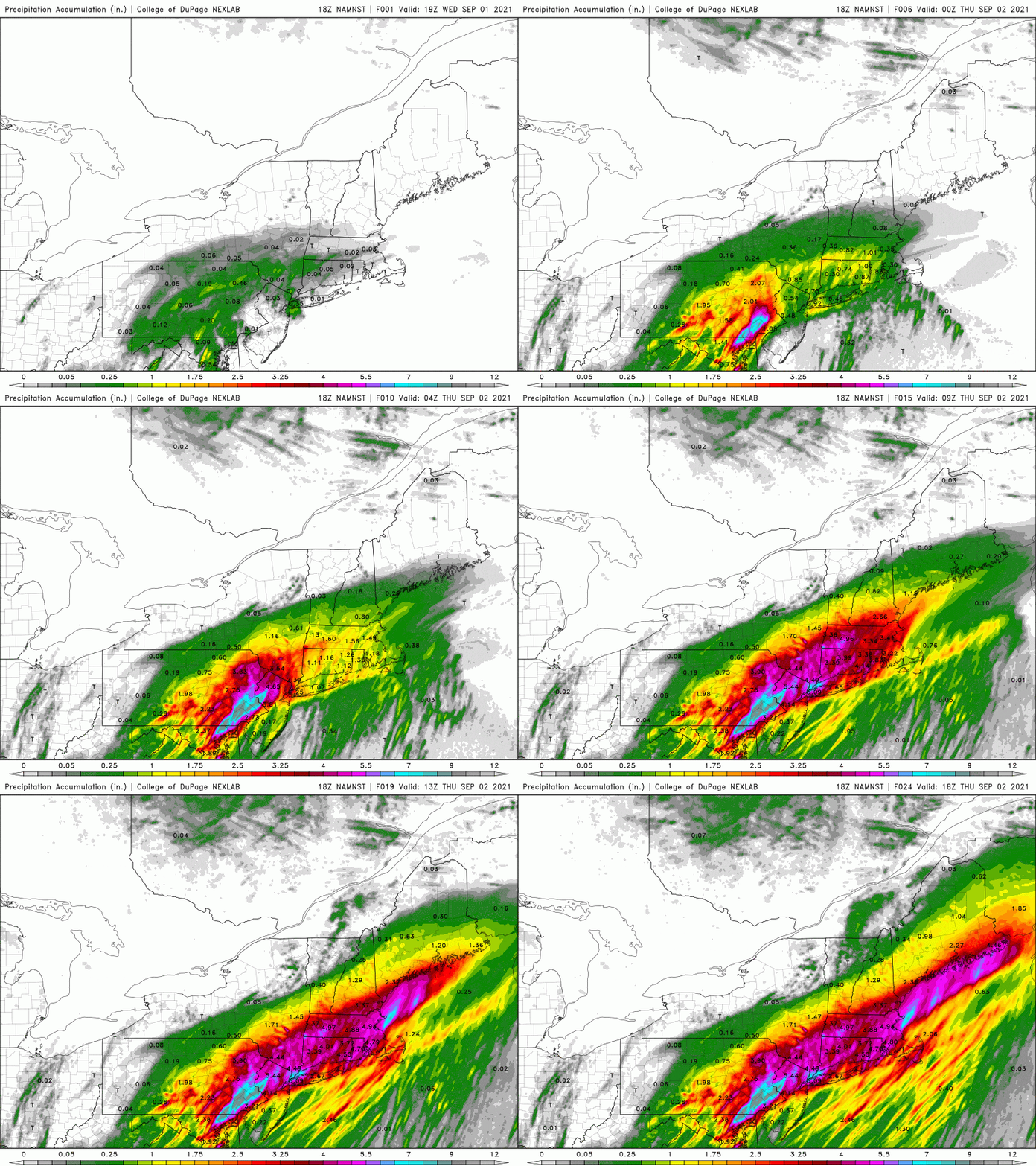
The storm will bring the possibility of flooding rains to the region overnight and into the first part of Thursday. The National Weather Service has posted flash flood watches for most of the state, in effect until Thursday at 2 p.m.
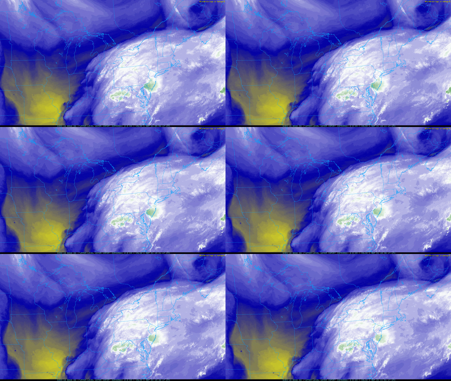
The amount of moisture in the air, something meteorologists call precipitable water (PW), is going to skyrocket. PW values help us determine the amount of rain to forecast.
When the rain does move in, it will be torrential, coming down at rates of over an inch an hour. This can overwhelm catch basins and gutters and lead to street and basement flooding for susceptible areas. There's also the possibility of some stream and small river floods because of all the water we had this summer.

Interesting side note: as the climate continues to warm, it allows for more precipitable water and thus the reason climate models predict more heavy rain events.
The circulation of Ida is still visible on satellite and this twist in the atmosphere can help produce severe weather overnight especially along the south coast. These situations are not clear-cut in that it's definitely going to happen, but it's one of those things that needs to be mentioned. Again, there's the possibility of small spin-up tornadoes and although unlikely the possibility does exist.
The axis of heaviest rain is difficult to predict. Some of the models have it somewhat north of the Pike, others somewhat south. Some people might see three inches of rain, likely closer to five. It wouldn't surprise me to see pockets even higher.
There will also be a little bit of wind with the system — more a result of a strong jet stream and not the remnants of Ida itself. It wouldn't take us much over 30 mph, along with a saturated ground and fully leafed trees, to fell a tree and subsequently power lines.
Advertisement

The heaviest rain will arrive by about 11 p.m and last until about 8 a.m. Thursday. Thereafter, the rain will taper off and the sun will come out, setting us up for a pretty nice weekend. Temperatures are going to be in the 60s with the rainfall but go back to the 70s for Friday through Sunday.
We will also have very comfortable nights this weekend to give those air conditioners a rest. There might be a few showers Sunday afternoon, but otherwise the first weekend of meteorological autumn looks dry.
This article was originally published on September 01, 2021.
This segment aired on September 1, 2021.
