Support WBUR
Greater Boston will likely see at least a foot of snow this weekend
A major nor'easter has become even more likely this weekend, with snow arriving early Saturday that could exceed 20 inches in some parts of the state.
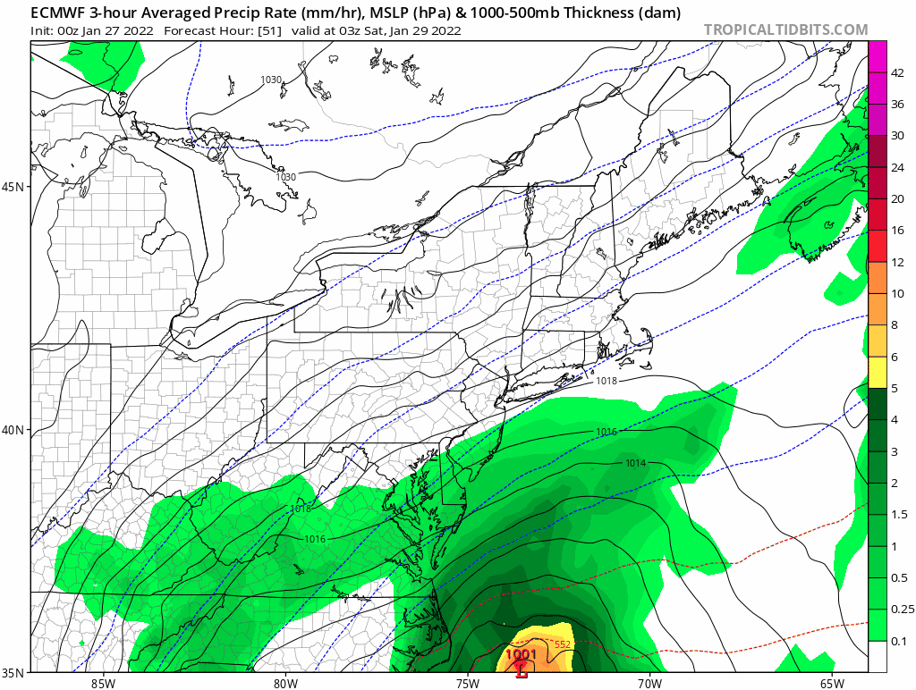
Some areas north and west of Boston were below 0 early Thursday, with the rest of us in the single digits. It will be bright blue and cold this afternoon, with highs in the 20s. This cold air is an important component of our upcoming storm. It will serve to keep the precipitation mostly in the form of snow across the entire region, with some mixing possible over Cape Cod and the Islands.
You should plan on the snow arriving in the early morning hours Saturday, which will be a tough travel day, especially from mid-morning through mid-evening.
The map below shows the amount of snow I'm expecting. Notice my arrows indicating that these higher totals could move west or a little further east, depending on how the storm develops.
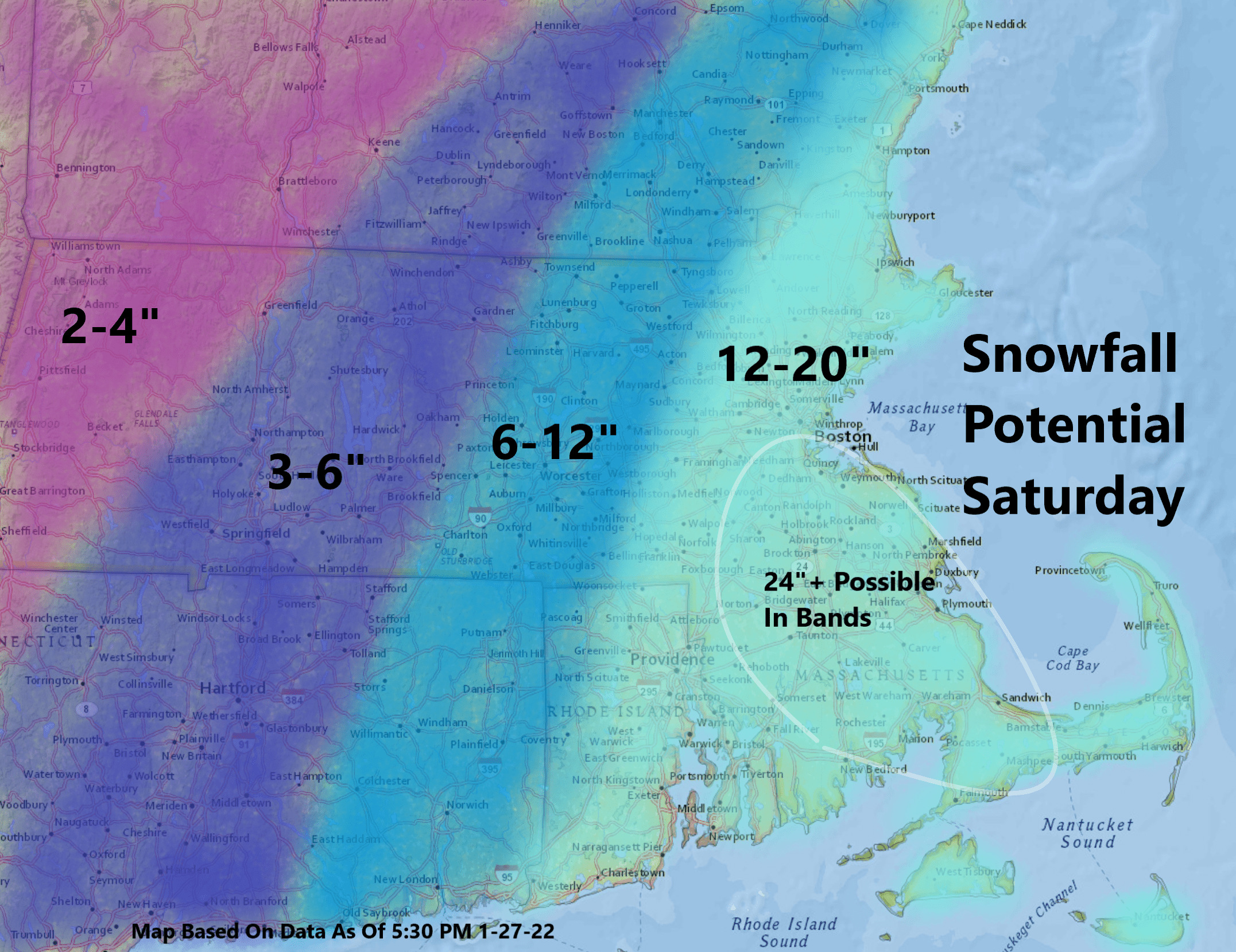
The cold temperatures will allow the snow to pile up easily. There could be some areas that see more than 20 inches, if the highest moisture ends up over land.
Winds will be strongest over Cape Cod and the Islands, where they could gust over 50 mph, causing some power outages. Because the snow will be generally on the lighter side, power outages are less likely — although not out of the question — over inland areas.
The tide is quite high Saturday mid-morning; however, the most intense part of the storm should occur afterward. In spite of this, expect some coastal flooding and beach erosion as the nor'easter bears down.
Boston Logan Airport is likely to be significantly affected, especially on Saturday. If we get more intense snowfall in Greater Boston, the airport could still be experiencing limited operations on Sunday morning.
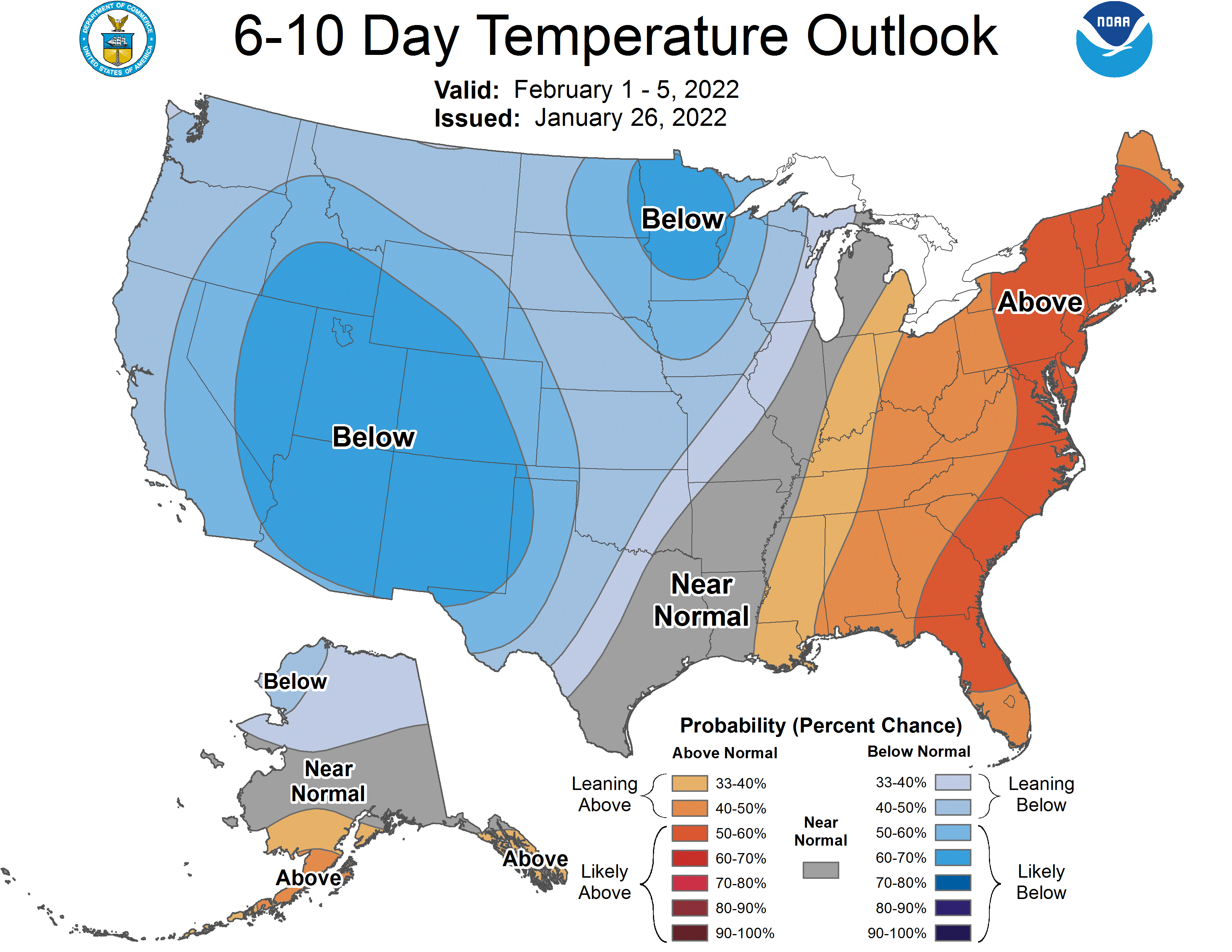
Speaking of Sunday, the sun will return as temperatures reach back into the 20s, giving you an opportunity to clean up and dig out from whatever has fallen. There are some signs that it does turn quite a bit milder later next week, so expect melting and the depth of snow to begin to decrease then.
This article was originally published on January 27, 2022.
This segment aired on January 27, 2022.
