Support WBUR
Flooding hits Vermont communities hard, and it's not over yet

Gov. Phil Scott said severe flooding across Vermont Monday morning “may be just the start” of the most severe weather event to hit the state since Tropical Storm Irene in 2011.
In response to a question by a reporter at a media briefing in Waterbury Monday morning, state officials said they had been made aware of reports of one fatality after someone was swept away by flood waters in Londonderry, but said the incident had not been confirmed.
As of 11 a.m., swift water rescue teams had ferried 19 people from flooded homes to dry land, and evacuated another 25 individuals whose dwellings were in the path of fast-rising waters, state officials said.
Deputy Commissioner of Public Safety Dan Batsie said flooding that began late Sunday night could last another 48 hours. And he said officials at Vermont Emergency Management will be focusing primarily on “life safety.”
“We know that the damage to property and infrastructure is now unavoidable, but we can save lives with simple common sense, and we ask you to exercise that common sense,” Batsie said.
Mike Cannon, manager of the Vermont Urban Search and Rescue task force, said it quickly became apparent that the 12 swift water rescue teams based in Vermont would not be sufficient for the storm response. Two swift water rescue teams from North Carolina arrived in the state Monday morning, and others are expected to come from Massachusetts, Michigan and Connecticut.
Updates from hard-hit communities
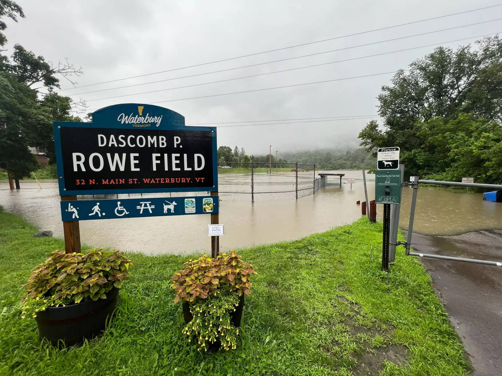
Officials say the towns of Londonderry, Weston and Ludlow have been hit particularly hard. Weston and South Londonderry, according to Cannon, are “totally inaccessible” due to flooded roads leading in and out of the communities.
Ludlow Town Manager Brendan McNamara told Vermont Public today that damage to the southern Vermont resort town that hosts Okemo is “catastrophic.”
McNamara said it’ll be days before the town can fully assess damage from a weather event that he says is “eerily similar” to Tropical Storm Irene in 2011.
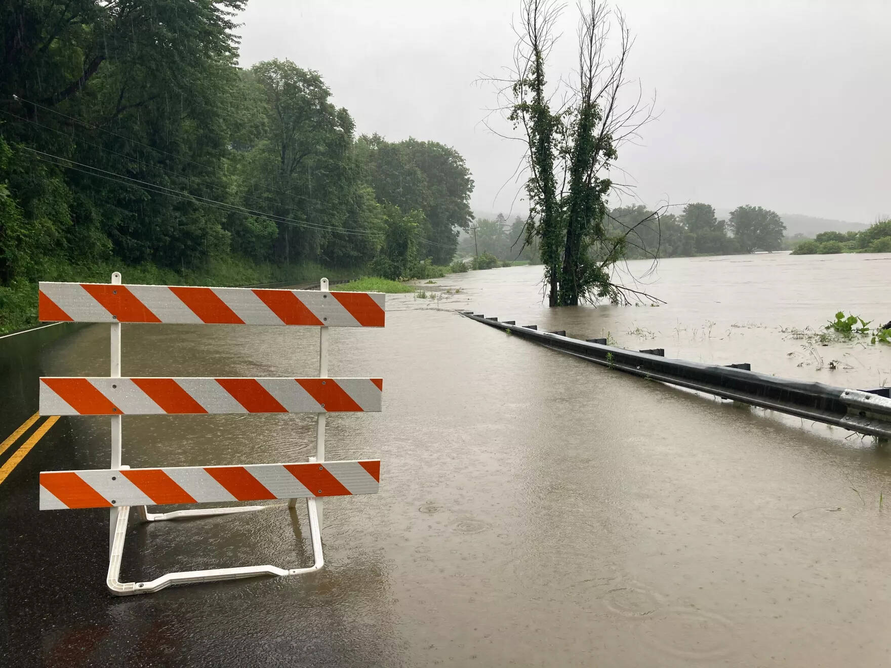
Secretary of Transportation Joe Flynn said his agency was aware of at least 25 complete closures of portions of major state routes.
For now, he said, work consists primarily of “blocking roads and waiting for the water to recede.”
“So that we can understand the condition of our infrastructure,” Flynn said. “We are also trying to communicate with local communities so that if there’s any assistance we can render, we’re aware of that as well.”
City officials in Montpelier are expecting low-lying parts of their downtown to begin flooding Monday evening, and say water levels could continue rising through the night.
Montpelier City Manager Bill Fraser said water levels are forecast to be at their highest between midnight and 4 a.m. And he said the city is urging people to get their cars onto to higher ground now, “just in case we get more water than we think.”
The Irene comparison
Asked about comparisons to Irene, which devastated vast swaths of the state and claimed seven lives, Scott said this latest storm poses challenges that Irene did not.
Scott said he spoke by phone Monday morning with Deanne Criswell, administrator of the Federal Emergency Management Agency. Scott said Criswell made clear that FEMA stands ready to assist the state in any way it can.
“The administrator just said, ‘Call and let us know what you’ll need, and we’ll be there,’” Scott said.
Officials said the Department of Environmental Conservation was monitoring two dams Monday, in Jamaica and Calais.