Support WBUR
Expect a slippery commute Tuesday as snow and sleet return to New England
The arctic cold front that barreled through the region with snow showers and squalls Sunday ushered in a much colder airmass that will stick around for the foreseeable future. Meanwhile, a storm exits the mid-Atlantic coast Monday night and track off the New England coast during the day Tuesday.
Some pockets of light snow may arrive overnight Monday, but would be light enough that minimal accumulation (a coating to 1 inch) is expected through Tuesday morning. Nonetheless, some slippery spots and snow covered roads will result, and anything untreated especially may be slick, so use caution.
For the remainder of Tuesday, off and on periods of snow will continue, slowly adding up over the course of the day. The period that could see the most accumulation is from noon to 2 p.m. Some mixing will occur with marginal temperatures at the coast to Cape Cod, and perhaps briefly farther inland as well. The back edge of the snow should arrive during the early evening from west to east.
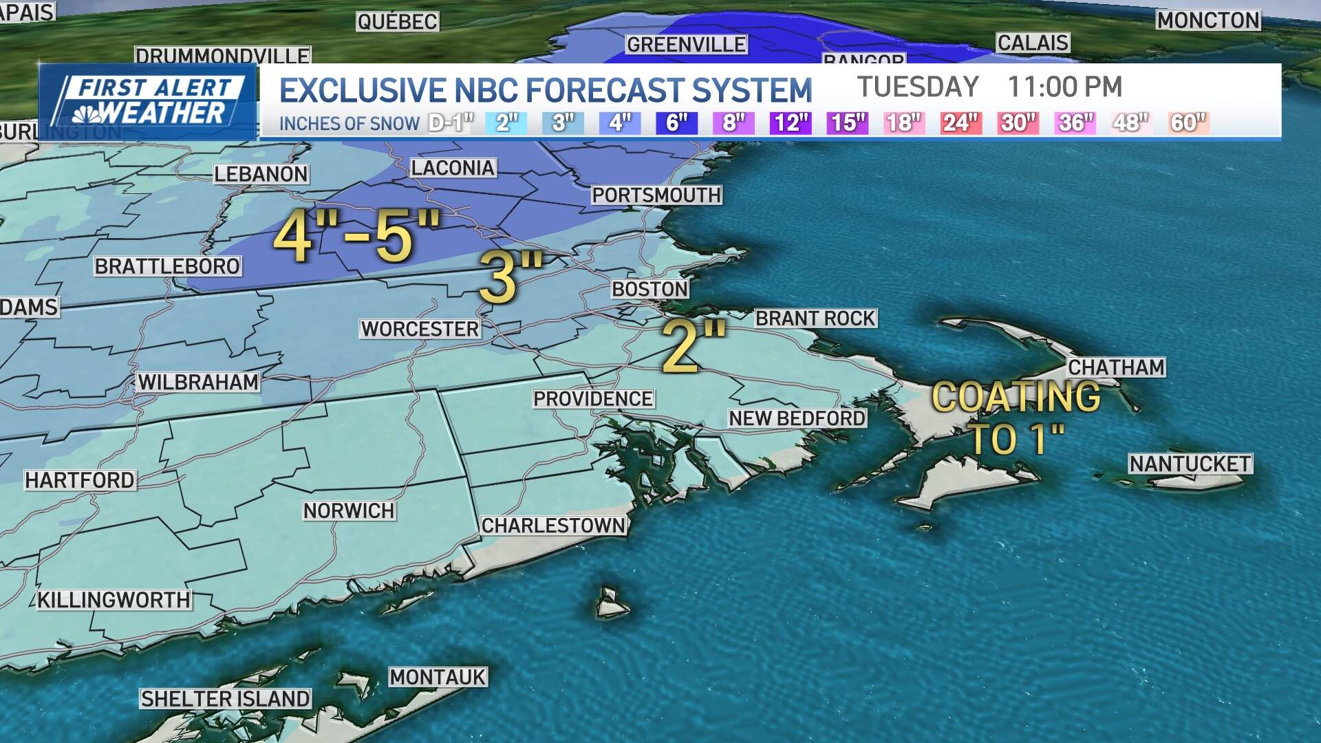
Snowfall accumulation will be 2-4 inches for many inland, with about 1-3 inches along the immediate coast and a coating on Cape Cod. Boston should see around or just over an inch. This will be a low impact event considering snowfall accumulation is anticipated over several hours — which should translate into a very manageable situation for those involved with cleanup. There are no wind concerns or flooding concerns.
The morning commute Tuesday may feature some slippery travel, along with the evening commute, especially inland. The MBTA Commuter Rail told passengers in a social media post that service may be impacted by the weather and to use caution when traveling. Temperatures will drop into the teens and 20s Tuesday night and won't get out of the 20s to low 30s on Wednesday, so untreated surfaces will freeze up solid during that time.
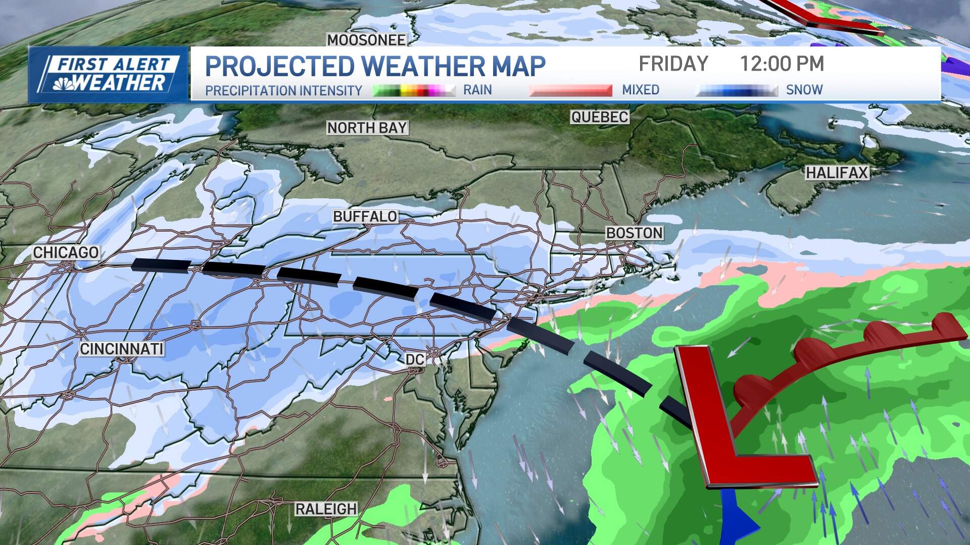
A quiet but cold few days are in store through the remainder of the week before the next disturbance arrives on Friday. The track of this next storm looks to be southeast of the region again, and perhaps a little farther offshore, meaning an all-snow scenario is looking increasingly likely. I have moderate to high confidence in another plowable event, so stay tuned for updates this week.