Support WBUR
Expected snow totals shift slightly lower as nor'easter's track wobbles south
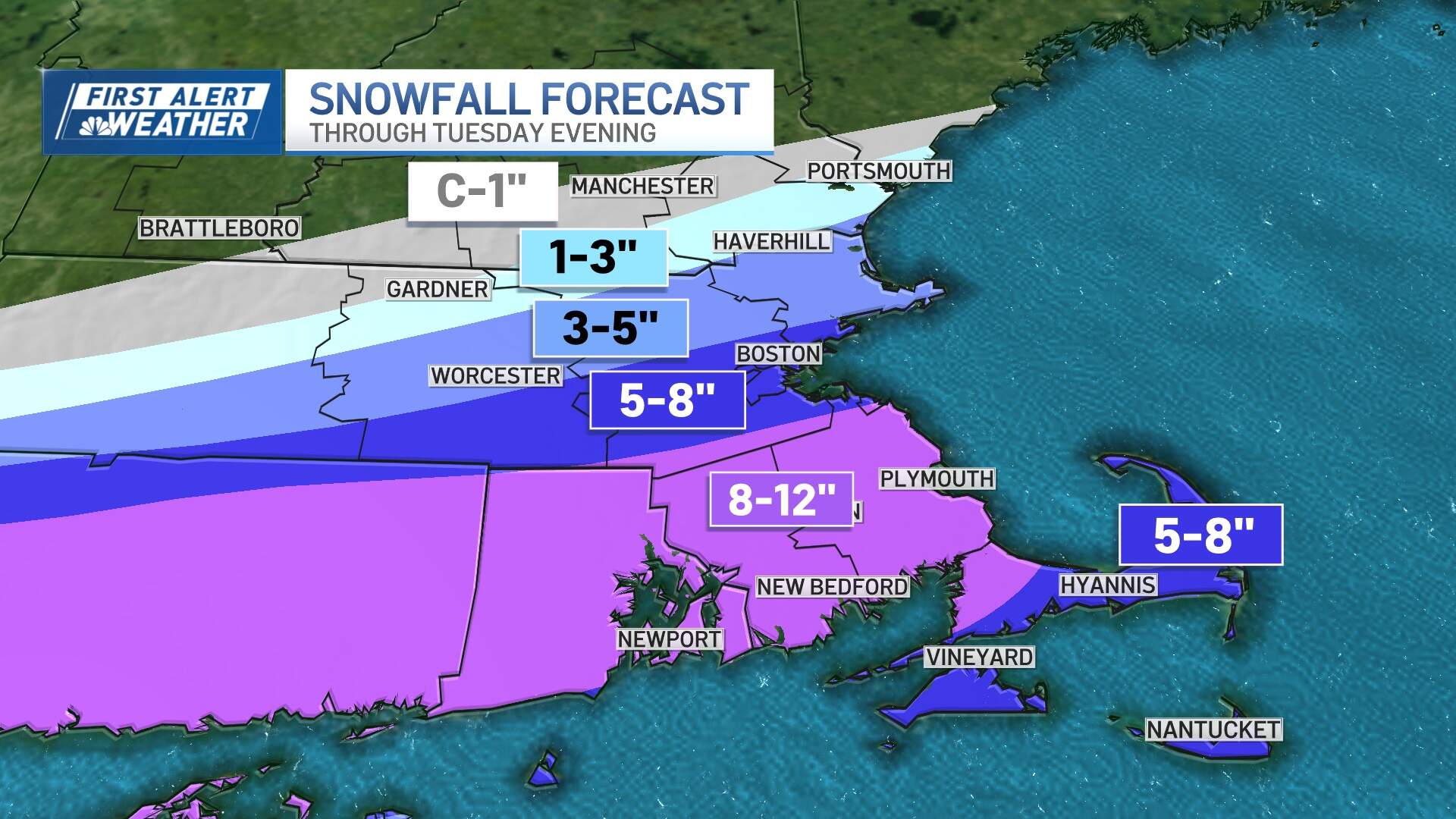
Our impending nor'easter is on the way, though a significant southward shift in the storm track means expected snowfall totals have been changing as well. This is still anticipated to be a moderate to high impact event south of the Massachusetts Turnpike, with lower impacts the farther north you go.
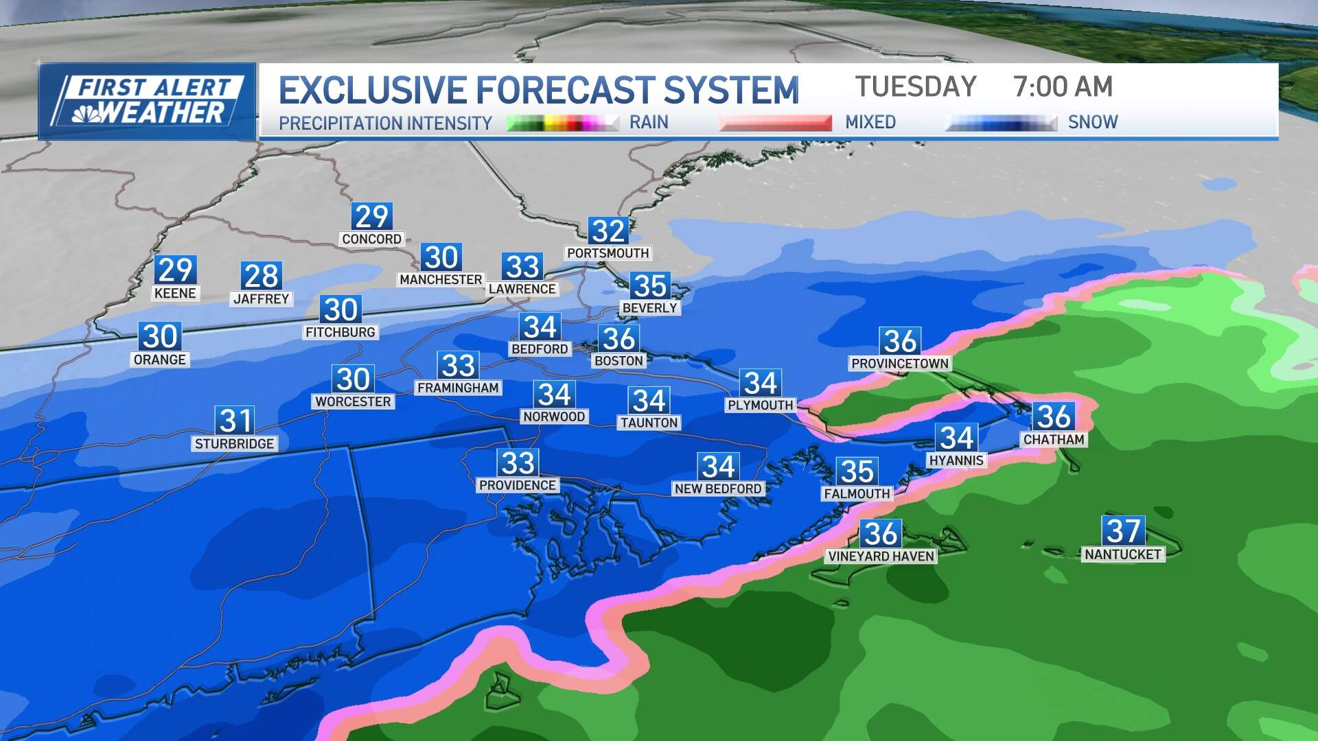
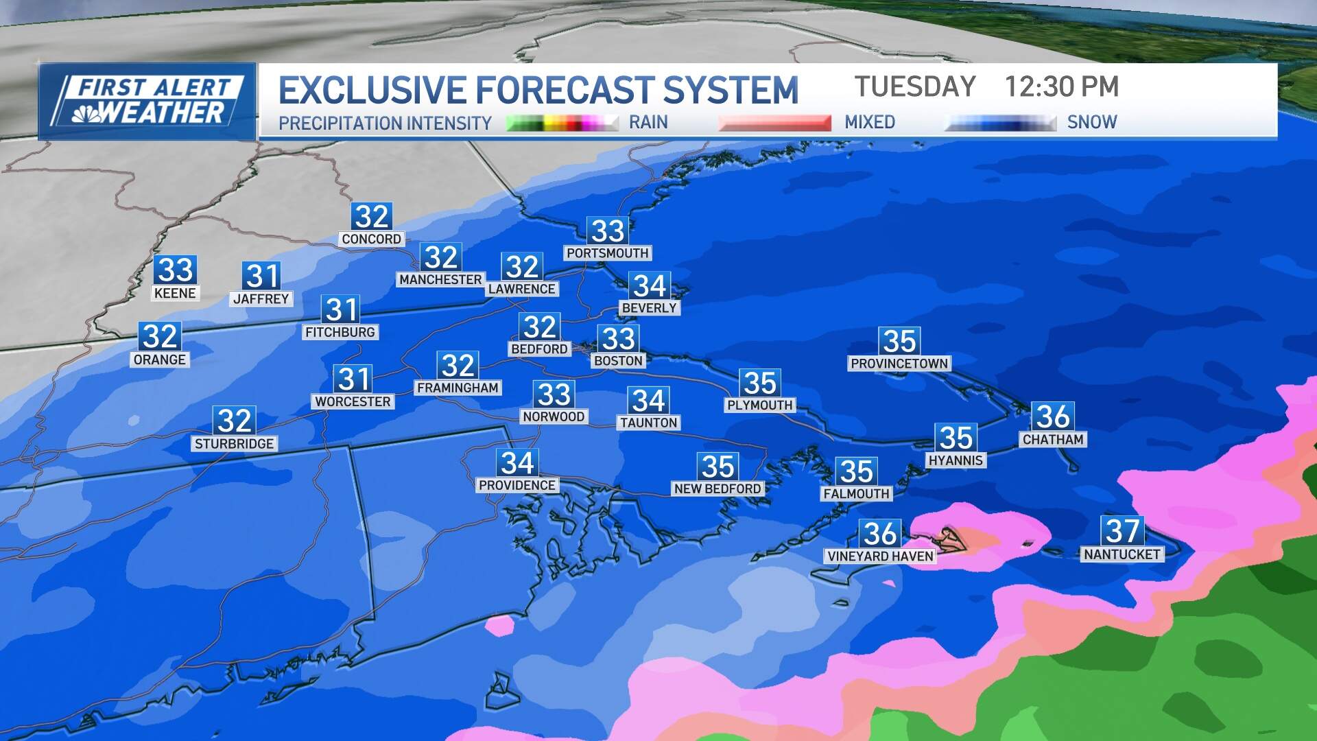
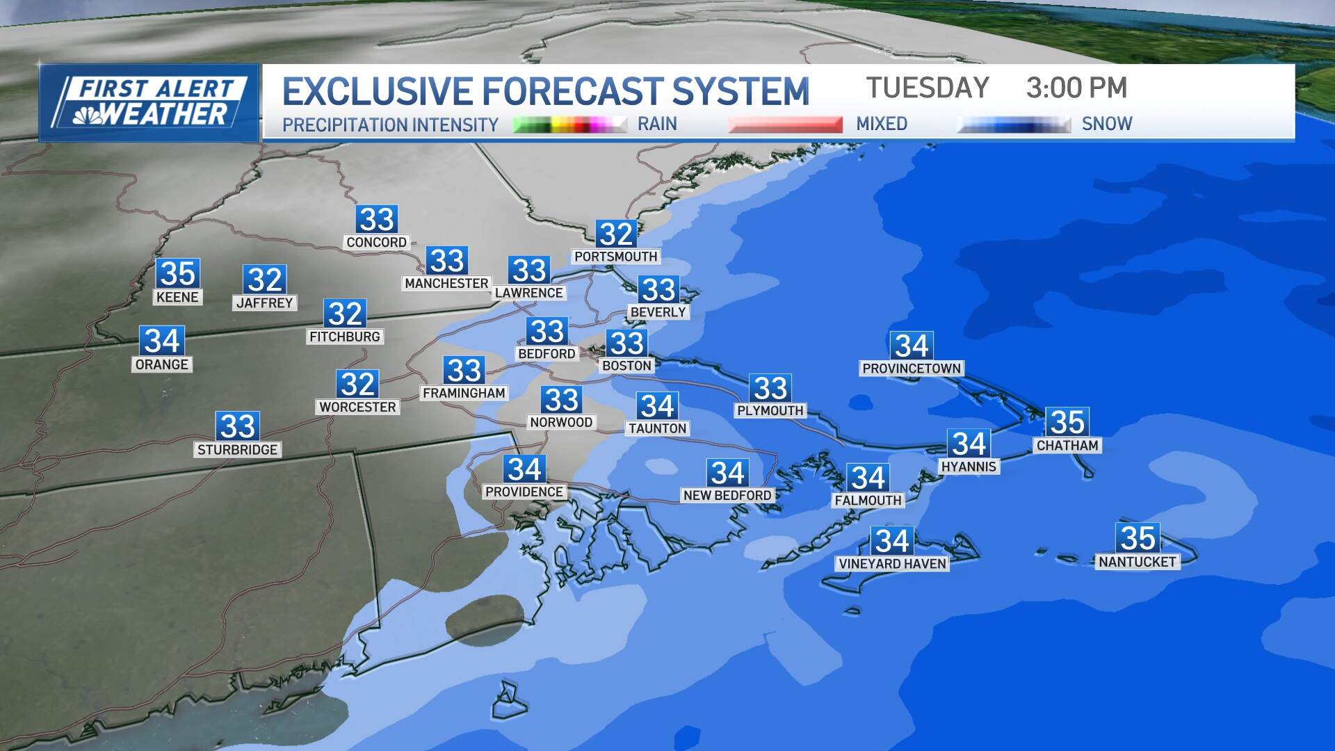
The timing hasn't shifted much: snow should arrive between 4 a.m. to 6 a.m. and ramp up through the morning hours, with the "peak" snowfall rates either side of midday. The back edge of the snow will shift through from west to east during the late afternoon to early evening, generally 4 p.m. to 6 p.m.
Eight inches or more is anticipated over southeast Massachusetts to the Upper Cape, with 5-8 inches in Boston itself. Amounts will taper off quite dramatically north and west of the city, with little if any over the New Hampshire border.
With marginal temperatures in place, the snow will be a wet consistency, clinging to limbs and power lines which may result in some isolated pockets of outages or damage.
A new moon with astronomical high tides and an onshore wind with building seas will bring widespread minor coastal flooding, with some moderate pockets possible on either side of the early afternoon high tide cycle.
The wind will ramp up tomorrow out of the northeast, gusting to 40 mph at times at the coast, and 45-55 mph on Cape Cod, shifting to the north then northwest from the afternoon to evening.
The main takeaway from all of this? Kids still need to do their homework tonight! There is still considerable uncertainty in the exact track of the storm and a jog north or south will mean additional forecast changes will be necessary tonight or tomorrow morning.
The remainder of this week looks quiet but cold, with temperatures generally running in the 30s. There's a chance for some snow as we head towards next weekend, though that's not as certain at this point, so stay tuned.
This article was originally published on February 11, 2024.
