Support WBUR
Coastal storm to deliver soaking rain ahead of Memorial Day weekend
If you were hoping for an early taste of summer this Memorial Day weekend, we’ve got some classic New England curveballs instead.
A storm center to our south will develop into a nor’easter and sweep through the region Thursday. Boston will be right in the thick of it, with heavy rain, gusty winds and that raw, damp chill we all know too well.
Let’s break down what you can expect heading into the long weekend.
Localized flooding
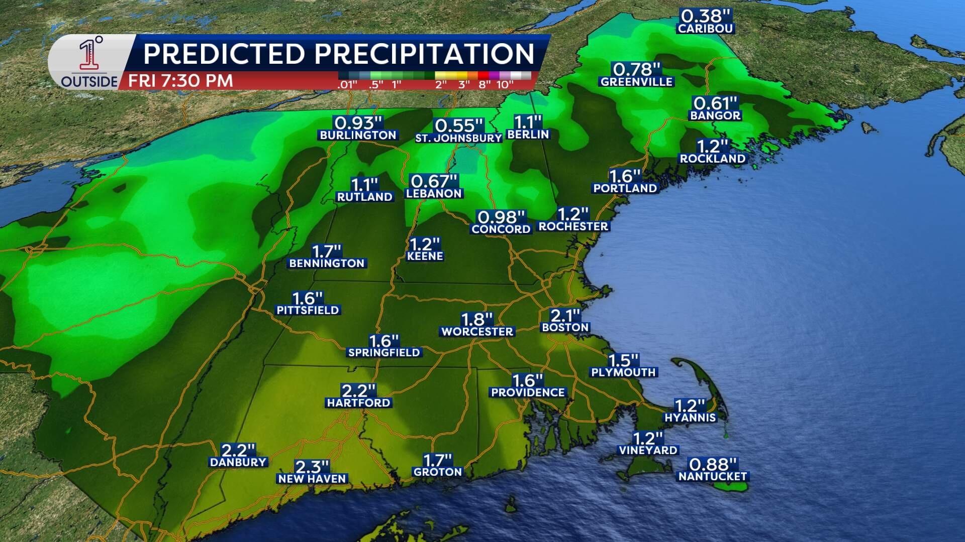
Rain will fill in across eastern Massachusetts early Thursday morning between 7 and 9 a.m. It will continue steadily and at times heavily through the remainder of Thursday.
The steadiest rain will end early Friday, between 5 and 7 a.m. Totals of 1 to 2 inches are widespread. But in and around Boston, up to 3 inches isn’t out of the question.
Keep an eye on:
- Street flooding in urban areas
- Low-lying intersections and underpasses
- Basement water in flood-prone homes
This is a true soaking — umbrellas won’t be optional, and if you’re out and about Thursday, plan on full rain gear.
Wind: Gusty and potentially damaging
The wind ramps up Thursday, with gusts over 40 mph possible in Boston by the late afternoon through the evening, and potential for gusts over 50 mph on Cape Cod and the Islands. Winds shift briefly out of the southwest on Cape Cod as the storm center passes near the canal.
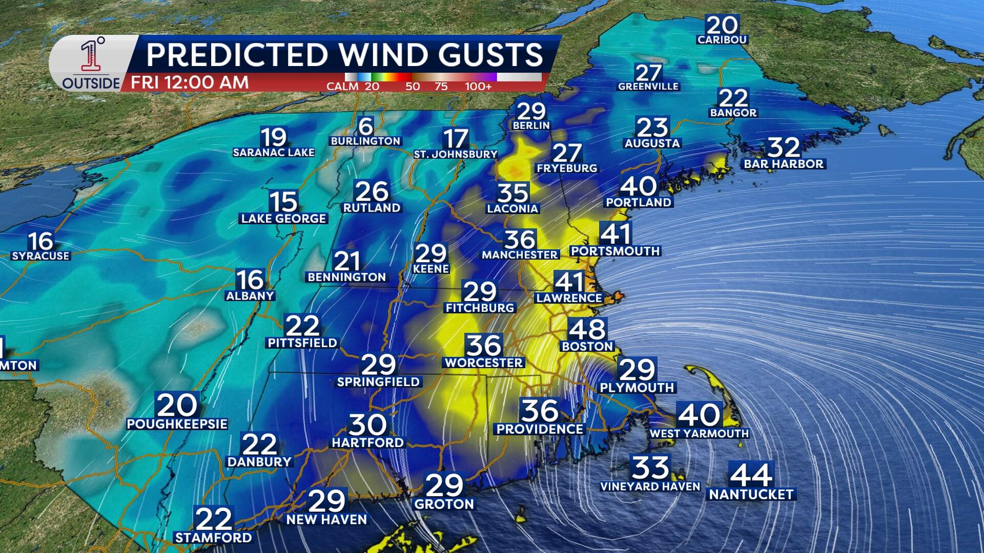
With leaves on the trees now and a soggy ground, some pockets of isolated wind damage are likely in eastern Massachusetts, especially at the coast.
There’s also minor coastal flooding and splash over potential along the eastern Massachusetts shoreline, especially around the Thursday evening high tide cycle — so if you live or commute near the waterfront, keep that in mind.
Wait — did someone say snow?
Yes, but don’t panic, Boston. This part is just for the mountains. Cold air aloft is allowing snow to fall above 3,000 feet across parts of Vermont, New Hampshire and northern Maine. Mount Washington may pick up half a foot or more, and even some valley locations could see a few stray flakes mixing in.
Still, it’s a reminder this is one cold late-May storm.
Memorial Day weekend outlook: Gradual improvement
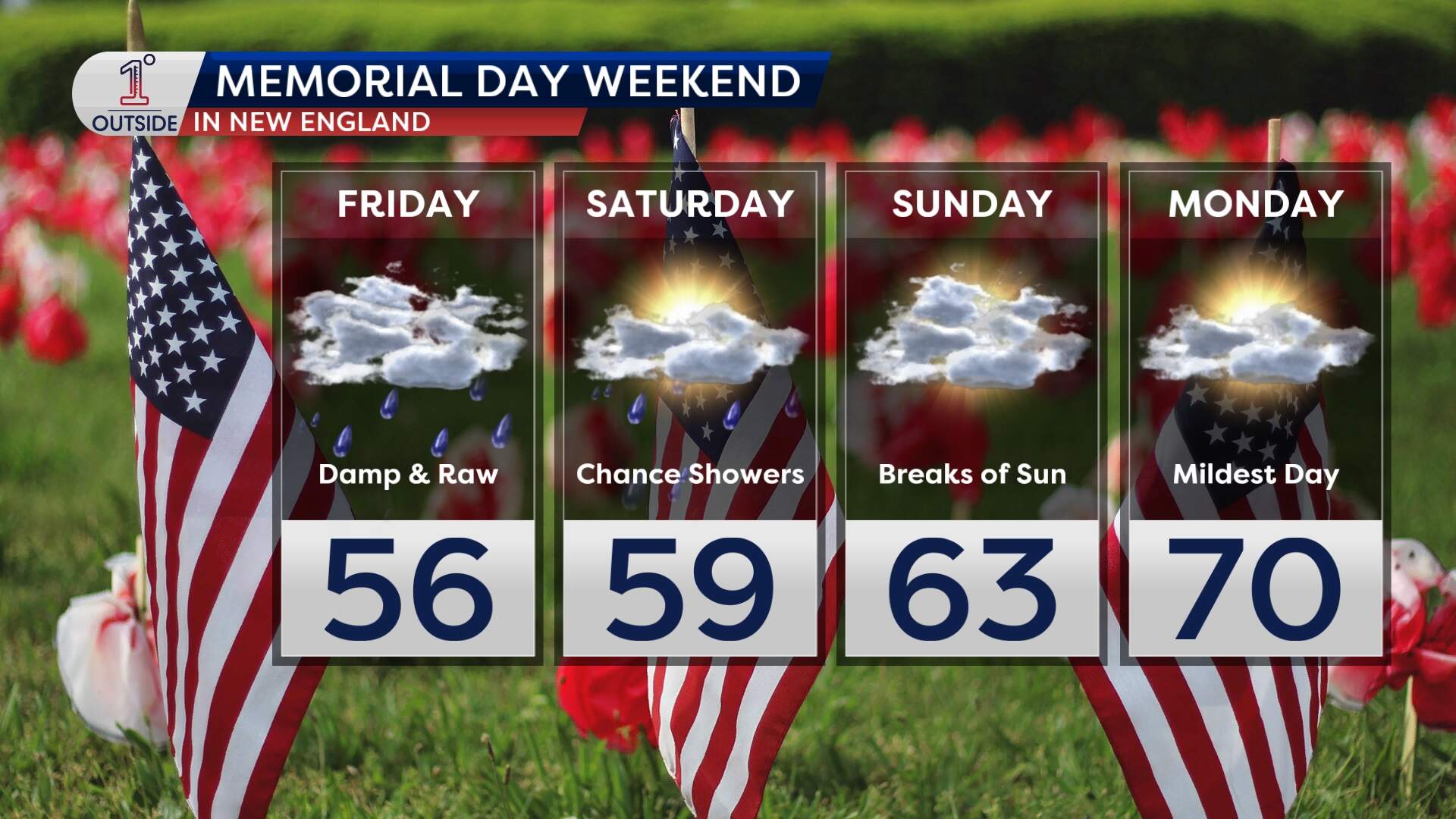
Here’s how things shape up for the long weekend:
- Friday: Lingering showers, cloudy skies and chilly with highs in the 50s to near 60. Breezy too — it’ll still feel raw, especially early.
- Saturday: Mostly cloudy, cool again with highs near 60. Spotty showers are possible in the afternoon. Not a washout, but not ideal for outdoor plans.
- Sunday: A bit better — still cooler than normal, but with a few sunny breaks and fewer showers. We’ll call it “improving.”
- Memorial Day Monday: The best of the bunch! Filtered sun, dry for many and highs near 70 in Boston. It might not be beach weather, but it’s definitely more comfortable and finally feeling a bit like late May. Still can't rule out a stray shower, but it would be isolated.
Red Sox forecast at Fenway
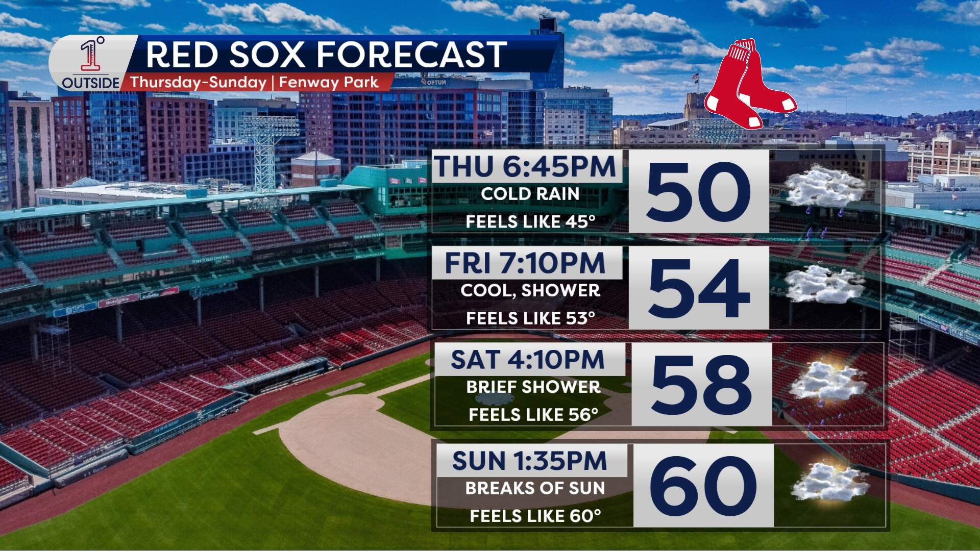
- Thursday night: Sorry Sox fans — this one’s probably a rainout. Cold, steady rain through the evening looks to win out.
- Friday: Better! Expect cool but playable conditions, with just a stray shower possible.
- Saturday and Sunday: Improving game by game. Sunday should be the best bet — dry, a bit brighter and more comfortable.
