Support WBUR
A heat wave is in the forecast, with a chance at 100 degrees Tuesday
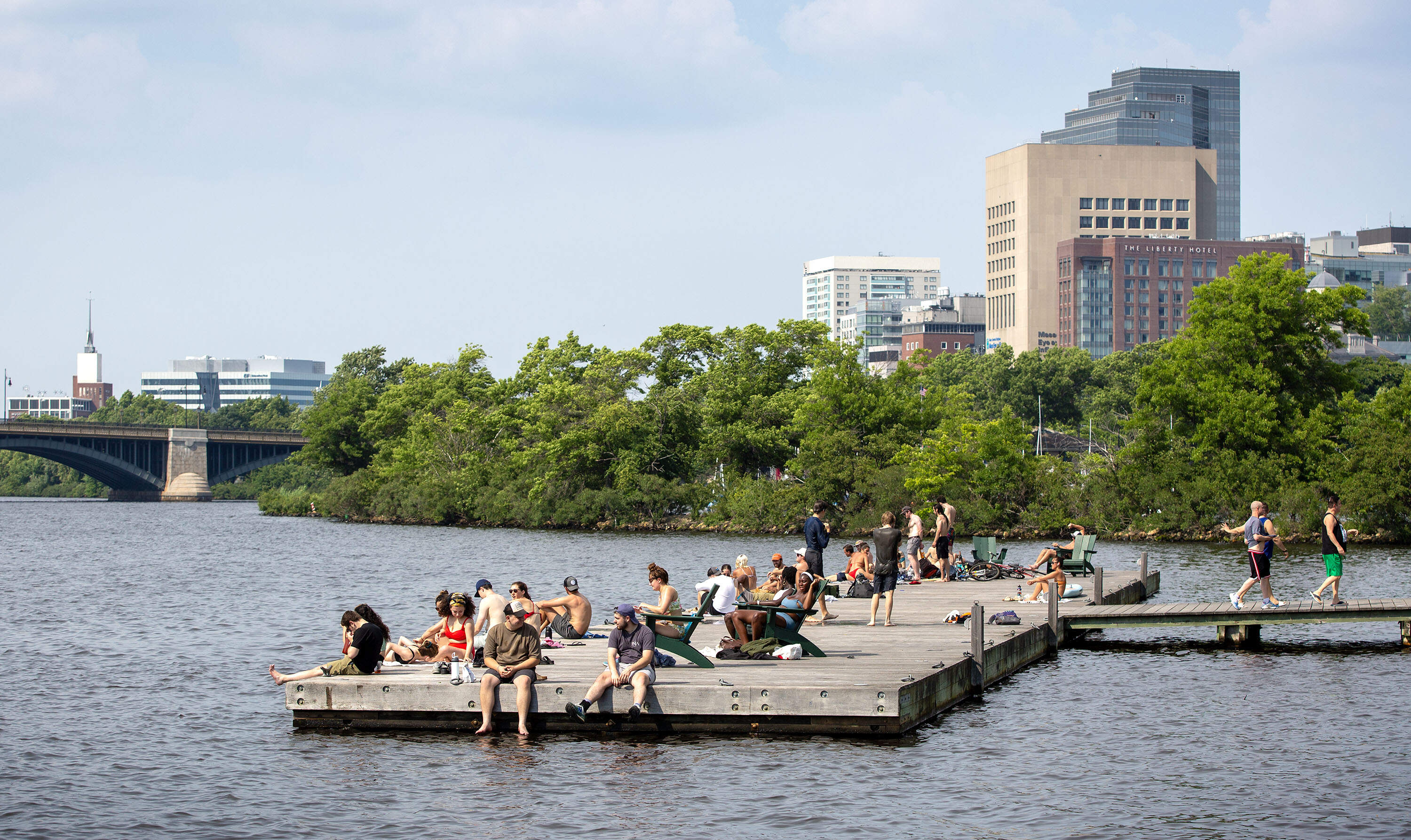
A stretch of intense heat and humidity is already breaking records across the Northeast. Boston sweltered to 94 degrees on Sunday, and if the temperature cracks 90 degrees again Monday, the city will have officially logged a three-day heat wave by the end of Tuesday.
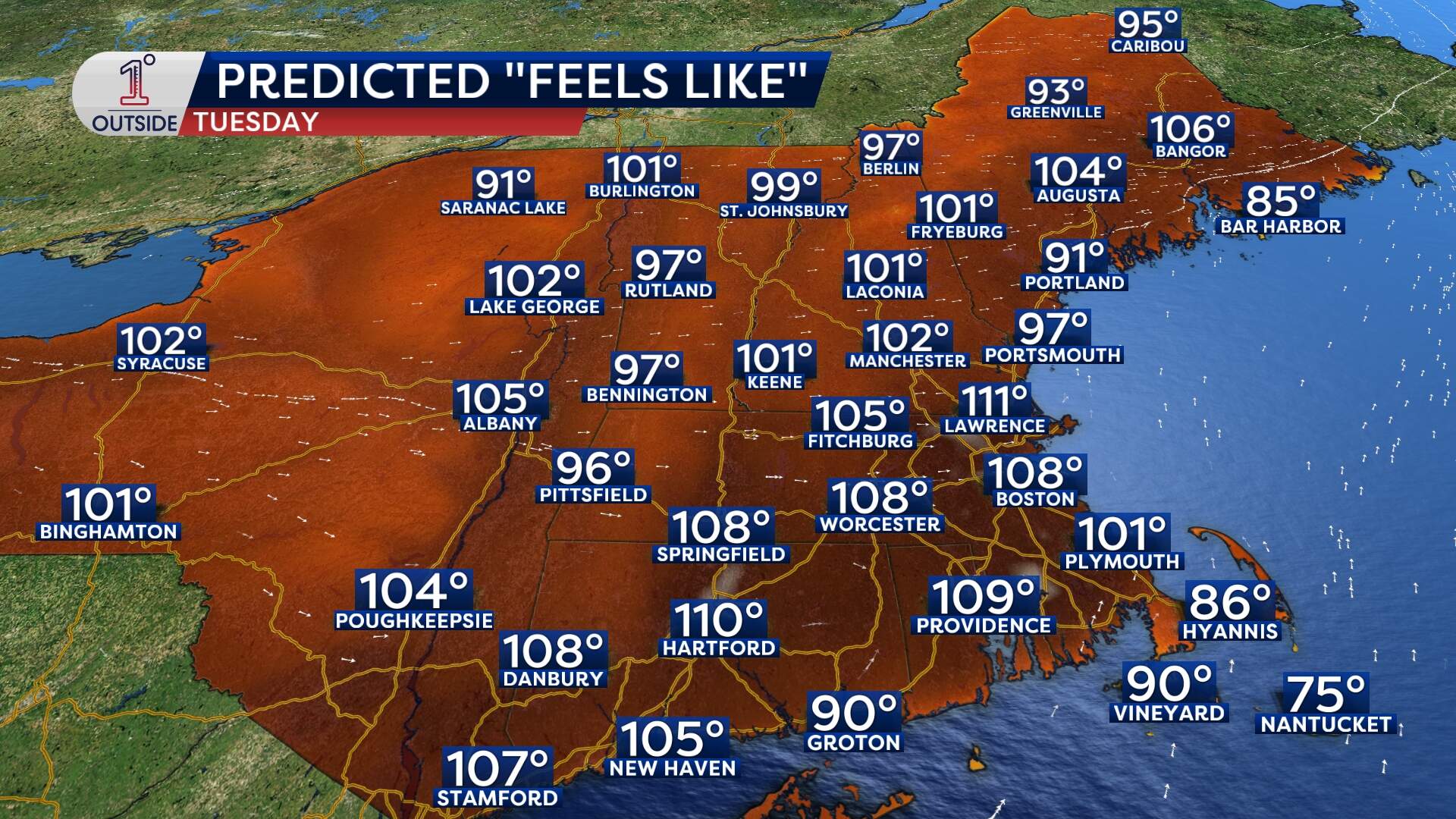
A heat wave is officially defined as three or more consecutive days of 90-plus degree temperatures. The heat peaks Tuesday, with a serious run at 100 degrees — a mark Boston hasn't reached since July 24, 2022. It would tie the all-time June record of 100 degrees (set in 2021, 1952, and 1925).
A quick stroll through Boston’s recent heat history:
All-time high: 104 degrees on July 4, 1911
Record June day: 100 degrees in June 2021, 1952 & 1925
Last time it hit 100 degrees: July 24, 2022
2024 highlights: Our hottest reading was 98 degrees on June 19. There were two heat waves last summer: June 18–20 and July 15–17. It was the hottest year on record in the contiguous United States, and the third-hottest in Massachusetts (runners up are 2012 and 2023).
What’s coming this week
Monday and Tuesday: Heat wave in full swing
Monday: Highs flirting with 90 degrees — depending on whether a light sea breeze kicks in first. Dew points in the 70s make the air feel soupy. Just away from the coast, highs soar into the mid- to upper-90s. The coast to Cape Cod is where the relief is.
Tuesday: The big push. Highs in the upper-90s to around 100, with heat-index values soaring into the 105- to 110-degree "danger zone." (The “heat index” is what the temperature feels like when you combine humidity and air temperature.) This is serious heat; take extra precautions if you're working or exercising outdoors.
Wednesday: Still too hot for comfort
Wednesday brings another 90-degree day, but some relief in the form of pop-up afternoon and evening thunderstorms, mainly inland. These brief storms can bring heavy downpours and lightning, so keep an eye on the sky.
Thursday: Finally, relief
By Thursday, a cooler air mass surges in. Highs tumble back into the 70s and humidity eases, though there will be some scattered showers and the chance of a thunderstorm. It looks like it will stay in the 70s for a few days as well, before some 80s return next week.
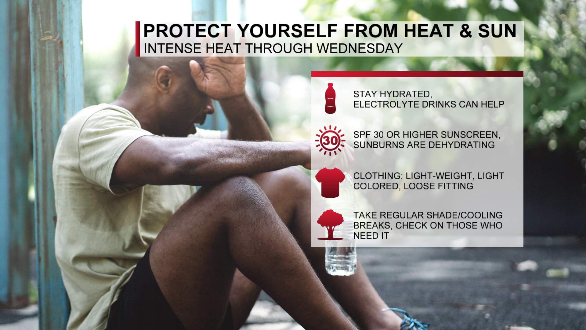
Heat-beating tips
- Stay hydrated. Water is your best friend. Sip it constantly, even before you feel thirsty.
- Limit midday exposure. The sun’s strongest from 11 a.m. to 4 p.m. Plan errands early or late.
- Dress for the heat. Light-colored, loose-fitting, breathable fabrics keep you cooler.
- Cool your pulse points. Apply ice packs or cold towels to your neck, wrists or behind your knees.
- Check on neighbors. Seniors, young children and pets need extra care when the heat soars.
Pop-up thunderstorms
That same heat and humidity fueling the furnace also prime the atmosphere for spotty afternoon and evening storms on Monday and Tuesday. They’ll be brief but can pack heavy downpours, gusty winds, and lightning. Keep an eye on the radar.
Buckle in for an early summer blast. Stay cool, stay safe, lean on these tips, and remember: relief is coming by the end of the week when highs fall back into the 80s and the air finally feels less like a sauna.
This article was originally published on June 20, 2025.
