Support WBUR
Traveling for Christmas? Here's the timing of snow and wind expected this holiday week
New England may not get a movie-worthy white Christmas, but depending on where and when you're traveling, you might still see a bit of snow.
The forecast leading up to the holiday is offering a bit of everything, from light snow to raindrops and strong winds. That said, Bostonians worried about a big winter storm this Tuesday can relax; nothing that significant appears headed our way.
Still, with some festive flakes flying at the right (or wrong) times, travel plans and city operations will need to be handled with care.
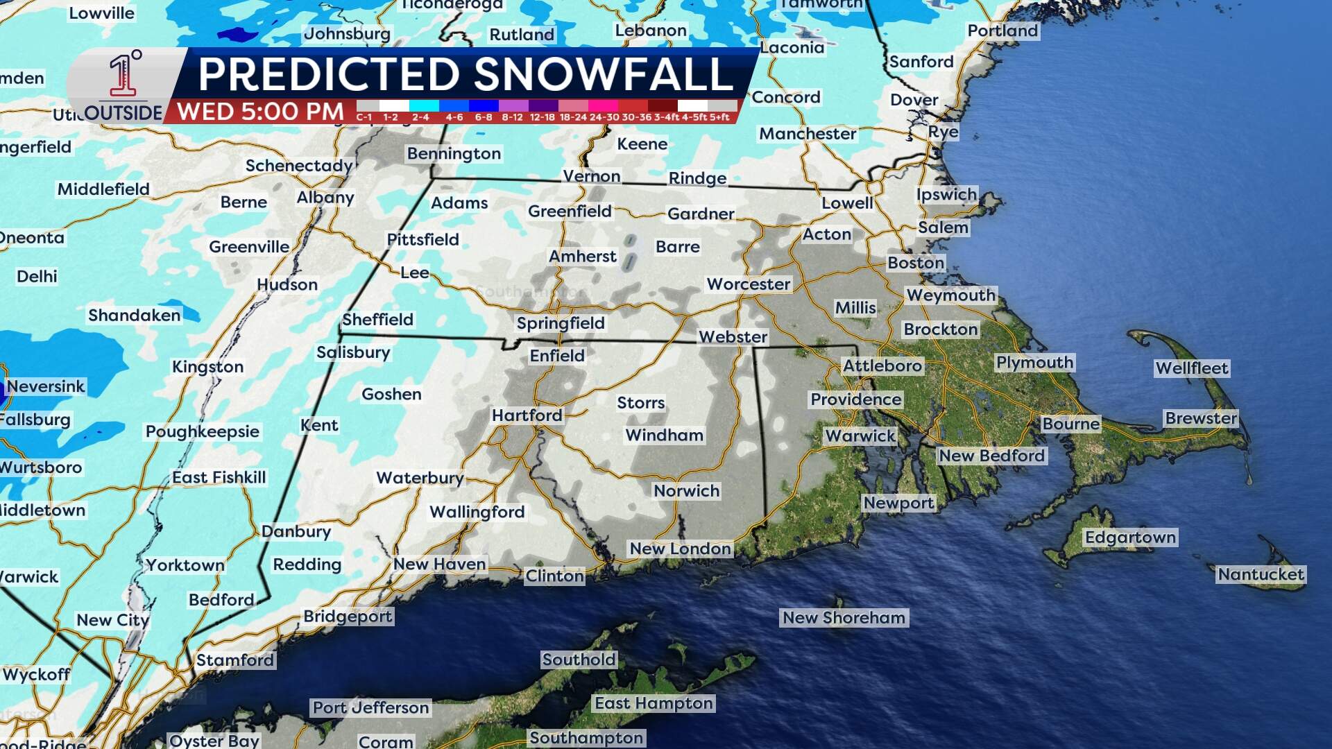
Tuesday: Light snowfall comes
Tuesday is set to bring the region a modest, and timely, snow event.
The snow is expected to begin falling across Greater Boston at some point in the mid- to late morning hours — most likely between 9-10 a.m. — as warm air runs head-on into the region's entrenched dome of cold air.
Temperatures will hover near freezing throughout the weak storm, meaning it'll be all snow for Bostonians and most others across Massachusetts. Only a few places along the South Coast and Cape Cod will get some rain in the mix at times.
In Boston, a coating up to an inch of snow may be possible by early afternoon. Total snow accumulation will range between 1 inch and up to 3 inches north and west of Boston (generally, outside of I-495). And while that isn't much snow, the flakes could fall at around 0.3 inches per hour for brief periods during the middle of the day. Road conditions may deteriorate during that time.
This is a classic “timing over totals” type of event. Slippery spots are most likely on untreated surfaces, ramps and hills — particularly for towns and cities west of Boston.
Treated main roads should hold up fairly well given the snow falls during daylight hours and road temperatures will be near freezing. Crews will need to re-treat roadways after sunset to prevent the wetness from refreezing.
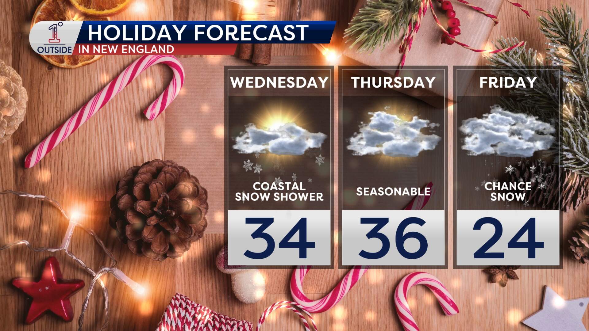
Wednesday (Christmas Eve): Flakes linger, but it's gusty
Lingering energy in the upper atmosphere could bring a few stray snow showers across Eastern Massachusetts Wednesday morning, especially near the coast and east of Worcester. The showers will be brief and scattered, but could still slick up the roads before noon.
What may grab your attention more on Wednesday is the wind. A quick-hitting shift in the atmosphere brings gusts up to 30–40 mph in Boston and perhaps stronger along the Cape and hilltops late morning into the afternoon.
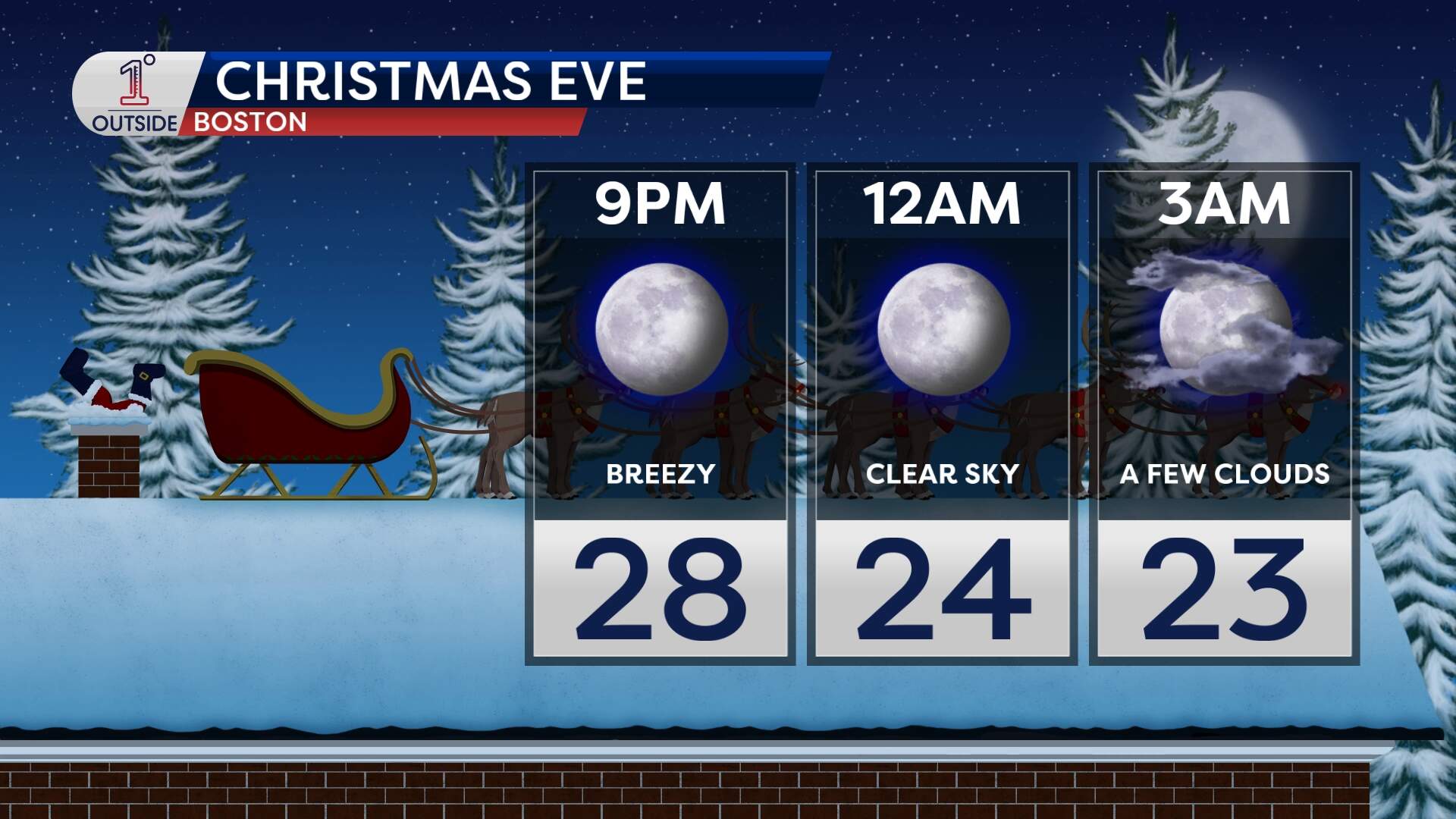
While not damaging, these winds will be enough to give Christmas Eve a proper wintry feel, especially with temperatures in the mid-30s.
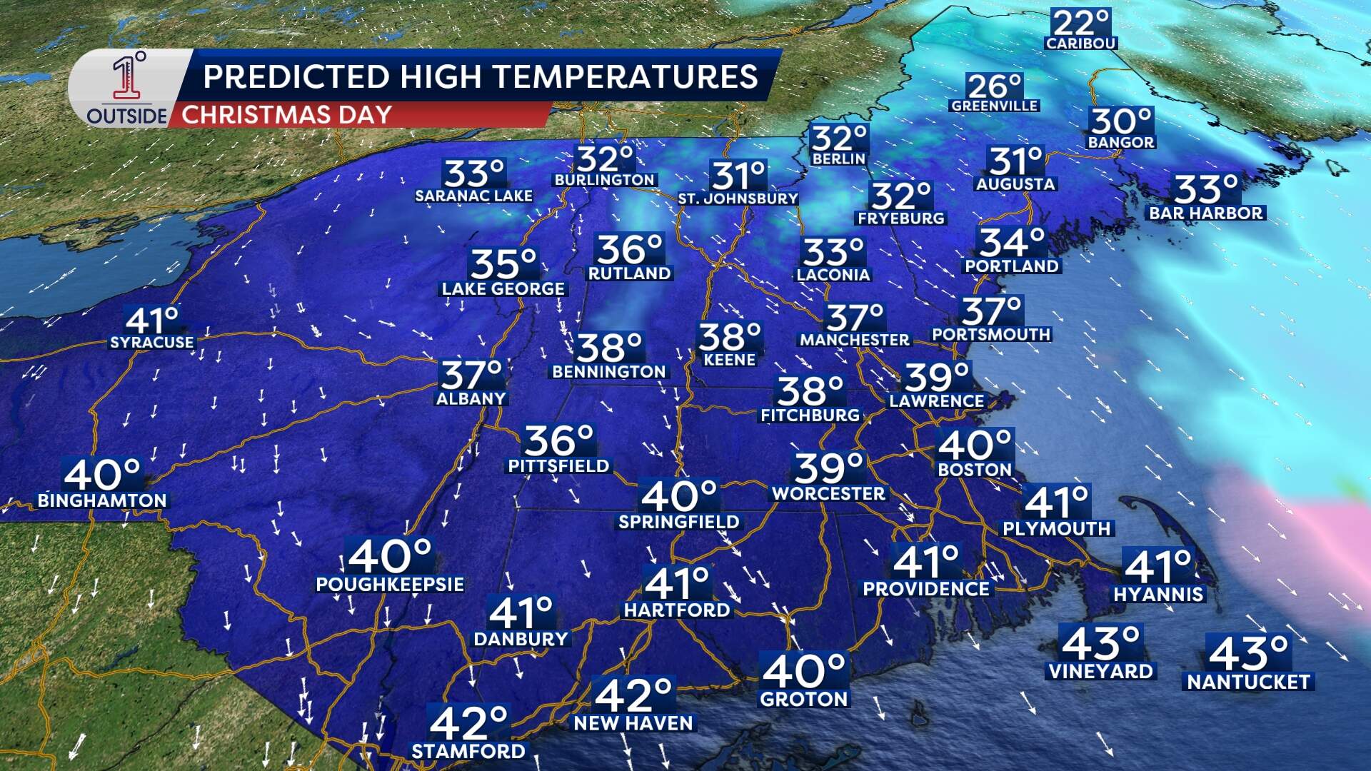
Christmas Day: Chilly, but calm skies
Thursday’s forecast is a gift to travelers and those dreaming of a peaceful holiday.
Christmas Day features a quiet and seasonable setup: clouds mixing with sun, dry air holding firm and highs near 40. Winds will be lighter than Wednesday, though occasional gusts over 20 mph are possible.
Friday: Will there be snow? It's not yet clear
Looking ahead to Friday, all eyes are on a developing storm that will likely track just to our south. New England remains on the colder side of the system, and it's not yet clear what the storm's final track will be.
At this point, southern and western parts of New England stand the best chance of seeing accumulating snow.
For Bostonians, the city looks to be on the northern edge of the system, meaning we'll only get a glancing snow or just some flurries. However, if the storm nudges slightly farther north, a more impactful event is on the table.
Want the latest updates? Track the snowflakes and temperatures in the free 1DegreeOutside mobile app.
