Support WBUR
Holiday forecast: A few flakes for that Christmas feeling, and a stormier weekend for travelers
From the city streets of Boston to the snowy slopes of northern New England, these days leading up to Christmas are shaping up to treat residents to a quintessential stretch of winter weather.
There'll be bursts of snow and gusts of wind at times. And on Christmas Day, there'll be just enough flurries to deliver the storybook feel many hope for.
Wednesday: A little slick on Christmas Eve
Bostonians and others across Eastern Massachusetts may see a coating of snow come Wednesday morning.
If you're headed out for some last-minute errands or holiday travel, give yourself a bit of extra time. Slick spots are possible in untreated areas, especially through midday. There may be a few more showers through then, with pockets of snow filling in through mid- to late morning. Impact will be fairly low, but visibility is likely to be reduced for a time as they blow through.
Temperatures fall in the afternoon, setting up the risk for icy patches by evening.
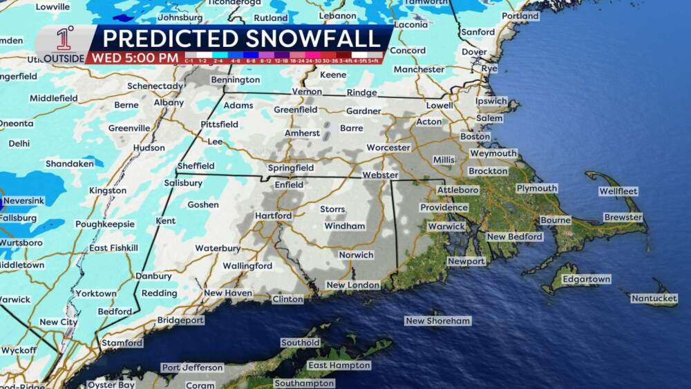
Winds will also be a factor Wednesday, gusting 30 to 40 mph at times with isolated higher gusts up to 45 mph on Cape Cod and in the higher elevations.
Fortunately, the wind begins to ease by evening, setting us up for a quiet & calm Christmas Eve night.
Thursday: A flurry-filled Christmas Day
Christmas Day brings a chance for holiday ambiance, with flurries and snow showers drifting through the region on a chilly northwest wind.
Northern New England stands the best shot at seeing a coating to an inch of snow, but there should be some brief flurries around southern New England too through the early afternoon hours.
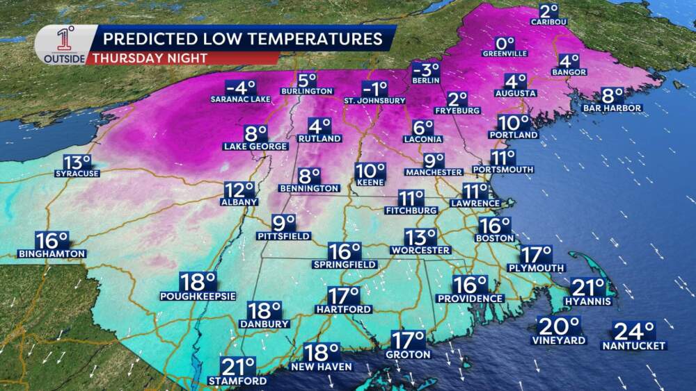
By Christmas night, colder air really pours in. Expect lows in the teens and 20s along the coast, single digits inland and sub-zero wind chills in far northern New England.
The intense cold will also set the stage for our next weather maker.
Weekend weather: Plowable snow before more snow and sleet
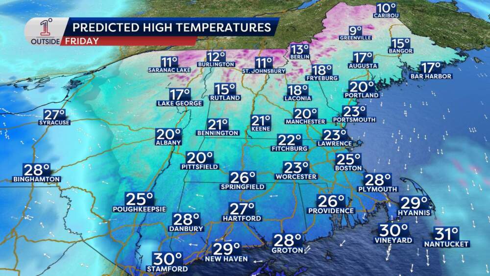
Friday starts quiet but cold, with sunshine fading behind thickening clouds. Highs will only be in the 20s.
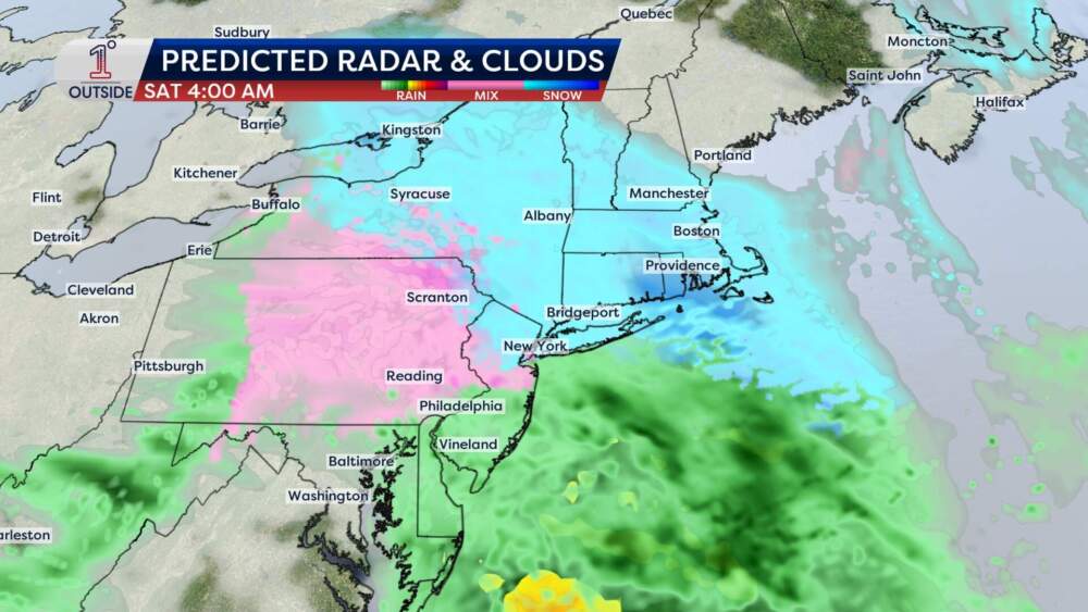
By evening, snow spreads from southwestern New England across the region overnight. Right now, the storm track favors a plowable snowfall on the order of 1-3 inches, but perhaps even 2-4 inches. It'll be a fluffier consistency, which means it will pile up a bit quicker, too.
Some cleanup will be underway Saturday as the snow winds down during the afternoon. Then, there's not much time before our next system arrives!
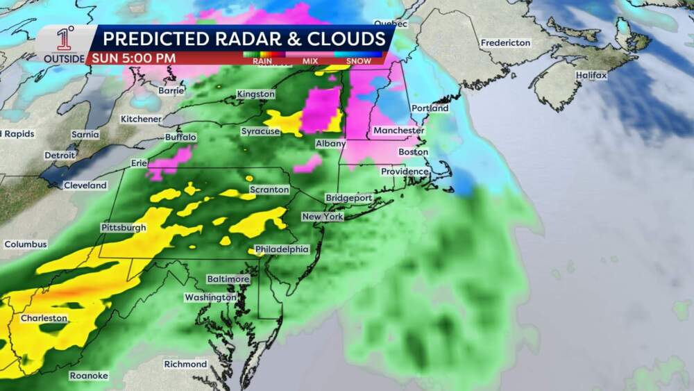
A disturbance on Sunday will bring a messier mix of precipitation. Temperatures should be cold enough to start the storm off with a burst of snow Sunday afternoon. Then, the snow is set to change to sleet and freezing rain inland, with rain hitting coastal communities in Massachusetts.
It's too early to know the exact timing or give a solid estimate on snow totals. We'll be back with updates as the storm gets closer.
Want the latest updates? Track the snowflakes and temperatures in the free 1DegreeOutside mobile app.