Support WBUR
Memorial Day weekend forecast is a true spring mix — sun, then showers and a pleasant holiday rebound
As Massachusetts residents head into the unofficial kickoff to summer, they'll no longer feel the record heat, as the holiday weekend brings a big pattern shift to the region.
On Tuesday, Boston smashed record highs by hitting 96 degrees. It was the second-hottest May temperature ever, giving many residents a little taste of summer. But, the atmosphere is set to flip the script.
While the weekend won't bring beach weather, there's no need to cancel your plans. While it will be significantly cooler at times, there will be plenty of bright spots. Here's when you should aim to get outside:
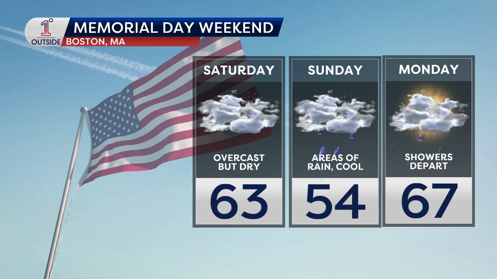
Saturday cool but dry
If you have outdoor plans, keep them on Saturday. Expect plenty of clouds, but it should remain mainly dry for the vast majority of the region. It will be seasonably cool, with low 60s at the coast and mid-60s inland. But it'll beperfectly fine for a parade or a backyard cookout.
A wet Sunday
Outdoor plans are a no-go on Sunday. A storm center spinning to the south will funnel in raw, cool and wet conditions. The area is looking at widespread rain filling in during the morning and becoming steadier through the afternoon and evening.
With an onshore breeze off the chilly 50 degree ocean, temperatures will struggle to get out of the mid 50s. It is definitely sweatshirt (or even rain jacket) weather.
Memorial Day Monday
Monday will be the warmest day of the long weekend. The holiday starts with some lingering dampness and gloomy clouds, but a drier northwest wind takes over later in the day. This should bring out breaks of sun, boosting temperatures into the upper 60s to low 70s.
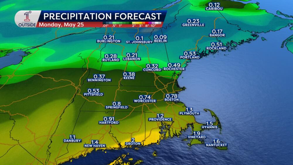
One warning for the South Coast: Moisture may linger a bit longer here, so keep an eye on the radar for those heading to the Cape.
Boating and coastal conditions
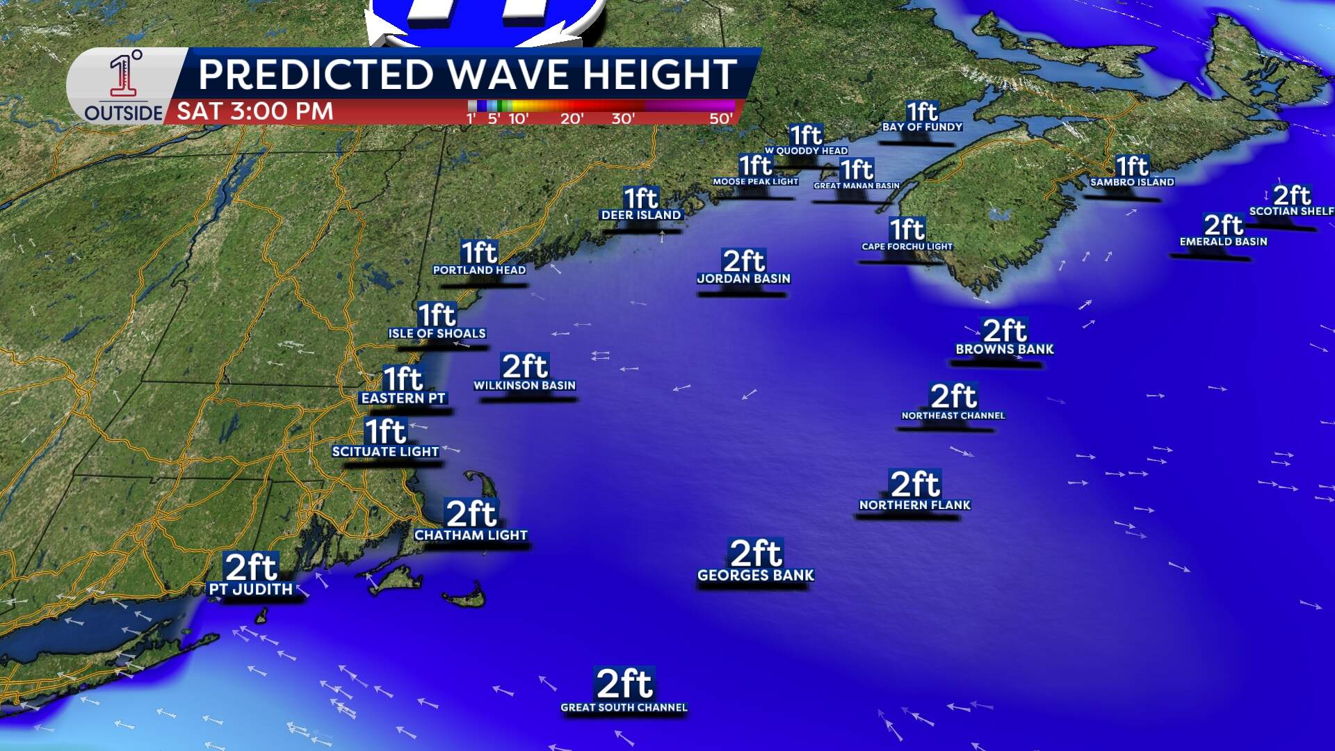
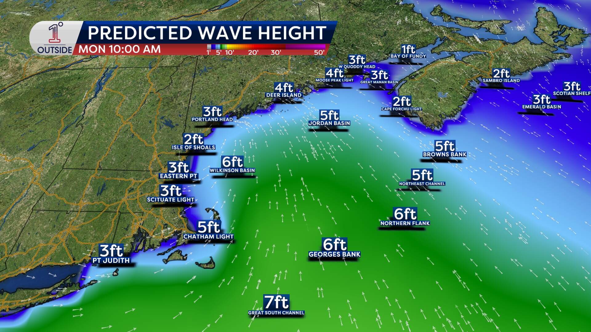
For those planning to hit the water, be mindful of building seas. While Friday and Saturday are relatively quiet (1- to 3-foot seas), conditions change Sunday.
We're expecting 4- to 6-foot seas along the South Coast by Sunday afternoon, building even further to 7 feet offshore by Memorial Day. If you're heading east of Wilkinson Basin, be prepared for choppy conditions.
Looking ahead
High pressure builds back in for Tuesday, with temperatures rebounding into the upper 70s and low 80s. Another cold front looks to arrive around midweek which will throttle back temperatures to near seasonable levels for Thursday and Friday — especially at the coast.
Whether you’re sticking in town, heading to the mountains or the coast, meteorologist Danielle Noyes has got you covered with the free 1DegreeOutside app.
This article was originally published on May 20, 2026.
