Advertisement

Keystone XL Pipeline: The Latest Facts And Figures

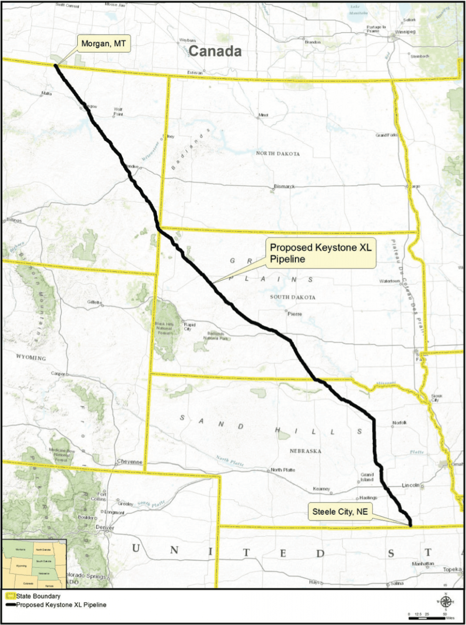
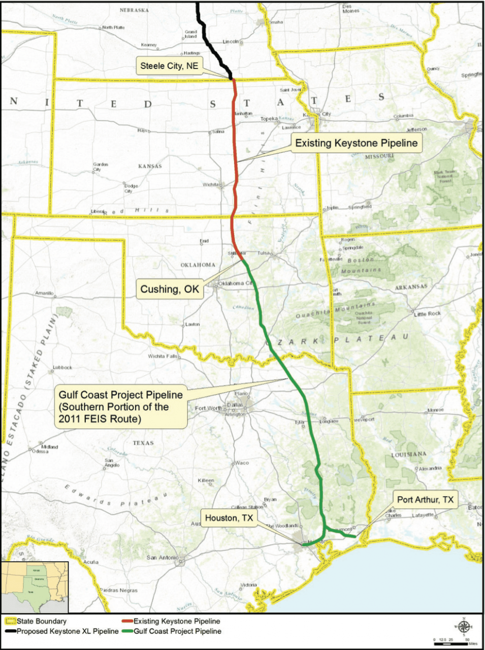
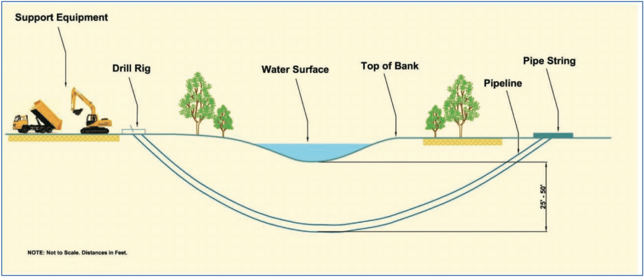
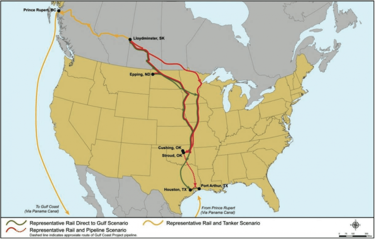
The proposed Keystone XL project consists of a 875-mile long pipeline and related facilities to transport up to 830,000 barrels/day from Alberta and  The Bakken Shale Formation in Montana.

A timeline of the Keystone XL Pipeline planning process (US State Dept)
The proposed Keystone XL pipeline route (US State Dept)
The Gulf Coast project route (Courtesy US State Dept)
The Gulf Coast project route  (US State Dept)

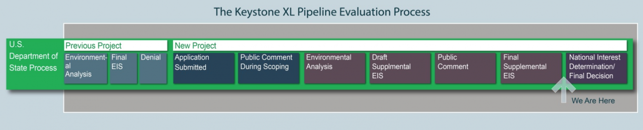
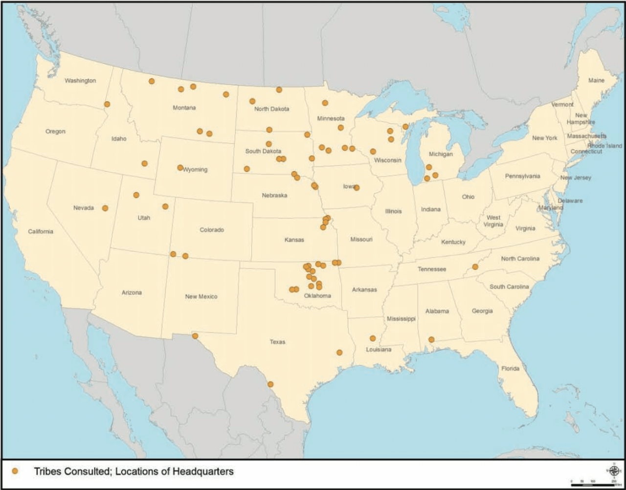
The U.S. State Department's Final Supplemental Environmental Impact Study is a technical assessment of the potential environmental impacts related to the proposed pipeline. It responds to more than 1.9 million comments received since June 2012 (from both the scoping and Draft Supplemental Environmental Impact Statement comment periods).

A typical pipeline construction sequence (US State Dept)
A cross-section of a typical horizontal directional drilling method (US State Dept)
Native American tribes consulted in the creation of the final State Dept. EIS (US State Dept)
Representative alternatives to the Keystone XL Pipeline (US State Dept)

All images and charts via the U.S. State Department.

The next step? Comments are being accepted between 2/5/14 and 3/7/14 at http://www.regulations.gov

Advertisement

More from On Point

Listen Live
Close