Support WBUR
What Happens To Forecasting When America’s Weather Satellites Die?
We look at what’s at stake for the future of weather forecasting when our aging weather satellites die.
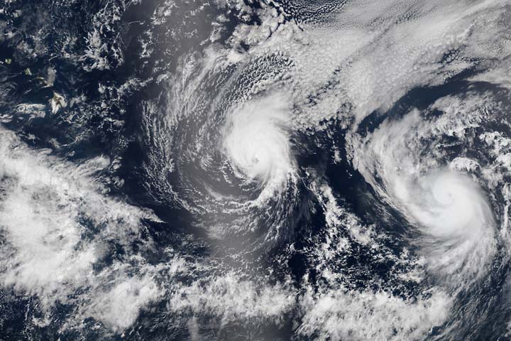
The weather report comes on, satellite images light up our screens, and we see the future barreling down on us. Hurricanes, super-storms, you name it – swirling across the blue Earth. Tracked from space. Our beach days depend on what we learn there. But so do our farmers, our fliers, our cargo ships, our traffic planners, and sometimes our lives. Now, incredibly, the US weather satellite system is in trouble. Aging out, without guaranteed replacement. We could soon be flying blind. Depending on the Chinese military to forecast America’s weather. This hour On Point: a rough forecast on weather.
-- Tom Ashbrook
Guests
Kathryn Miles, writer-in-residence at Green Mountain College. Author of the forthcoming book, "Super Storm: Nine Days Inside Hurricane Sandy." (@Kathryn_Miles)
Marshall Shepherd, director of the atmospheric sciences program at the University of Georgia. (@DrShepherd2013)
Kerri Cahoy, assistant professor of aeronautics and astronautics at the Massachusetts Institute of Technology.
Dave Brody, executive producer at Space.com. (@DavidSkyBrody)
From The Reading List
Popular Mechanics: America's Weather-Tracking Satellites Are in Trouble — "To pull together your five-day forecast, meteorologists rely on two types of satellites. The first sits 22,000 miles up, capturing basic information on a fixed location. The second orbits the poles, 500 miles up, filling in crucial image gaps and, more important, providing essential information about cloud formation, surface temperatures, and atmospheric conditions—the data that help us know where a storm is heading and how big it will be when it gets there. "
NextGov: Hacker Breached NOAA Satellite Data From Contractor's PC — "Unauthorized smartphone and thumb drive use was recently detected on 41 percent of components in systems supporting POES; 36 percent of GOES support systems; and 48 percent of components in the Environmental Satellite Processing Center, a system that handles data received from the satellites."
The Vane: Why Can Google See Your Car But Satellites Can't Clearly See Debris? — "Satellites are an integral part of life these days, from meteorologists tracking storm systems to spying on your neighbors in Google Earth. When Malaysia Airlines 370 went missing a few weeks ago, investigators turned to satellite imagery to aid search and rescue teams spot any possible wreckage in the ocean. While crews are using the blurry images as possible leads to search for debris, people on social media want to know why we can't see the objects more clearly from space."
This program aired on August 14, 2014.