Advertisement
Super Storm Threatens Northeast
Resume
The pre-Halloween hybrid weather monster that forecasters call "Frankenstorm" is looking more ominous by the hour for the East Coast.
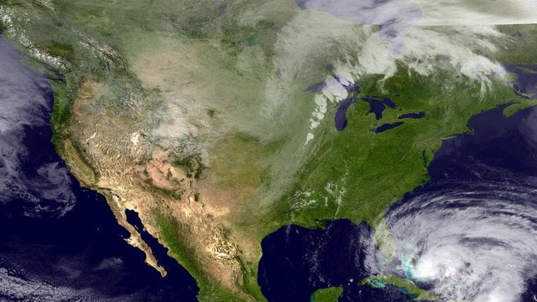
Meteorologists expect a natural horror show of high wind, heavy rain, extreme tides and maybe snow to the west beginning early Sunday, peaking with the arrival of Hurricane Sandy on Tuesday and lingering past Halloween on Wednesday.
With a rare mix of three big merging weather systems over a densely populated region, experts predict at least $1 billion in damage.

The stage is set as Hurricane Sandy, having blown through Haiti and Cuba, continues to barrel north. A wintry storm is chugging across the country from the west. And frigid air is streaming south from Canada.
And if they meet Tuesday morning around New York or New Jersey, as forecasters predict, they could create a big, wet mess that settles over the nation's most heavily populated corridor and reaches as far west as Ohio.
"Sandy is going to merge with what we call a middle latitude cyclone coming from west," said Here & Now's meteorologist Ed Kieser. "That's a type of weather system that produces snowstorm and blizzards in winter. So this storm will cover a much larger area and effect a bigger area and affect more people than the typical hurricane."
The mountains of central and western West Virginia might see as much as two feet of snow from this storm, Kieser said.
- Track the storm: National Weather Service
Guest:
- Ed Kieser, Here & Now's meteorologist at-large.
This segment aired on October 26, 2012.