Support WBUR
5 Takeaways From Boston's Climate Resilience Plans For Downtown, North End And Dorchester
On Thursday, Boston Mayor Marty Walsh announced climate resilience plans for two Boston neighborhoods: Dorchester and Downtown/North End.
The documents, officially called Coastal Resilience Solutions for Downtown Boston and North End and Coastal Resilience Solutions for Dorchester, are the latest in a long line of reports that look at the city's increasing vulnerability to extreme heat and flooding, and lay out options for dealing with it.
Read the reports if you have time — they have lots of detailed information and snazzy maps. But together they're close to 300 pages long, so if you can't face that much reading, here are five quick takeaways:
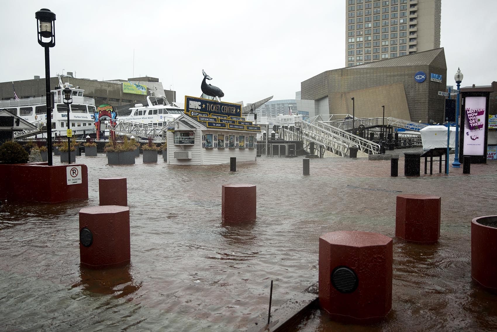
1. Parts of Dorchester, Downtown and the North End are going to be under water. OK, well maybe not totally under water all the time. But Boston is expected to see 9 inches of sea level rise over 2013 levels by the 2030s. That means that areas like Long Wharf and Morrissey Boulevard that already flood during big storms and king tides will likely flood every month at high tide. By the 2070s, sea level is expected to rise 40 inches, severely impacting these areas and making low-lying neighborhoods like Port Norfolk into flood pathways.
2. There are lots of different ways to deal with all this water. Berms, flood gates, tidal wetlands, raised harborwalks, flood-able parks, strengthened seawalls — they're all in the reports! Take Morrissey Boulevard, for instance: two possible solutions are raising the road 16 feet, or raising the road 10 feet and building a landscape berm along the edge. Each of those solutions has pros and cons — and hefty price tags in the tens of millions of dollars.
3. The city of Boston can't pay for all this by itself. The Walsh administration has set aside 10% of the city’s annual capital budget for resilience efforts. But Chris Cook, Boston's Chief of Environment, Energy, and Open Space, says that $20-30 million won’t be enough, and completing these projects will require private partnerships and federal funding as well.
Cook says not to get too hung up on the cost, though, because these infrastructure changes can do a lot more than just keep the floodwaters at bay. They can add green space and walking paths, parks and playgrounds, and reconnect neighborhoods to the water.
"It’s gonna cost a lot of money, but what it protects is so much more valuable," Cook says. "At the end of the day, the reason we're doing this work is to protect the people and to protect the neighborhoods that they live in."
4. Neighborhood input is critical. Critics are concerned that Boston's climate resilience efforts may lead to gentrification and displacement. And city and state officials often catch flak for not including local communities in infrastructure planning — take the East Boston substation controversy, for example. City officials say they are trying to do better, and note that resilience planning offers the city a chance to rectify a history of environmental racism that has put many communities on color on the frontlines of climate change.
"Neighborhood association meetings were especially critical for engaging both the coastal and inland communities in the Dorchester area," says Zoe Davis, a Climate Resilience Project Coordinator with the city. They "allowed residents to really dig in with us to the solutions, and [allowed] a lot of us to listen and to have a dialog with folks who may not have been historically participating in these processes."
5. Some projects are already underway, others will take decades. In the North End, a $15.3 million project to make Langone Park and Puopolo Playground ready for 2050 flood levels should be completed this year. The project includes raised athletic fields, a harborwalk elevated four feet and a strengthened the sea wall.
Some other projects, like the redesign of Moakley Park and Christopher Columbus Park, are already underway. Others, like fortifying the U.S. Coast Guard Station in the North End, don't appear on the timeline until 2050.
One thing to note: Planners designed the Langone Park project so that it could adapt to even higher sea levels if needed, and Cook says this type of flexibility is important for all the city’s resilience projects, because "some of those projections out 70-100 years are dire indeed."