Support WBUR
Nor'Easter Headed To Mass. This Weekend, Likely Bringing Snowfall To Much Of The State
Although it hasn't felt like the right conditions for snow over the past few weeks, it looks like a winter storm is on the way this weekend.
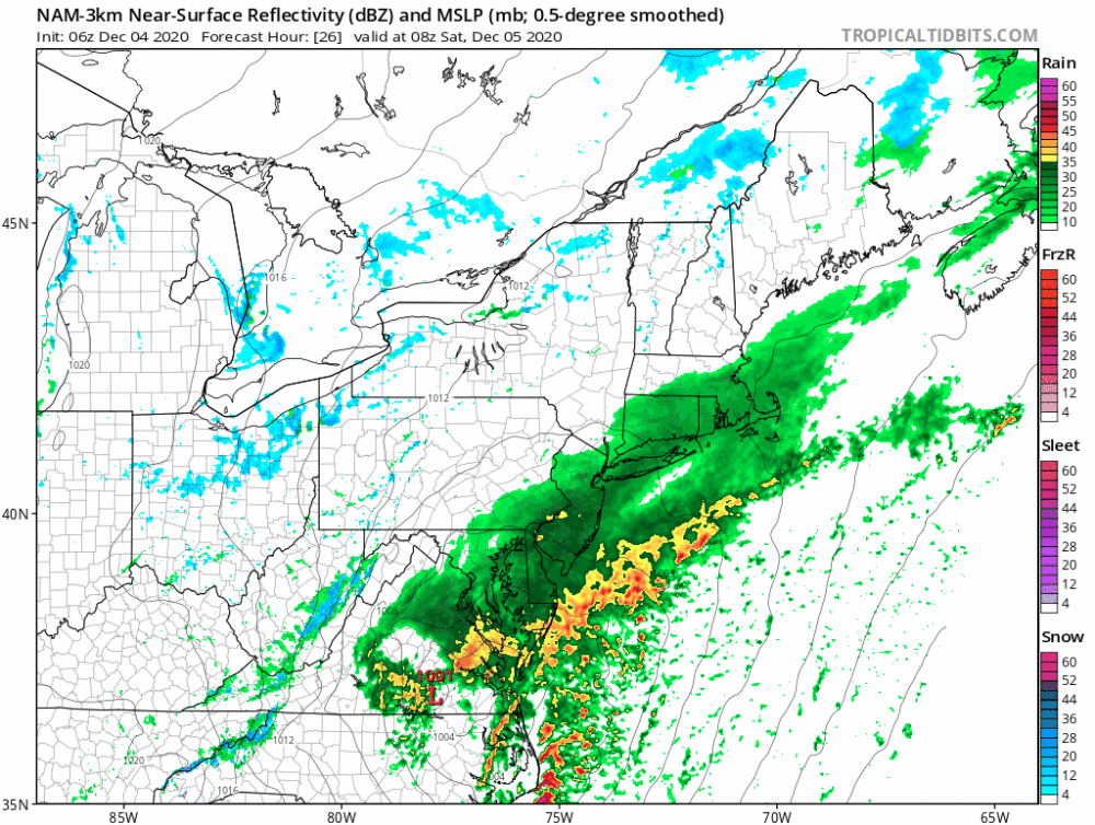
Two areas of energy and moisture are going to merge — one from the north and one from the south — and create a storm off the coastline Saturday. This will be a rapidly developing situation, and a slight deviation in track could change the snow amount, or even limit it altogether.
Currently, it looks like we'll see rain starting Saturday morning, then changing over to snow from west to east. The snow will probably not reach Boston until mid- to late afternoon, between 3 and 5 p.m. Places like Logan Airport may see mostly rain throughout the storm, despite the fact that it will likely snow as close as Newton.
The coastline will likely not see more than a coating, but west of that, amounts will ramp up significantly. Some parts of central Massachusetts could see up to 10 inches of snowfall.
The heavy, wet nature of the snow will make those areas most vulnerable to power outages, so plan accordingly. Worcester County, Northern Middlesex County and Western Essex County are at highest risk for outages.
Rain Or Snow?
If the storm were to come a little further inland, it would pull warm air off the ocean, and the snow bands would actually shift west. If the storm takes a more eastward track, we could see the bands shift east a bit, although the warm ocean ultimately should prevent downtown Boston from seeing a major snowstorm.
Either of these scenarios is still possible, and early December snow storms can have a very wide range of snow totals from the coast to the hills because the ocean is still so warm.
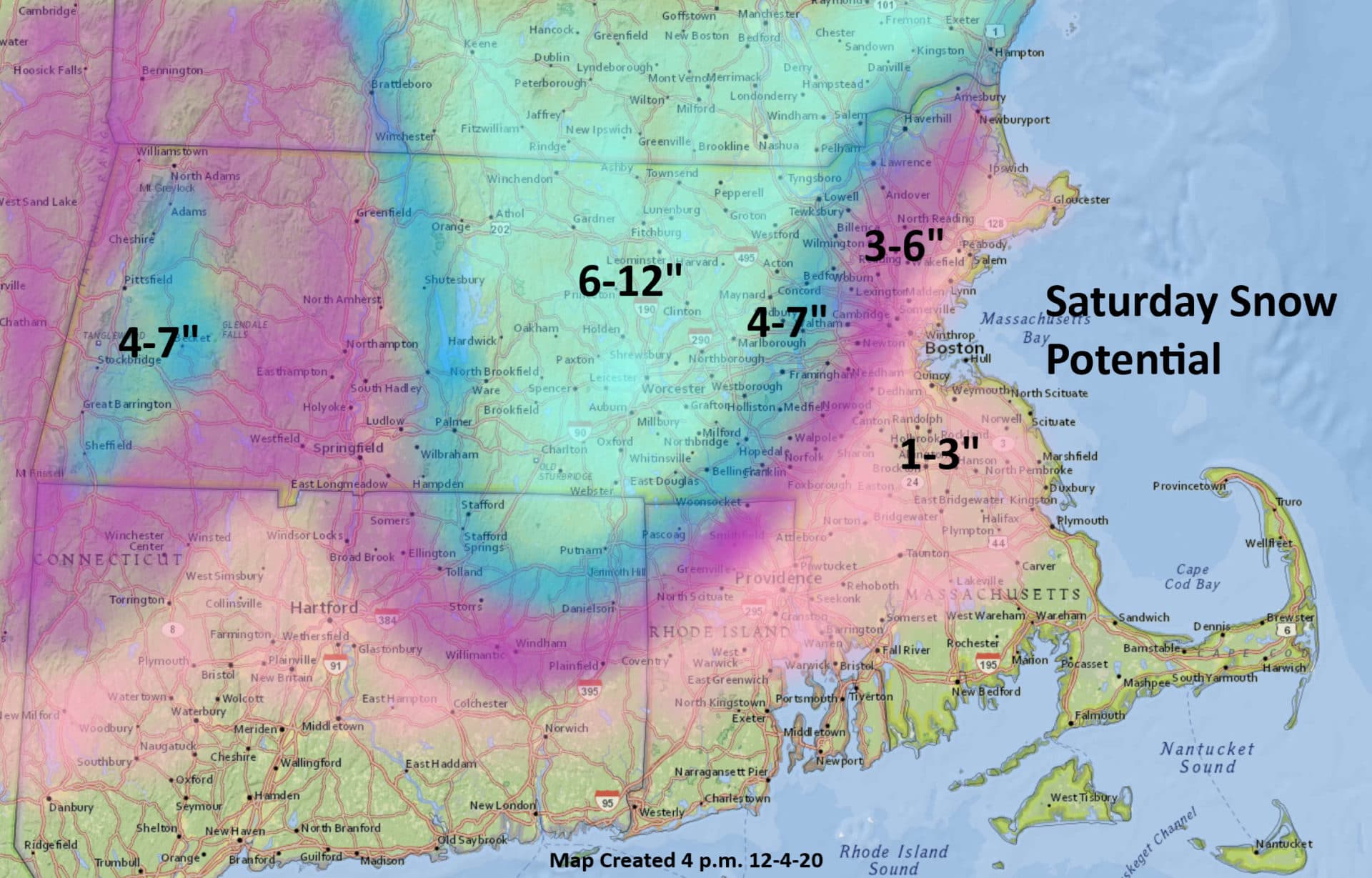
Winds will be strongest over Cape Cod and the Islands, where gusts could reach over 50 mph and a High Wind Watch has been issued. There's also a Winter Storm Watch because there is potential for over 6 inches of snow in that region.
The storm will wind down Saturday evening and by Sunday, the sunshine is back. But unlike our storm in October, the snow will not melt quickly. Temperatures are going to remain in the 30s for the next few days, and the low sun angle doesn't allow for much solar help.
After that, there are no major storms in sight. As a matter of fact, the weather looks rather tranquil with a bit of a moderating trend as we head into early next week.
This article was originally published on December 04, 2020.
This segment aired on December 4, 2020.
