Support WBUR
Region's first plowable snowstorm of this winter is on its way
Southern New England will see its first plowable snow event this weekend.
Winter in the region has been relatively tame so far this year, and as a result, the weekend storm has created a good deal of buzz for lovers and haters of snow, alike. Roughly 48 hours out, the trickiest aspect of the forecast is determining where the rain/snow line is expected to fall.
Here's a breakdown of the details on snowfall totals and timing:
Snow or rain? That's the question
The storm is set to arrive in Massachusetts Saturday, and while there remains uncertainty around how far inland the rain/snow line will penetrate, areas north and west of Boston are expected to see the most snow.
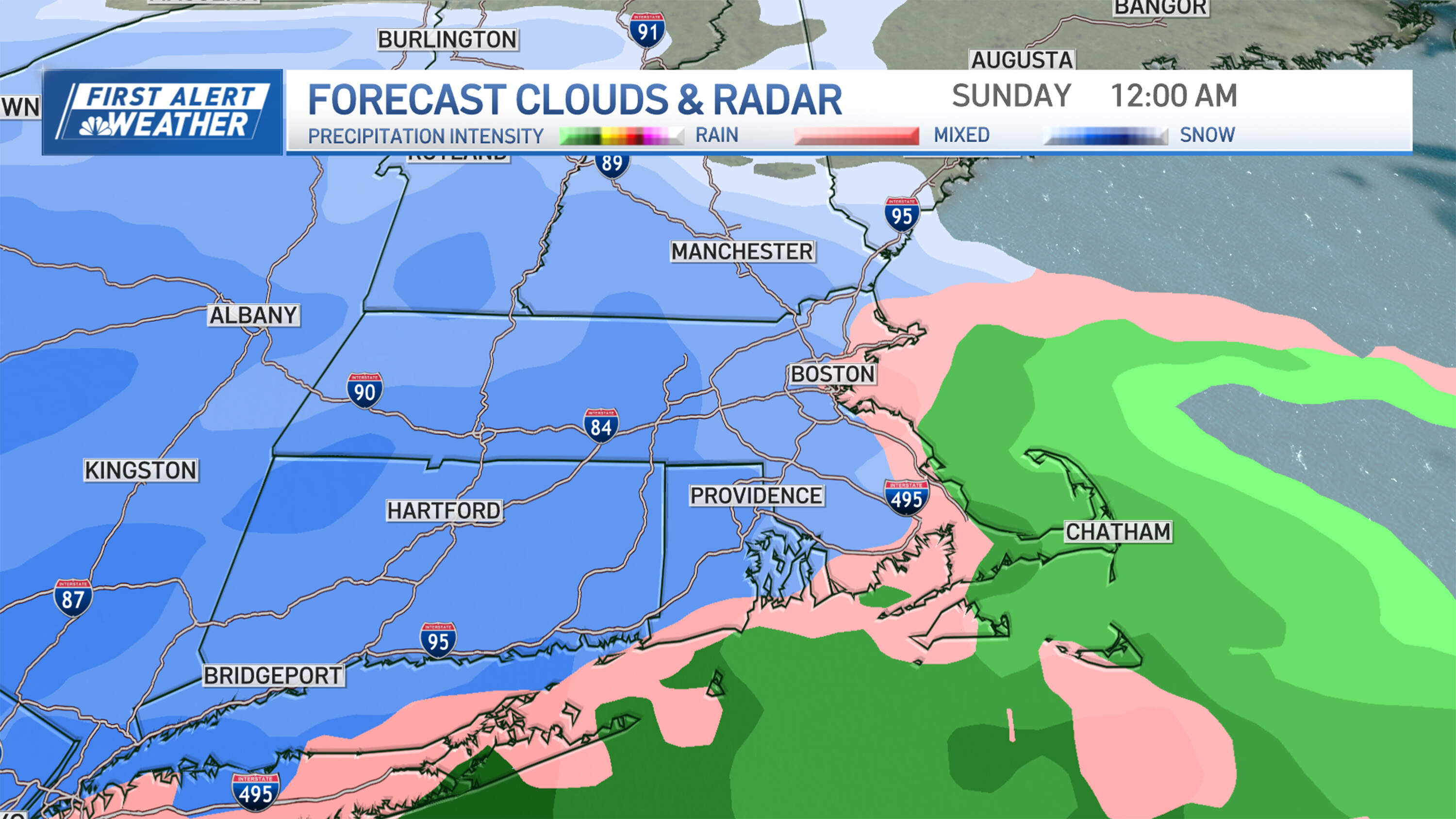
Meanwhile, an eastward wind is set to blow in off the ocean, which typically means many communities will see any snowfall flip to either mild accumulation or a mix or snow and rain.
This will not be a blockbuster or historic storm. However, snow or rainy mixture will create some hazardous travel conditions. Plus, areas that see the heaviest and wettest snowfall may also face isolated power outages.
It'll be chilly soon
Before the storm arrives, cold air will cross into the region.
The cold front will harshen the air on a relatively comfortable January day by Thursday evening. A northwest wind behind the cold front gusts to 35 mph, and temperatures will drop with wind chill values settling into the teens by late evening.
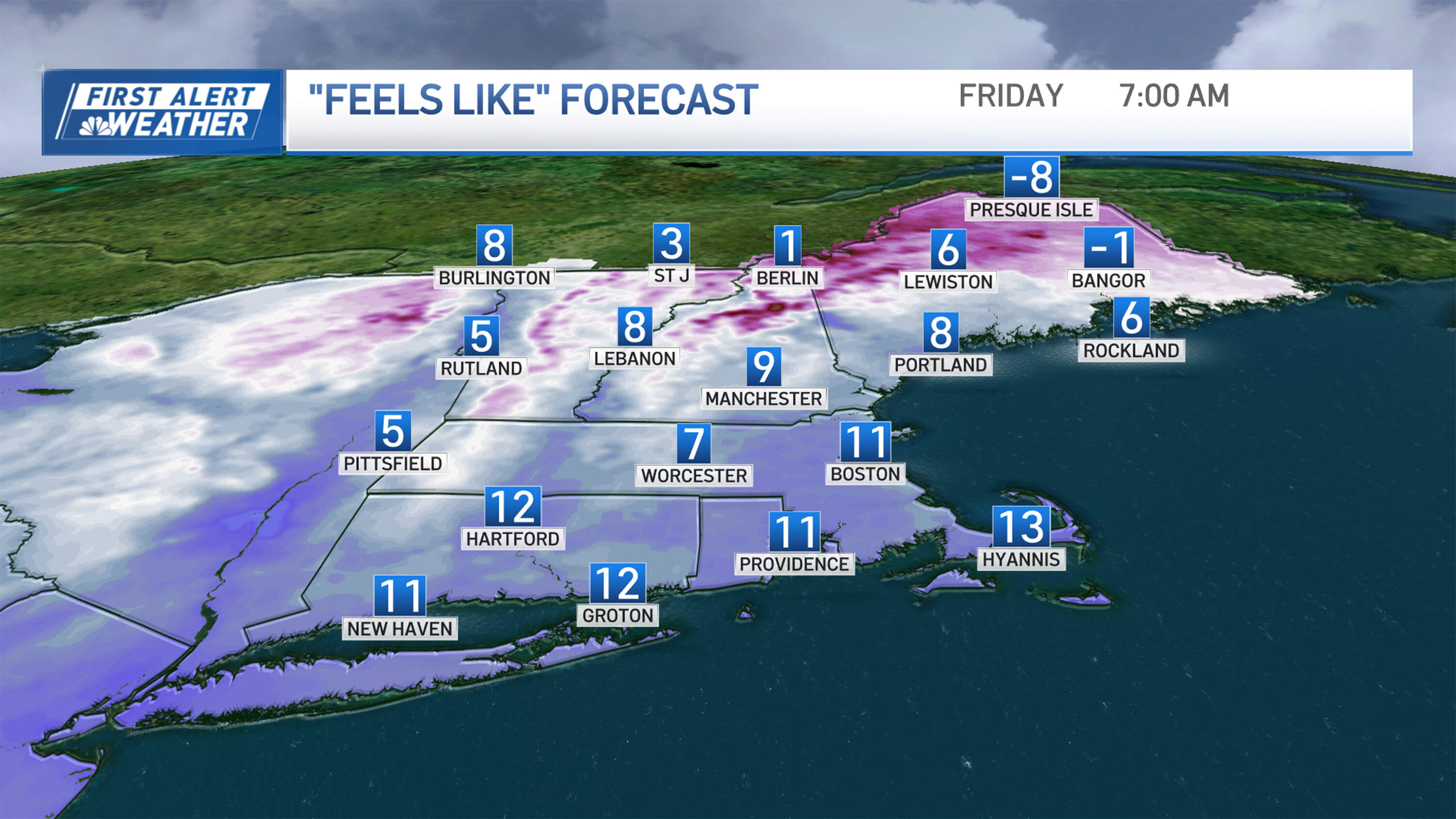
Overnight and through Friday morning, many communities will experience wind chills in the single digits.
Be sure to dress appropriately as you head out the door Friday. Kids will need to be bundled up before setting out for school.
Highs won't rise above the 30s Friday, despite full sunshine. Then, clouds are expected to arrive ahead of Saturday's storm. The chill in the air will continue with light winds.
When the snow will fall
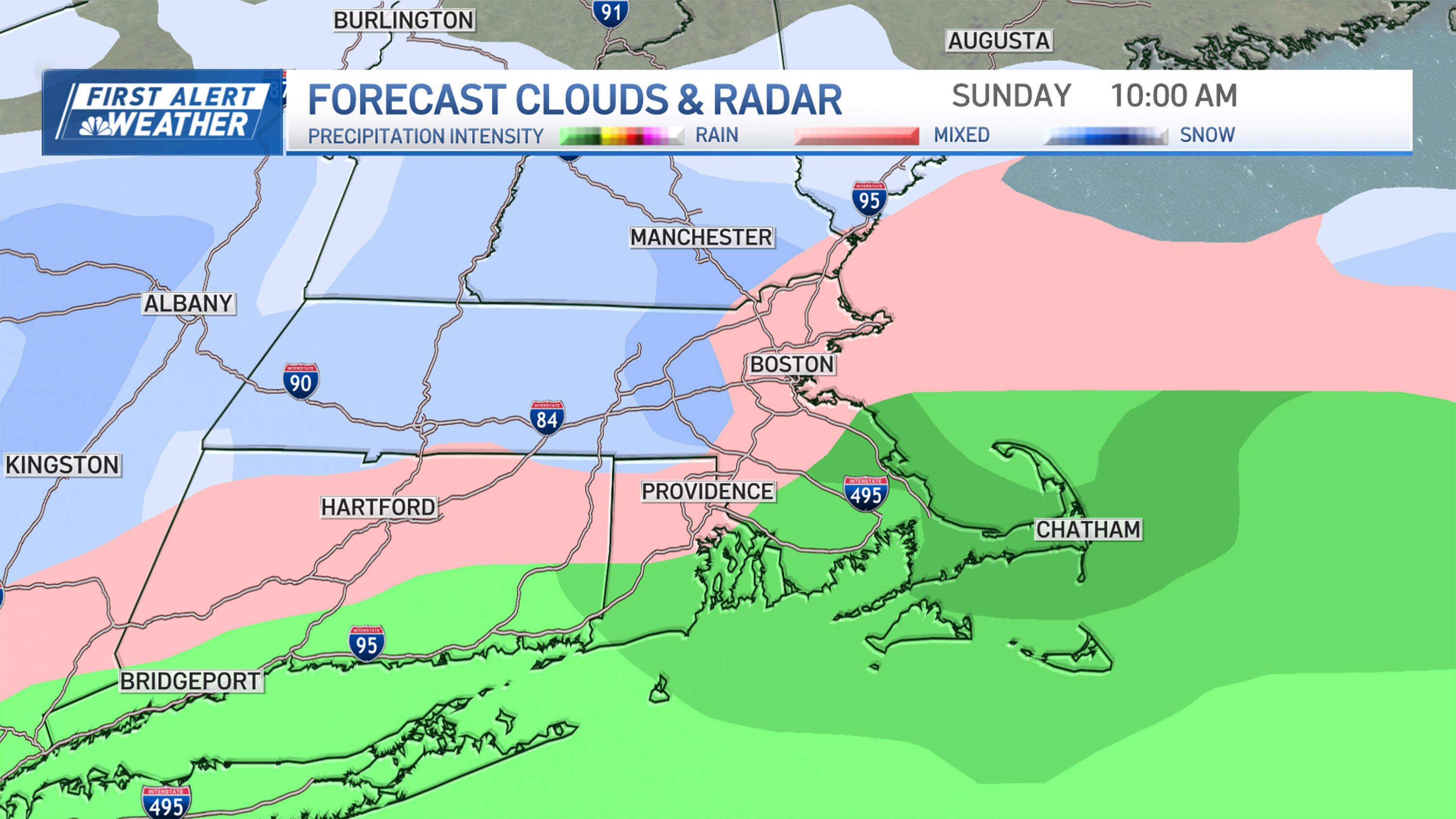
While the onset of significant snow is expected to occur late Saturday evening into overnight Sunday, it’s worth noting that an ocean breeze may also develop late Saturday. That may carry some pockets of light snow or flurries into a few spots around Southern New England as early as dinnertime Saturday.
As snow rates increase into the early Sunday hours, plows will likely be out treating roadways in many communities and into Sunday morning. That's when the intensity of the storm should begin to gradually — but steadily — wane before ending Sunday afternoon.
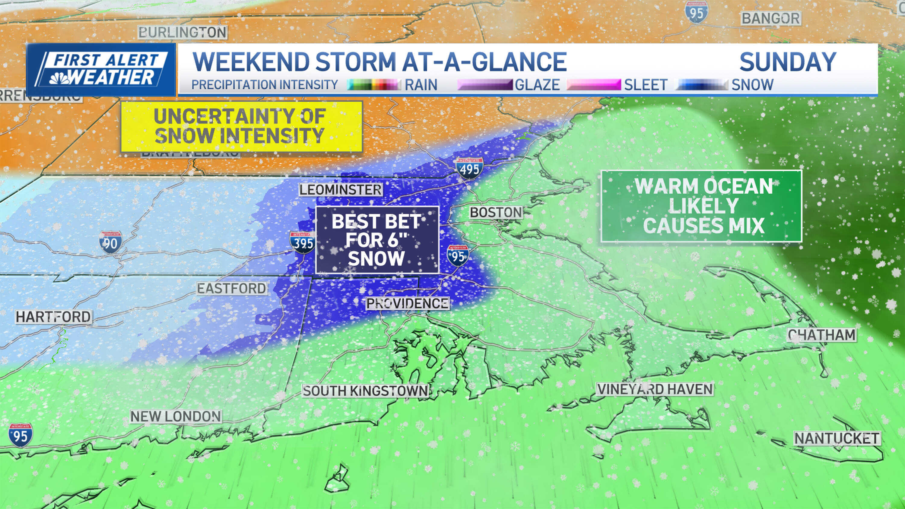
While six inches of snow seems increasingly likely for places inland like Worcester, the Cape and region's coastal communities will mostly see rain Saturday into Sunday. That's because of eastward winds gusting upwards of 40 mph are certain to carry warmth off the roughly 44-degree ocean water.
The real zone to watch is about 10 miles inland off the coast. Areas around I-95 and perhaps even along I-495 in eastern Massachusetts may be affected by the snow. That said, the gusty eastward wind could possibly carry warmth in those places, too, limiting how much snowfall those communities ultimately see.
Towns and cities in northern New England may see between 4-8 inches of snow, but it's a question of how organized the snow bands will become in those areas.
Another storm to watch
As the storm departs, sunshine and seasonable air return Monday.
But if you end up disappointed by the snow totals this time around, another storm is set to move in Tuesday night.
Right now, that storm looks like it will bring snow to the mountains, hitting much of southern New England with a wintry mix that may quickly change to rain.
By Wednesday, temperature highs could even reach 50 degrees. We'll offer more updates on that storm, including adjusted accumulation maps and timing details, in future posts.
The bottom line going into this weekend, however, is that it's time to put your snow stakes in, gas up the snowblower and dig out your shovels and sleds — especially if you live north or west of Boston.
