Support WBUR
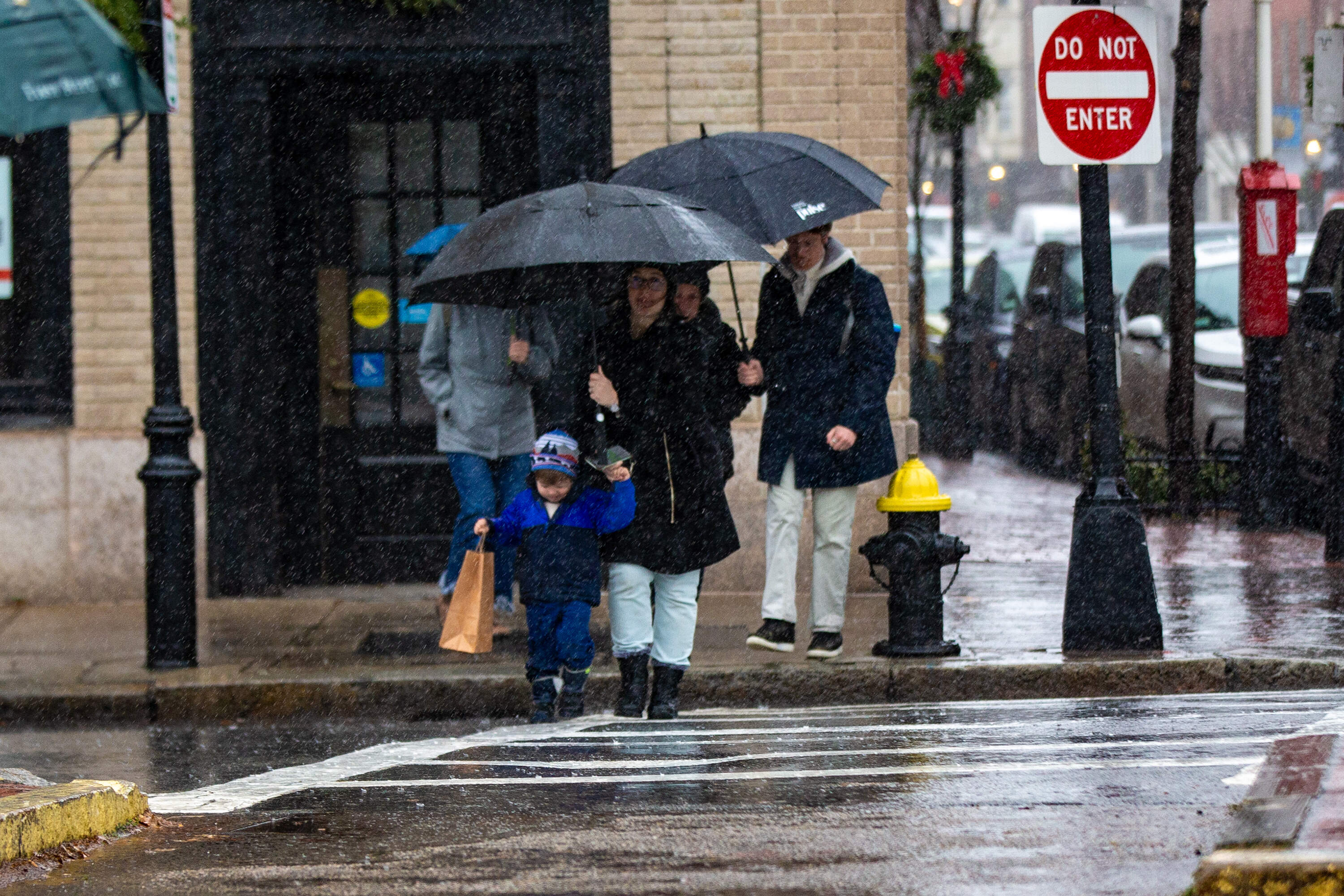
Rain and wind hit Greater Boston on an unseasonably warm December day

Bostonians battled the rain and wind on Wednesday as temperatures hit the mid-60s.
The National Weather Service Boston reported 3.08 inches of rain fell on Fenway Park. Rain gauges in Attleboro measured 4.19 inches, the heaviest accumulation in the state, according agency data.
Localized flooding from the heavy rains caused the Massachusetts Department of Transportation to temporarily shut down an off-ramp to I-93 on the westbound side of Boston's Ted Williams Tunnel around 8:40 p.m. Wednesday. Footage shows cars driving slowly through rushing water. WHDH reports the ramp was reopened at 11 p.m.
The rain should help ease drought conditions that have dogged the state. As recently as last week, state environmental officials in Massachusetts raised drought concerns on Cape Cod, while a more critical drought declaration remained in effect in other parts of the state.

Wind was a major factor in the storm. The National Weather Service reported wind gusts of 51 mph at Logan Airport. The south coast, Cape and Islands received the strongest winds. Gusts of 66 mph blew through Woods Hole and 65 mph winds were recorded in Hull.
Power was knocked out for thousands across the state. By 7 a.m. Thursday morning, just under 2,000 customers remained without power, according to the Massachusetts Emergency Management Agency.
Ahead of rush hour Wednesday night, The MBTA commuter rail warned passengers that four lines would face "significant delays" because of a downed overhead wire. The agency did not specify if the storm caused the wire failure.
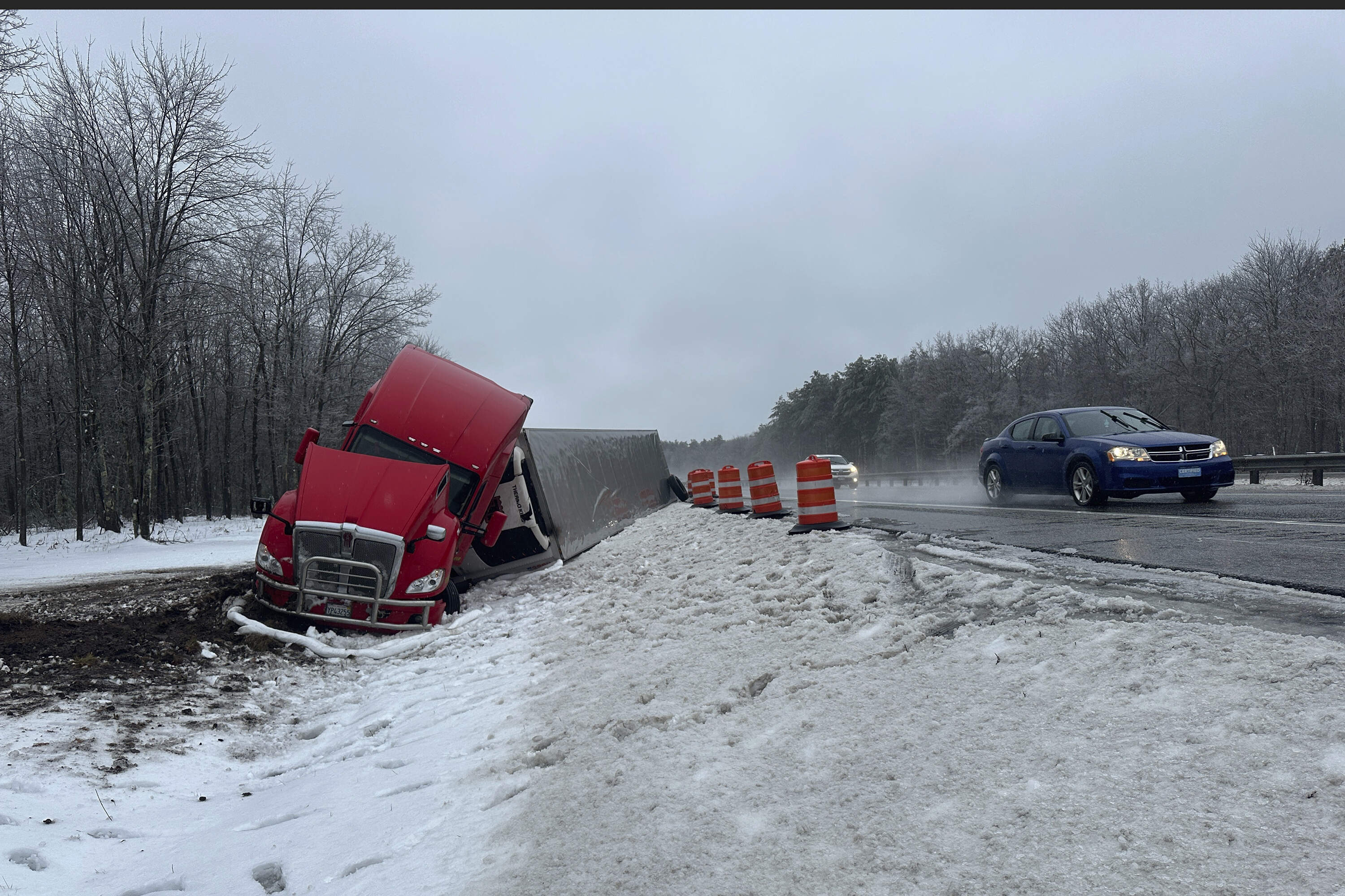
Around the region, the storm began with combination of fog and freezing rain Tuesday night into early Wednesday, making travel treacherous. A tractor-trailer carrying a load of oranges went off the Maine Turnpike in New Gloucester; the road was so treacherous that the oranges couldn’t be removed until a day later.
In New Hampshire, the Mount Washington Avalanche Center issued a special bulletin Wednesday for the Presidential Range of mountains, which received significant snowfall over the last two weeks. “Heavy rainfall could create dangerous and unpredictable avalanche conditions on steep snow-covered slopes,” the avalanche center warned.
Atop Mount Washington, wind gusts hit 89 mph. The location is one of the planet’s windiest spots. Its highest gust recorded for 2023 was 132 mph. From January to December of that year, it saw 145 days with gusts of 73 mph or higher.
Flood watches were in effect in Vermont, where the capital city of Montpelier, hard hit in past floods, advised residents to elevate items in basements and low areas that are prone to flooding. And in Rhode Island, heavy surf and flooding closed several roads in Newport.
In Higganum, Connecticut, 13 students and a bus driver had to wait inside their bus as utility crews and firefighters removed downed electrical wires that fell onto the bus. Once the area was deemed safe, students evacuated the bus and boarded another that took them to their parents, said Olivia Drake, public information officer for the Haddam Volunteer Fire Company.
It was the fire department’s third incident involving power lines on Wednesday. Earlier in the day, firefighters responded to a pole fire and a tree that was leaning on power lines and was smoldering.
With reporting from The Associated Press.
This article was originally published on December 11, 2024.